
The Wyperfeld National Park is the third-largest national park in Victoria, Australia, located in the Mallee district, approximately 450 kilometres (280 mi) north-west of Melbourne. The national park was declared in 1921 and has been expanded significantly since, to protect 357,017 hectares of mallee, woodland, and heathland. Along with the Hattah-Kulkyne National Park, Murray-Sunset National Park, Lake Albacutya Park and Murray-Kulkyne Park, Wyperfeld National Park is managed as part of the Victorian Mallee Parks.

Stawell ( "stall"), is an Australian town in the Wimmera region of Victoria 237 kilometres (147 mi) west-north-west of the state capital, Melbourne. Located within the Shire of Northern Grampians local government area, it is a seat of local government for the shire and its main administrative centre. At the 2021 census, Stawell had a population of 6,220.

Nhill is a town in the Wimmera, in western Victoria, Australia. Nhill is located on the Western Highway, halfway between Adelaide and Melbourne. At the 2016 census, Nhill had a population of 1,749. "Nhill" is believed to be a Wergaia word meaning "early morning mist rising over water" or "white mist rising from the water".

Ararat is a town in the Central Highlands region in Victoria, Australia, about 198 kilometres (120 mi) west of Melbourne, on the Western Highway on the eastern slopes of the Ararat Hills and Cemetery Creek valley between Victoria's Western District and the Wimmera. Its urban population according to 2021 census is 8,500 and services the region of 11,880 residents across the Rural City's boundaries. It is also the home of the 2018/19 GMGA Golf Championship Final.

The Victorian government's Wimmera Southern Mallee subregion is part of the Grampians region in western Victoria. It includes most of what is considered the Wimmera, and part of the southern Mallee region. The subregion is based on the social catchment of Horsham, its main settlement.
Rainbow is a town in the Shire of Hindmarsh in northwest Victoria, Australia, 400 kilometres (250 mi) from Melbourne. The nearest large towns are Warracknabeal, Dimboola and Nhill, all to the south. At the 2021 census, Rainbow had a population of 672.

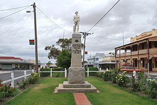
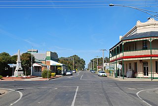
Warracknabeal is a town in the Australian state of Victoria, located in the Victorian wheatbelt. Situated on the banks of the Yarriambiack Creek, 330 km northwest of Melbourne, it is the business and services centre of the northern Wimmera and southern Mallee districts, and hosts local government offices of the Shire of Yarriambiack. At the 2021 census, the Warracknabeal township had a population of 2,359.

St Arnaud is a town in the Wimmera region of Victoria, Australia, 244 kilometres north west of the capital Melbourne. It is in the Shire of Northern Grampians local government area. At the 2021 census, St Arnaud had a population of 3,453.

Horsham is a regional city in the Wimmera region of western Victoria, Australia. Located on a bend in the Wimmera River, Horsham is approximately 300 kilometres (190 mi) northwest of the state capital Melbourne. As of the 2021 census, Horsham had a population of 20,429. It is the most populous city in Wimmera, and the main administrative centre for the Rural City of Horsham local government area. It is the eleventh largest city in Victoria after Melbourne, Geelong, Ballarat, Bendigo, Wodonga, Mildura, Shepparton, Warrnambool, Traralgon, and Wangaratta.
Antwerp is a locality in Victoria, Australia on the Dimboola – Rainbow Road, in the Shire of Hindmarsh, 14 kilometres (8.7 mi) north of Dimboola and 356 kilometres (221 mi) north-west of Melbourne. The Wimmera River passes 500 metres (550 yd) west of the locality. The population at the 2016 census was 63.

Minyip is a town in the Wimmera region of Victoria, Australia, 320 kilometres (199 mi) north west of Melbourne. It is in the Shire of Yarriambiack local government area. At the 2016 census, Minyip had a population of 524.

The Wimmera River, an inland intermittent river of the Wimmera catchment, is located in the Grampians and Wimmera regions of the Australian state of Victoria. Rising in the Pyrenees, on the northern slopes of the Great Dividing Range, the Wimmera River flows generally north by west and drains into Lake Hindmarsh and Lake Albacutya, a series of ephemeral lakes that, whilst they do not directly empty into a defined watercourse, form part of the Murray River catchment of the Murray-Darling basin.
Sea Lake is a town in the Mallee district of north-west Victoria, Australia and is situated on the southern shores of Lake Tyrrell. The town is located on the Calder Highway, 351 kilometres (218 mi) north-west of Melbourne, and 73 kilometres (45 mi) west of Swan Hill. Sea Lake is in the heart of Australia's wheat belt, and is the main township for a number of wheat farms in the region. At the 2021 census, Sea Lake had a population of 619.
Tungamah is a town in the Goulburn Valley region of northern Victoria, Australia. The town is located in the Shire of Moira local government area, 259 kilometres (161 mi) from the state capital, Melbourne. Tungamah is situated on the banks of Boosey Creek and at the 2006 census, Tungamah had a population of 355.
The Shire of Dimboola was a local government area in the Wimmera region of western Victoria, Australia. The shire covered an area of 4,856 square kilometres (1,874.9 sq mi), and existed from 1885 until 1995.

Nullawil is a town in Victoria, Australia, located approximately 302 kilometres (188 mi) from the state capital, Melbourne. At the 2021 census, Nullawil had a population of 92.
Lake Albacutya is an ephemeral lake located in Albacutya within the Wimmera region of Victoria, Australia. It is one of a series of terminal lakes on the Wimmera River, which form the largest land-locked drainage system in Victoria. Lake Albacutya is designated as a wetland of international importance under the Ramsar Convention.
Yaapeet is a town in the Wimmera region of western Victoria, Australia. The town is located in the Shire of Yarriambiack local government area, 417 kilometres (259 mi) north west of the state capital, Melbourne.
The Wotjobaluk are an Aboriginal Australian people of the state of Victoria. They are closely related to the Wergaia people.

The Barengi Gadjin Land Council was formed in 2005 to represent the Wotjobaluk, Jardwadjali, Wergaia and Jupagalk peoples. The Council manages native title rights across Western Victoria in an area "roughly described as the Wimmera River from the head of the Yarriambiack Creek through to Outlet Creek at the northern end of Lake Albacutya". The Council is governed by a board of directors representing various family groups and has offices in Wail and Horsham. The current chairperson is Dylan Clark.


