Arturo Merino Benítez International Airport, also known as Santiago International Airport and Nuevo Pudahuel Airport, located in Pudahuel, 15 km (9.3 mi) north-west of central Santiago, is Chile's largest aviation facility and busiest international airport.

Santos Dumont Airport is the second major airport serving Rio de Janeiro, Brazil. It is named after the Brazilian aviation pioneer Alberto Santos Dumont (1873–1932).

Pucón Airport is an airport 5 kilometres (3.1 mi) east of Pucón, a city on the eastern shore of Villarrica Lake in the Araucanía Region of Chile.

Uberaba–Mário de Almeida Franco Airport is the airport serving Uberaba, Brazil.
Santos Dumont Airport is the airport serving Paranaguá, Brazil. Like the airport in Rio de Janeiro, it is named after the Brazilian aviation pioneer Alberto Santos Dumont (1873–1932).

Mocopulli Airport is an airport serving Dalcahue, a port city on Chiloé Island in the Los Lagos Region of Chile, as well as the city of Castro. The airport is 6 kilometres (3.7 mi) northwest of Dalcahue.
Santa Rita Airport is an airstrip 6 kilometres (3.7 mi) northwest of Casablanca, a city in the Valparaíso Region of Chile.
Franco Bianco Airport is an airport 5 kilometres (3.1 mi) northwest of Cerro Sombrero, a petroleum production town in the Magallanes Region of Chile. Cerro Sombrero is near the eastern entrance to the Strait of Magellan.
Chaitén Airfield was an airport serving Chaitén, a town in the Los Lagos Region of Chile. The airport was damaged and closed after the 2008 eruption of Chaitén Volcano.

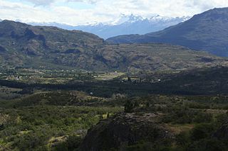
Cochrane Airport Spanish: Aeródromo Cochrane, is an airport serving Cochrane, a town in the Aysén Region of Chile. The airport is just northwest of the town, at the foot of Cerro Tamanguito (sv).
Teniente Vidal Airport is an airport serving Coyhaique, capital of the Aysén Region of Chile. The airport is 3 kilometres (1.9 mi) southwest of Coyhaique.
San Rafael Airport Spanish: Aeródromo de San Rafael de Los Andes, is an airport serving Los Andes, a city in the Valparaíso Region of Chile. The airport is 5 kilometres (3.1 mi) west-northwest of the city.

María Dolores Airport is an airport serving Los Ángeles, capital of Bío Bío Province in the Bío Bío Region of Chile.
El Alba Airport, is an airport 6 kilometres (3.7 mi) northwest of Melipilla, a city in the Santiago Metropolitan Region of Chile.
Santa Teresa del Almendral Airport, is an airport 12 kilometres (7.5 mi) north-northwest of Melipilla, a city in the Santiago Metropolitan Region of Chile. The airport is 1 kilometre (0.6 mi) west of the Puangue River.
Estero Seco Airport, is an airstrip in the Pirque commune of the Santiago Metropolitan Region in Chile.

Municipal de Vitacura Airport is a general aviation airport in Vitacura, a northern suburb of the Santiago Metropolitan Region of Chile. The airport is in a narrow slot between a major city street in Vitacura and a parallel freeway.
El Corte Airport, is an airport 5 kilometres (3.1 mi) south-southeast of Talagante, a city in the Santiago Metropolitan Region of Chile.
Barriles Airport Spanish: Aeropuerto Barriles is an airport 15 kilometres (9.3 mi) east-southeast of Tocopilla, a Pacific coastal town in the Antofagasta Region of Chile.
Augusto Vergara Airport is an airport serving the city of Los Santos, in Panama. It is located 16 kilometres (10 mi) southeast of the city, north of the town of Guararé.


