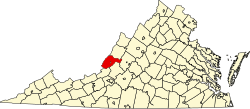
Alleghany, Virginia

Last updated

Alleghany is an unincorporated community in Alleghany County, Virginia, United States.

Unincorporated area Region of land not governed by own local government

In law, an unincorporated area is a region of land that is not governed by a local municipal corporation; similarly an unincorporated community is a settlement that is not governed by its own local municipal corporation, but rather is administered as part of larger administrative divisions, such as a township, parish, borough, county, city, canton, state, province or country. Occasionally, municipalities dissolve or disincorporate, which may happen if they become fiscally insolvent, and services become the responsibility of a higher administration. Widespread unincorporated communities and areas are a distinguishing feature of the United States and Canada. In most other countries of the world, there are either no unincorporated areas at all, or these are very rare; typically remote, outlying, sparsely populated or uninhabited areas.

Alleghany County, Virginia County in the United States

Alleghany County is an American county located on the far western edge of Commonwealth of Virginia. It is bordered by the Allegheny Mountains, from which the county derives its name, and it is the northernmost part of the Roanoke Region. The county seat is Covington.

Virginia State of the United States of America

Virginia, officially the Commonwealth of Virginia, is a state in the Southeastern and Mid-Atlantic regions of the United States located between the Atlantic Coast and the Appalachian Mountains. Virginia is nicknamed the "Old Dominion" due to its status as the first English colonial possession established in mainland North America and "Mother of Presidents" because eight U.S. presidents were born there, more than any other state. The geography and climate of the Commonwealth are shaped by the Blue Ridge Mountains and the Chesapeake Bay, which provide habitat for much of its flora and fauna. The capital of the Commonwealth is Richmond; Virginia Beach is the most populous city, and Fairfax County is the most populous political subdivision. The Commonwealth's estimated population as of 2017 is over 8.4 million.

Related Research Articles

Silver Beach Provincial Park is a provincial park in British Columbia, Canada, located at the head of the Seymour Arm of Shuswap Lake in that province's Shuswap Country, adjacent to the settlement of Seymour Arm.

Backbone is an unincorporated community in Alleghany County, Virginia, United States.

Boiling Spring is an unincorporated community in Alleghany County, Virginia, United States.

Callaghan is a census-designated place (CDP) in Alleghany County, Virginia, United States. The population as of the 2010 Census was 348.

Clifdale is an unincorporated community in Alleghany County, Virginia, United States.

Crows is an unincorporated community in Alleghany County, Virginia, United States.

Earlehurst is an unincorporated community in Alleghany County, Virginia, United States.

Hematite is an unincorporated community in Alleghany County, Virginia, United States.

Iron Hill Springs is an unincorporated community in Alleghany County, Virginia, United States.

Jordan Mines is an unincorporated community in Alleghany County, Virginia, United States.

Moss Run is an unincorporated community in Alleghany County, Virginia, United States.

Oakwood Forest is an unincorporated community in Alleghany County, Virginia, United States.

Potts Creek, Virginia human settlement in United States of America

Potts Creek is an unincorporated community in Alleghany County, Virginia, United States. It is also the name of a watercourse in the same area, Potts Creek (watercourse). It is located about 1 mile north of the Craig County line, 6 miles north of Paint Bank, and 18 miles south of Covington all via Virginia State Route 18.

Stonewall is an unincorporated community in Alleghany County, Virginia, United States.

Sweet Chalybeate is an unincorporated community in Alleghany County, Virginia, United States. It is located directly across the state-line from Sweet Springs, West Virginia. It is serviced by Virginia State Route 311.

Westwood Place is an unincorporated community in Alleghany County, Virginia, United States.

Draper is a census-designated place (CDP) in Pulaski County, Virginia, United States. The population as of the 2010 Census was 320. Draper has both a fire station and post office.

Skidmore is an unincorporated community in Cherokee County, Kansas, United States.

Grays Point is an extinct town in Scott County, in the U.S. state of Missouri.

References

Coordinates: 37°44′50″N80°14′25″W / 37.74722°N 80.24028°W / 37.74722; -80.24028

Geographic coordinate system Coordinate system

A geographic coordinate system is a coordinate system that enables every location on Earth to be specified by a set of numbers, letters or symbols. The coordinates are often chosen such that one of the numbers represents a vertical position and two or three of the numbers represent a horizontal position; alternatively, a geographic position may be expressed in a combined three-dimensional Cartesian vector. A common choice of coordinates is latitude, longitude and elevation. To specify a location on a plane requires a map projection.