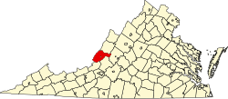
Potts Creek is an unincorporated community in Alleghany County, Virginia. It is also the name of a watercourse in the same area, Potts Creek (watercourse). It is located just north of the Craig County line, 6 miles north of Paint Bank, and 18 miles south of Covington. It is located on Virginia State Route 18.
Monroe County is a county in the U.S. state of West Virginia. As of the 2020 census, the population was 12,376. Its county seat is Union.
Pulaski County is a county located in the southwestern part of the U.S. state of Virginia. As of the 2020 census, the population was 33,800. Its county seat is Pulaski. Pulaski County is part of the Blacksburg–Christiansburg, VA Metropolitan Statistical Area.
Cumberland County is a county located in the Commonwealth of Virginia, United States. As of the 2020 census, the population was 9,675. Its county seat is Cumberland.
Craig County is a county located in the Commonwealth of Virginia. As of the 2010 census, the population was 4,892. Its county seat is New Castle.
Alleghany County is an American county located on the far western edge of Commonwealth of Virginia. It is bordered by the Allegheny Mountains, from which the county derives its name, and it is the northernmost part of the Roanoke Region. The county seat is Covington. As of the 2020 census, the population was 15,223.
Stokes County is a county located in the U.S. state of North Carolina. As of the 2020 census, the population was 44,520. Its county seat is Danbury.
Davidson County is a county located in the U.S. state of North Carolina. As of the 2020 census, the population was 168,930. Its county seat is Lexington, and its largest city is Thomasville.
Ira Township is a civil township of St. Clair County in the U.S. state of Michigan. The population was 5,178 at the 2010 Census.
New Castle is the only town in Craig County, Virginia, United States. The population was 153 at the 2010 census. It is the county seat of Craig County.
Rich Creek is a town in Giles County, Virginia, United States. The population was 774 at the 2010 census, up from 665 at the 2000 census. It is part of the Blacksburg–Christiansburg Metropolitan Statistical Area.
New Martinsville is a city in Wetzel County, West Virginia, United States, along the Ohio River. The population was 5,366 at the 2010 census. It is the county seat of Wetzel County.
The Huron River is a 130-mile-long (210 km) river in southeastern Michigan, rising out of the Huron Swamp in Springfield Township in northern Oakland County and flowing into Lake Erie, as it forms the boundary between present-day Wayne and Monroe counties. Thirteen parks, game areas, and recreation areas are associated with the river, which passes through the cities of Dexter, Ann Arbor, Ypsilanti, Belleville, Flat Rock and Rockwood that were developed along its banks.
Prairie Spirit Trail State Park is a rail trail that is a Kansas State Park.
Stewarts Creek Township is one of fifteen townships in Surry County, North Carolina, United States. The township had a population of 5,653 according to the 2000 census.
Greenwood Mountain is the name of several mountain summits in the United States.
Alpine Creek is a small river in San Mateo County, California. It flows about 5 miles (8 km), from its source near West Alpine Road about a mile southwest of Skyline Boulevard (CA 35), to its confluence with La Honda Creek to form San Gregorio Creek in La Honda at California State Route 84.
Palmyra Township is a township in Douglas County, Kansas, USA. As of the 2000 census, its population was 5,760. It was named after a small trail stop on the Santa Fe Trail that was later absorbed into Baldwin City. When it was first established in 1855, it was called Calhoun, until 1858.
Paint Bank is an unincorporated community in northern Craig County, Virginia, United States. It is located at the intersection of State Route 18 and State Route 311 northwest of the town of New Castle, the county seat. The village is located between Potts Mountain and Peters Mountain.
Carpenter Creek in western Virginia, now known as Potts Creek, was shown on a map of the area drawn by Joshua Fry and Peter Jefferson in 1751 and printed in 1755, and so called in the text of Thomas Jefferson's "Notes on the State of Virginia" that he prepared in the 1780s. Carpenter's Creek is also shown as such on John Ballendine's map of the James River published c1772 and Thomas Hutchins' map of the western regions of Virginia published in 1778.
Payne's Creek is a 33.7-mile-long (54.2 km) natural watercourse in Tehama County, California. The creek was apparently originally called Paines Creek according to an 1879 land survey map of the area. The town of Paynes Creek was named after the creek. The creek most likely was named after James S. Payne, the proprietor of a local sawmill.