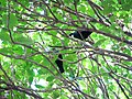
Almorah Rock Forest

Last updated

Almorah Rock Forest
Almorah Road Rock Forest.jpg
View of a remaining portion of the Almorah Road Rock Forest taken from Withiel Thomas Reserve.
Ecology
Realm Australasian
Biome temperate broadleaf and mixed forests
Geography
Area0.032 km2 (0.012 sq mi)
Country New Zealand
Region Auckland Region
Coordinates 36°52′26″S174°46′19″E / 36.874°S 174.772°E / -36.874; 174.772

The Almorah Rock Forest (also known as the Epsom Rock Forest) is a lava rock forest located on the northeastern slope of Maungawhau / Mount Eden, in Auckland, New Zealand. [1] It is one of the few remaining lava rock forest patches in the region. [2]

Contents

Geography

The forest established itself upon lava fields surrounding Maungawhau/Mount Eden, which were formed 28,000 years ago. [2] These fields were formed through the movement of magma through the scoria base of Maungawhau/Mount Eden leading to lava flows down the slope of the volcano. This magma solidified to create deposits of basalt rock. [3]

The Almorah Rock Forest was once 5,000 hectares (12,000 acres) in size, but has since been reduced to a 3.2 hectares (7.9 acres) pocket of land encompassing three small reserves and a number of private properties making up the majority of remaining lava rock forest in Auckland. Together these are designated as a Significant Ecological Area by Auckland Council.

The basalt forest floor contains a limited amount of soil, but accumulates leaf litter allowing plants to germinate between large boulders. [4]

Biodiversity

Kawakawa (Piper excelsum) in the understory of Withiel Thomas Reserve Kawakawa Piper excelsum at Withiel Thomas.jpg
Kawakawa (Piper excelsum) in the understory of Withiel Thomas Reserve

The Almorah Rock Forest hosts a variety of native and introduced flora and fauna.

Flora

The Almorah Rock Forest is a broadleaf forest. [2] A study by Smale and Gardner in 1999 found that 40% of plant species identified in the Withiel Reserve were native. Large native canopy trees found within the Almorah Rock Forest include; Mangeao (Litsea Calicaris), Tītoki (Alectryon excelsus), Pūriri (Vitex Lucens), Kohe Kohe (Dysoxylum spectabile) and Akapuka (Griselinia lucida). Sub-canopy species include Māhoe (Melicytus ramiflorous), Houpara (Pseudopanax lessonii). Native understory plants include Kawa Kawa(Piper excelsum) and Karamū(Coprosma robusta). A variety of ferns have also been noted on the forest floor, such as King Ferns (Ptisana salicina) [5] Additionally, a rare and native fern species known as Sickle Fern (Pellaea falcata), was found to have regenerated within the forest. [2]

The Almorah Rock Forest also contains various introduced weeds such as Climbing Asparagus[Asparagus scandens] and Japanese Hill Cherry (Prunus serrulata). [5] In 2016, works were carried out in collaboration between Auckland Council and the Auckland Motorway Alliance to remove 40 invasive tree privets from the northeastern edge of the forest. [6] [7]

Fauna

The Almorah Rock Forests provide a favorable habitat for native bird species including Kererū (Hemiphaga novaeseelandiae), Pīwakawaka/Fantail (Rhipidura fuliginosa) and Tūī (Prosthemadera novaeseelandiae). [8] Kākā (Nestor meridionalis) and Tauhou/Silvereye (Zosterops lateralis) have also been spotted there. [9] [10]

Auckland Council notes the presence of introduced mammals, particularly rodents and possums, within the rock forest. Possums pose a threat to native biodiversity by feeding on indigenous plants. [2] and attacking native birds. Rats predate native birds eggs and chicks as well as consuming plant seeds on the forest floor and therefore negatively affecting forest regeneration processes. Urban Ark - Manawa Taiao is a support organisation for a range of community conservation group including the Maungawhau Ecological Halo, which since 2021 has created a network of backyard traps around the rock forest patches and Maungawhau to reduce the number of mammalian predators in the area.

History

Early history

Much of the native forest of the Auckland isthmus is believed to have been burned and repurposed for cultivation by Māori settlers starting in the 13th century. [1] [11] This likely included portions of the Almorah Rock Forest due to its proximity to a site on Maungawhau/Mount Eden. [12] The pā was occupied by various iwi over time, such as Ngā Oho, before being occupied by Huakaiwaka, which was made up by various iwi and hapū. In 18th century, the pā site was left vacant as a result of warfare. [13]

Post 1840

Rockwood House in 1901 Rockwood after additions (AM PH-NEG-C5938) (cropped).jpg
Rockwood House in 1901

The Almorah Rock Forest area was sought after by European settlers as a place of residence. In 1865, Rockwood House was constructed near the rock forest. In 1876, the house and its surrounding forest was depicted in a painting by Alfred Sharpe. Subdivision in the area continued until the 1980s, when it was halted due to ecological and architectural heritage concerns [1]

In 1948, the descendants of Algernon Thomas gifted the city a 0.7 hectares (1.7 acres) block of land within the Almorah Rock Forest. [1] This land had belonged to Thomas during his lifetime. [11] Thomas was natural history scholar and became one of the first professors of the Auckland University College in 1883. [14] Thomas was a conservationist who called for the protection of native bird species in 1886. [15] This block of land is now called the Withiel Thomas Reserve and is available for public access.

In 2001, a 1.4 hectares (3.5 acres) site of the Almorah Road Rock Forest was placed under the ownership of the Department of Conservation following public controversy over a resource consent application for a developer to construct a series of dwellings on the site. The decision was made following negotiations with the developer. [16] [17]

In 2014, a landowner was fined $16,250 after felling vegetation and removing rock in breach of the Auckland Unitary Plan. [18]

Related Research Articles

<span class="mw-page-title-main">Flora of New Zealand</span> Plant species of New Zealand

This article relates to the flora of New Zealand, especially indigenous strains. New Zealand's geographical isolation has meant the country has developed a unique variety of native flora. However, human migration has led to the importation of many other plants as well as widespread damage to the indigenous flora, especially after the advent of European colonisation, due to the combined efforts of farmers and specialised societies dedicated to importing European plants & animals.

<span class="mw-page-title-main">New Zealand falcon</span> Species of bird

The New Zealand falcon is New Zealand's only falcon. Other common names for the bird are bush hawk and sparrow hawk. It is frequently mistaken for the larger and more common swamp harrier. It is the country's most threatened bird of prey, with only around 3000–5000 breeding pairs remaining.

<span class="mw-page-title-main">Kermadec Islands</span> Subtropical island arc in the South Pacific Ocean

The Kermadec Islands are a subtropical island arc in the South Pacific Ocean 800–1,000 km (500–620 mi) northeast of New Zealand's North Island, and a similar distance southwest of Tonga. The islands are part of New Zealand. They are 33.6 km2 (13.0 sq mi) in total area and uninhabited, except for the permanently staffed Raoul Island Station, the northernmost outpost of New Zealand.

<span class="mw-page-title-main">Epsom, New Zealand</span> Suburb in Auckland, New Zealand

Epsom is a suburb of Auckland, New Zealand. It is located in the centre of the Auckland isthmus between Mount Eden and Greenlane, south of Newmarket, and 5 km (3.1 mi) south of the Auckland City Centre.

<span class="mw-page-title-main">Mount Eden</span> Suburb in Auckland, New Zealand

Mount Eden is a suburb in Auckland, New Zealand whose name honours George Eden, 1st Earl of Auckland. It is 4 kilometres (2.5 mi) south of the Central Business District (CBD). Mt Eden Road winds its way around the side of Mount Eden Domain and continues to weave back and forth as it descends into the valley; it runs south from Eden Terrace to Three Kings. Mt Eden village centre is located roughly between Valley Road and Grange Road. The domain is accessible on foot from many of the surrounding streets, and by vehicle from Mt Eden Road. The central focus of the suburb is Maungawhau / Mount Eden, a dormant volcano whose summit is the highest natural point on the Auckland isthmus.

<span class="mw-page-title-main">Waitākere Ranges</span> Mountain range on the North Island of New Zealand

The Waitākere Ranges is a mountain range in New Zealand. Located in West Auckland between metropolitan Auckland and the Tasman Sea, the ranges and its foothills and coasts comprise some 27,720 hectares of public and private land. The area, traditionally known to Māori as Te Wao Nui o Tiriwa, is of local, regional, and national significance. The Waitākere Ranges includes a chain of hills in the Auckland Region, generally running approximately 25 kilometres (16 mi) from north to south, 25 km west of central Auckland. The ranges are part of the Waitākere Ranges Regional Park.

<span class="mw-page-title-main">Maungawhau railway station</span> Railway station in New Zealand

Maungawhau railway station, formerly known as Mount Eden railway station, is a Western Line station of the Auckland railway network in the Auckland suburb of Mount Eden in New Zealand. The station has been closed since 2020 and is currently undergoing an extensive reconstruction as part of the wider work on the City Rail Link. The station is due to reopen to the public in early 2026.

<span class="mw-page-title-main">Morningside, Auckland</span> Suburb in Auckland, New Zealand

Morningside is a suburb of Auckland, New Zealand. It lies four kilometres south-west of the city centre, close to Eden Park and Western Springs Reserve.

<span class="mw-page-title-main">Konini</span> Suburb in Auckland, New Zealand

Konini is a suburb in West Auckland, New Zealand, under the local governance of Auckland Council.

<span class="mw-page-title-main">Auckland isthmus</span> Narrow landstrip in Auckland, New Zealand

The Auckland isthmus, also known as the Tāmaki isthmus, is a narrow stretch of land on the North Island of New Zealand in the Auckland Region, and the location of the central suburbs of the city of Auckland, including the CBD. The isthmus is located between two rias : the Waitematā Harbour to the north, which opens to the Hauraki Gulf / Tīkapa Moana and Pacific Ocean, and the Manukau Harbour to the south, which opens to the Tasman Sea. The isthmus is the most southern section of the Northland Peninsula.

<span class="mw-page-title-main">Meola Reef</span> Lava flow in Auckland, New Zealand

Meola Reef, or Te Tokaroa in Māori, is a lava flow forming a reef peninsula across part of Auckland's Waitemata Harbour, New Zealand. The reef extends for over 2 kilometres across the harbour, to within 500 metres of Kauri Point on the northern shore.

<span class="mw-page-title-main">Algernon Thomas</span> New Zealand university professor, geologist, biologist and educationalist

Sir Algernon Phillips Withiel Thomas was a New Zealand university professor, geologist, biologist and educationalist. He was born in Birkenhead, Cheshire, England in 1857 and died in Auckland, New Zealand in 1937. He is best known for his early research (1880–83) into the life cycle of the sheep liver fluke, a discovery he shared with the German zoologist Rudolf Leuckart, his report on the eruption of Tarawera (1888) and his contribution to the development of New Zealand pedagogy.

<span class="mw-page-title-main">Maungawhau / Mount Eden</span> Scoria cone in Auckland, New Zealand

Maungawhau / Mount Eden is a scoria cone and Tūpuna Maunga in the Mount Eden suburb of Auckland, New Zealand. The cone is part of the Auckland volcanic field, the tallest located on the isthmus.

<span class="mw-page-title-main">Eden Valley, New Zealand</span> Suburb in Auckland Council, New Zealand

Eden Valley is an inner-city suburb of Auckland, the largest and most populous urban area in New Zealand. The suburb grew around Dominion Road, one of the Auckland's main arterial routes. Eden Valley's commercial hub is made up of a collection of businesses, shops, and dining options that service the area. The eclectic collection of shop fronts and signage on Dominion Road has aptly been described as, "colour and chaos". The "colour and chaos" of the commercial hub is strongly contrasted by the surrounding residential area. Eden Valley is characterized by heritage buildings that house modern day businesses, a residential area that has a range of late Victorian, Edwardian and transitional bay villas, and basalt and scoria stone walls that give the area a long established feel.

Ngā Uruora - Kāpiti Project is a community conservation project set up in Paekākāriki, New Zealand in 1997 by Fergus Wheeler. It is named after the book Ngā Uruora: The Groves of Life - Ecology & History in a New Zealand Landscape by ecologist Geoff Park. The main aims of Ngā Ururoa are protecting and restoring the Kāpiti Coast's unique kohekohe forest, re-establishing forests through planting programmes, and undertaking pest and weed control.

<span class="mw-page-title-main">Albert-Eden</span> Local board area in Auckland, New Zealand

Albert-Eden is a local government area in Auckland, in New Zealand's Auckland Region. It is governed by the Albert-Eden Local Board and Auckland Council, and is located within the council's Albert-Eden-Puketāpapa Ward.

<span class="mw-page-title-main">Ambury Regional Park</span>

Ambury Regional Park is a regional park situated on the coast of Manukau Harbour, in Auckland in New Zealand's North Island. It is situated in the suburb of Māngere Bridge and in the local board area of Māngere-Ōtāhuhu, to the west of Māngere Mountain.

<span class="mw-page-title-main">Tūpuna Maunga o Tāmaki Makaurau</span> Mountains in Auckland, New Zealand

The Tūpuna Maunga o Tāmaki Makaurau are 14 volcanic cones that hold great historical, spiritual, ancestral and cultural significance to the 13 Māori iwi and hapū of Ngā Mana Whenua o Tāmaki Makaurau, who have owned them since 2014.

<span class="mw-page-title-main">Gribblehirst Park</span> Park in Auckland, New Zealand

Gribblehirst Park is a park in central Auckland, New Zealand, close to the suburbs of Sandringham and Morningside. Originally the park was known as Cabbage Tree Swamp.

References

  1. 1 2 3 4 "Eden in Auckland". New Zealand Geographic. Retrieved 23 November 2023.
  2. 1 2 3 4 5 OurAuckland. "Restoring one of Auckland's rarest ecosystems". OurAuckland. Retrieved 23 November 2023.
  3. Hayward, Bruce W (2019). Volcanoes of Auckland: A Field Guide. Auckland University Press. pp. 8–9. ISBN   9781776710492.
  4. "Eden in Auckland". New Zealand Geographic. Retrieved 23 November 2023.
  5. 1 2 Cameron, Ewen K. (2018). "Mt Eden/Maungawhau urban rock-forests revisited" (PDF). Auckland Botanical Society Journal. 73 (2): 102–112.
  6. Ecological Management Almorah Rock Forest – Collaboration between landowners (PDF) (Report). New Zealand Transport Agency. February 2019. p. 1. Retrieved 23 November 2023.
  7. Edmonds, Elesha (8 August 2016). "Saving Auckland's largest remaining lava rock forest". Stuff. Retrieved 26 November 2023.
  8. "Lava Rock Forests". Urban Ark – Manawa Taiao. Retrieved 27 November 2023.
  9. OurAuckland. "Locals supported to help preserve ecological treasure". OurAuckland. Retrieved 27 November 2023.
  10. "Withiel Thomas Reserve, Auckland City County, AUK, NZ – eBird Hotspot". ebird.org. Retrieved 27 November 2023.
  11. 1 2 Council, Auckland. "Withiel Thomas Path – short walks in Auckland". Auckland Council. Retrieved 27 November 2023.
  12. Smale, M.C.; Gardner, R.O. (1999). "Survival of Mount Eden Bush, an Urban Forest Remnant in Auckland, New Zealand". Pacific Conservation Biology. 5 (2): 83–93. doi:10.1071/PC990083.
  13. Maungawhau: A Short History of Volunteer Action. Friends of Maungawhau Inc. 2014. pp. 8–9.
  14. "History of the University of Auckland – The University of Auckland". www.calendar.auckland.ac.nz. Retrieved 27 November 2023.
  15. "AUCKLAND INSTITUTE". Auckland Star. 17 November 1886. p. 6. Retrieved 27 November 2023.
  16. "Mayor backs calls for Almorah Road preservation | Scoop News". www.scoop.co.nz. 16 January 2001. Retrieved 27 November 2023.
  17. "Unique Auckland Rock Forest Saved | Scoop News". www.scoop.co.nz. 13 December 2001. Retrieved 27 November 2023.
  18. "Prosecution for rare lava flow damage | Scoop News". www.scoop.co.nz. 13 February 2014. Retrieved 27 November 2023.