Altleiningen

Last updated • 4 min readFrom Wikipedia, The Free Encyclopedia
Altleiningen
DEU Altleiningen COA.svg
Coat of arms
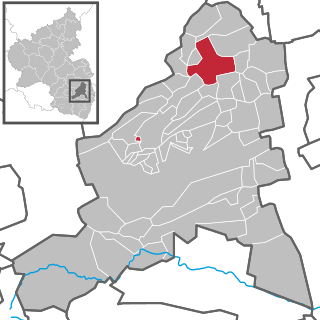
Location of Altleiningen within Bad Dürkheim district
Altleiningen in DUW.svgMeckenheimCarlsbergLindenbergLambrechtObrigheimBattenbergWorms
Germany adm location map.svg
Red pog.svg
Altleiningen
Rhineland-Palatinate location map.svg
Red pog.svg
Altleiningen
Coordinates: 49°30′29″N08°04′28″E / 49.50806°N 8.07444°E / 49.50806; 8.07444 Coordinates: 49°30′29″N08°04′28″E / 49.50806°N 8.07444°E / 49.50806; 8.07444
Country Germany
State Rhineland-Palatinate
District Bad Dürkheim
Municipal assoc. Leiningerland
Government
   Mayor (201924) Gunther Schneider [1]
Area
  Total11.47 km2 (4.43 sq mi)
Elevation
301 m (988 ft)
Population
 (2020-12-31) [2]
  Total1,737
  Density150/km2 (390/sq mi)
Time zone UTC+01:00 (CET)
  Summer (DST) UTC+02:00 (CEST)
Postal codes
67317
Dialling codes 06356
Vehicle registration DÜW
Website www.vg-l.de/ortsgemeinden/altleiningen/

Altleiningen is an Ortsgemeinde – a municipality belonging to a Verbandsgemeinde , a kind of collective municipality – in the Bad Dürkheim district in Rhineland-Palatinate, Germany.

Contents

Geography

Location

The municipality lies at an elevation of 300 m above sea level in the northeast Palatinate Forest in the valley of the Eckbach, a 39 km-long brook that empties into the Rhine. Altleiningen belongs to the Verbandsgemeinde of Leiningerland, whose seat is in Grünstadt.

History

Name

Altleiningen, originally Leiningen, had its first documentary mention in 780 when the 50 km-distant Lorsch Abbey’s catalogue of holdings listed a woodland holding in linunga marca (Latin for “in the Leiningen area”). The naming referred to the Leinbaum, a name used locally at the time mostly for the Norway Maple, but sometimes also for the large-leaved linden. Since both trees were often found growing alongside the Eckbach, the brook at this time also went by the name Leinbach.

From the municipality's name also sprang the noble family Leiningen’s name. This family held the so-called Leiningerland for centuries.

Local administration

After the Second World War, the municipality belonged at first to the Frankenthal district, which in the course of administrative reform in Rhineland-Palatinate was abolished in 1969. Altleiningen then found itself in the newly created district of Bad Dürkheim. In 1972, Altleiningen also found itself in the likewise newly created Verbandsgemeinde of Hettenleidelheim.

Religion

In 2007, 45.7% of the inhabitants were Evangelical and 30.1% Catholic. The rest belonged to other faiths or adhered to none. [3]

Politics

Municipal council

The municipal election held on 7 June 2009 yielded the following results:

Parties and voter communities%
2009
Seats
2009
Difference
to 2004
WG Dennhardt35.06+2
FWG32.85-2
SPD 20.53+1
WG Köhler6.31+1
CDU 5.41-2

Mayors

since 2019 Gunther Schneider
2009–2019 Frank Dennhardt (WG)
1992–2009 Karl Meister (FWG)
1990–1992 Michael Haab (CDU)
1979–1990 Otwin Frank (FWG)
1974–1979 Jakob Neu (CDU)
1971–1974 Gerd Abel (WG)
1969–1971 Friedrich Dörner (WG)
1952–1969 Jakob Neu (CDU)
1948–1952 August Dörner
1945–1948 Christoph Bohn II.
1934–1945 Johannes Jotter II.
1933 (June–December) August Alebrand

1931–1933 Christoph Bohn II.
1910–1931 Karl Heinrich Klein
1899–1909 Heinrich Müller
1894–1899 Karl Krauß I.
1871–1894 Heinrich Müller III.
1870–1871 Johann Müller IV.
1859–1869 Philipp Jakob Zimmermann
1848–1859 Samuel Krebill
1844–1848 Heinrich Krebill
1842–1844 Heinrich Haartung
1820–1842 Abraham Krebill
1814–1820 Jakob Zimmermann
1808–1814 Abraham Krebill
1804–1808 Georg Walter

Coat of arms

The German blazon reads: In Rot ein schwebendes angetatztes goldenes Kreuz mit eingeschlagenen eichenblattartigen Verzierungen an den Balkenenden, bewinkelt von vier silbernen Adlern.

The municipality's arms might in English heraldic language be described thus: Gules a cross pattée couped with an oakleaf adornment at the end of each arm Or between four eagles displayed argent.

The arms were approved by the now defunct Regierungsbezirk of Rheinhessen-Pfalz. It goes back to a seal from 1716. They match arms borne by the Counts of Leiningen-Westerburg, who had their ancestral seat at Castle Altleiningen. [4]

Culture and sightseeing

Castle's inner ward, nowadays a youth hostel Burg Altleiningen Jugendherberge.JPG
Castle's inner ward, nowadays a youth hostel
St. Jacob's in the outlying centre of Honingen. in the background at right, the ruined monastery church's west gable St.jacob.jpg
St. Jacob's in the outlying centre of Höningen. in the background at right, the ruined monastery church's west gable

Altleiningen Castle

Altleiningen Castle (Burg Altleiningen) was built on the summit of a hill, some 400 metres high, that rises above the left bank of the Eckbach. Within the castle are a youth hostel and – in the moat – a heated swimming pool. In the roofed Ehrenhalle – "Hall of Honour" – a room separated from the castle courtyard by arcades, the amateur theatre group, the Altleiningen Castle Players (Burgspiele Altleiningen) has been producing challenging plays – classical, modern, often also some with historical aspects – every year in the summer months since 1980.

Höningen Abbey and the Church of St. James

At Höningen, about 2 km to the south, are the Romanesque Church of St. James (Kirche St. Jacob) and the remnants of the canonical monastery of Höningen. The latter has a gateway arch at the north entrance, and the west gables of the convent buildings and monastery church are parallel to the modern high street. Saint James’ and the abbey were both built about 1120. Two letters patent, one each from Pope Innocent II and Emperor Friedrich Barbarossa, underscore the monastery's importance at the time of its founding.

Höningen Latin School

Recalling the Höningen Latin School (Höninger Lateinschule, 1573–1630), in which the Leininger-Gymnasium in Grünstadt has its roots, is a gatehouse at the way into the back alley.

20-Pipe Well

From the 20-Pipe Well (20-Röhren-Brunnen), which is fed from an adit that was sunk deep into the cliff about 1600 to supply the castle above with water, the Eckbach nowadays draws most of its flow. It is also here that the 19 km-long Eckbach Mill cycling and hiking path begins, which follows the river downstream to Dirmstein.

Economy and infrastructure

Established businesses

The industrial location Drahtzug lies on the Eckbach 2 km northeast of the village and is named after the Drahtzug Stein GmbH + Co. KG, which has its production facility there. The business is the Bad Dürkheim district's biggest employer.

Transport

The Leiningen Valley Railway once ran from Altleiningen to Grünstadt. Passenger services were operated on the line from 1903 to 1969 and, until late 2005, the remaining section of railway still operated goods traffic on the Grünstadt–Drahtzug section to serve the factory.

The bus service on the Grünstadt–Altleiningen route stops at Drahtzug.

Famous people

Sons and daughters of the town

Famous people associated with the municipality

Related Research Articles

Grünstadt Place in Rhineland-Palatinate, Germany

Grünstadt is a town in the Bad Dürkheim district in Rhineland-Palatinate, Germany with roughly 13,200 inhabitants. It does not belong to any Verbandsgemeinde – a kind of collective municipality – but is nonetheless the administrative seat of the Verbandsgemeinde of Leiningerland.

Bissersheim Place in Rhineland-Palatinate, Germany

Bissersheim is an Ortsgemeinde – a municipality belonging to a Verbandsgemeinde, a kind of collective municipality – in the Bad Dürkheim district in Rhineland-Palatinate, Germany.

Bockenheim an der Weinstraße Place in Rhineland-Palatinate, Germany

Bockenheim an der Weinstraße is an Ortsgemeinde – a municipality belonging to a Verbandsgemeinde, a kind of collective municipality – in the Bad Dürkheim district in Rhineland-Palatinate, Germany.

Ebertsheim Place in Rhineland-Palatinate, Germany

Ebertsheim is an Ortsgemeinde – a municipality belonging to a Verbandsgemeinde, a kind of collective municipality – in the Bad Dürkheim district in Rhineland-Palatinate, Germany.

Großkarlbach Place in Rhineland-Palatinate, Germany

Großkarlbach is an Ortsgemeinde – a municipality belonging to a Verbandsgemeinde, a kind of collective municipality – in the Bad Dürkheim district in Rhineland-Palatinate, Germany.

Kirchheim an der Weinstraße Place in Rhineland-Palatinate, Germany

Kirchheim an der Weinstraße is an Ortsgemeinde – a municipality belonging to a Verbandsgemeinde, a kind of collective municipality – in the Bad Dürkheim district in Rhineland-Palatinate, Germany.

Kleinkarlbach Place in Rhineland-Palatinate, Germany

Kleinkarlbach is an Ortsgemeinde – a municipality belonging to a Verbandsgemeinde, a kind of collective municipality – in the Bad Dürkheim district in Rhineland-Palatinate, Germany.

Laumersheim Place in Rhineland-Palatinate, Germany

Laumersheim is an Ortsgemeinde – a municipality in the Bad Dürkheim district in Rhineland-Palatinate, Germany. It lies in the northwest part of the Rhine-Neckar urban agglomeration.

Mertesheim Place in Rhineland-Palatinate, Germany

Mertesheim is an Ortsgemeinde – a municipality belonging to a Verbandsgemeinde, a kind of collective municipality – in the Bad Dürkheim district in Rhineland-Palatinate, Germany.

Neuleiningen Place in Rhineland-Palatinate, Germany

Neuleiningen is an Ortsgemeinde – a municipality belonging to a Verbandsgemeinde, a kind of collective municipality – in the Bad Dürkheim district in Rhineland-Palatinate, Germany.
Obersülzen Place in Rhineland-Palatinate, Germany

Obersülzen is an Ortsgemeinde – a municipality belonging to a Verbandsgemeinde, a kind of collective municipality – in the Bad Dürkheim district in Rhineland-Palatinate, Germany. It lies in the northwest of the Rhine-Neckar urban agglomeration.

Tiefenthal Place in Rhineland-Palatinate, Germany

Tiefenthal is an Ortsgemeinde – a municipality belonging to a Verbandsgemeinde, a kind of collective municipality – in the Bad Dürkheim district in Rhineland-Palatinate, Germany.
Wattenheim Place in Rhineland-Palatinate, Germany

Wattenheim is an Ortsgemeinde – a municipality belonging to a Verbandsgemeinde, a kind of collective municipality – in the Bad Dürkheim district in Rhineland-Palatinate, Germany.

Battenberg, Rhineland-Palatinate Place in Rhineland-Palatinate, Germany

Battenberg is an Ortsgemeinde – a municipality belonging to a Verbandsgemeinde, a kind of collective municipality – in the Bad Dürkheim district in Rhineland-Palatinate, Germany.
Carlsberg, Germany Place in Rhineland-Palatinate, Germany

Carlsberg is an Ortsgemeinde – a municipality belonging to a Verbandsgemeinde, a kind of collective municipality – in the Bad Dürkheim district in Rhineland-Palatinate, Germany.
Obrigheim, Rhineland-Palatinate Place in Rhineland-Palatinate, Germany

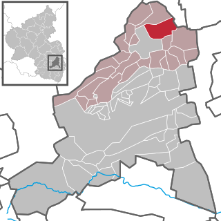
Obrigheim (Pfalz) is an Ortsgemeinde – a municipality belonging to a Verbandsgemeinde, a kind of collective municipality – in the Bad Dürkheim district in Rhineland-Palatinate, Germany. It lies in the northwest of the Rhine-Neckar urban agglomeration.

Eckbachweiher

The Eckbachweiher in the Palatine Leiningerland in the German state of Rhineland-Palatinate is a woog on the Eckbach stream. A woog is the name given to still bodies of water, especially man-made reservoirs, in southwest Germany.
Leininger Sporn

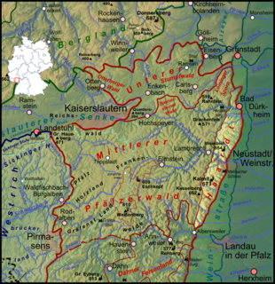
The Leininger Sporn is a highly prominent ridge in the northeast of the Palatinate Forest in western Germany, mainly composed of the rock formations of the Middle and Upper Bunter. It forms the western edge of Upper Rhine Plain between Grünstadt in the north and Leistadt, a village in the county of Bad Durkheim, in the southeast. In the natural region system of the German Central Uplands it is considered one of the four sub-units of the Middle Palatinate Forest.

Altleiningen Castle

Altleiningen is a castle in the Palatinate Forest in Germany. It lies in the parish of Altleiningen in the county of Bad Durkheim in the German state of Rhineland-Palatinate.
Leiningerland Historic landscape in the Palatinate region in the German federal state of Rhineland-Palatinate

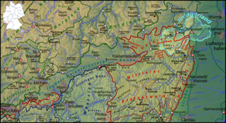
The Leiningerland is an historic landscape in the Palatinate region in the German federal state of Rhineland-Palatinate. It is named after an aristocratic family that used to be the most important in the region, the House of Leiningen.

References

  1. Direktwahlen 2019, Landkreis Bad Dürkheim, Landeswahlleiter Rheinland-Pfalz, accessed 3 August 2021.
  2. "Bevölkerungsstand 2020, Kreise, Gemeinden, Verbandsgemeinden". Statistisches Landesamt Rheinland-Pfalz (in German). 2021.
  3. KommWis, Stand: 31.12.2007 Archived 2007-09-29 at the Wayback Machine
  4. Karl Heinz Debus: Das große Wappenbuch der Pfalz. Neustadt an der Weinstraße 1988, ISBN   3-9801574-2-3