Hettenleidelheim

Last updated • 5 min readFrom Wikipedia, The Free Encyclopedia
Hettenleidelheim
DEU Hettenleidelheim COA.svg
Coat of arms
Location of Hettenleidelheim within Bad Dürkheim district
Hettenleidelheim in DUW.svgMeckenheimCarlsbergLindenbergLambrechtObrigheimBattenbergWorms
Germany adm location map.svg
Red pog.svg
Hettenleidelheim
Rhineland-Palatinate location map.svg
Red pog.svg
Hettenleidelheim
Coordinates: 49°32′08″N08°04′24″E / 49.53556°N 8.07333°E / 49.53556; 8.07333 Coordinates: 49°32′08″N08°04′24″E / 49.53556°N 8.07333°E / 49.53556; 8.07333
Country Germany
State Rhineland-Palatinate
District Bad Dürkheim
Municipal assoc. Leiningerland
Government
   Mayor (201924) Steffen Blaga [1] (CDU)
Area
  Total5.08 km2 (1.96 sq mi)
Elevation
295 m (968 ft)
Population
 (2020-12-31) [2]
  Total3,071
  Density600/km2 (1,600/sq mi)
Time zone UTC+01:00 (CET)
  Summer (DST) UTC+02:00 (CEST)
Postal codes
67310
Dialling codes 06351
Vehicle registration DÜW
Website www.hettenleidelheim.de

Hettenleidelheim (Palatine German: Hettrum) is an Ortsgemeinde – a municipality belonging to a Verbandsgemeinde , a kind of collective municipality – in the Bad Dürkheim district in Rhineland-Palatinate, Germany. Until 2018, it was the seat of the like-named Verbandsgemeinde.

Contents

Geography

Location

The municipality lies in the north of the Palatinate Forest Nature Park (Naturpark Pfälzerwald) in the vicinity of the watershed between the Eisbach and the Eckbach, which flow by the municipality to the north and the south respectively. To the town of Eisenberg to the north, it is 2 km.

History

In 1155, Hettenleidelheim had its first documentary mention and was originally made up of two centres: Hitenheim (later Hettenheim) and Luttelheim (later Leidelheim). Both fell under the Ramsen Monastery's lordship in the Middle Ages, passing to the Bishopric of Worms in 1485 after the monastery's dissolution. Municipal union under a common village court goes back to 1556. In the time of the Reformation, Hettenheim and Leidelheim, along with the outlying Protestant parishes of Eisenberg and Wattenheim, became Lutheran. However, already by about 1634, when the Catholic party got the upper hand in the Thirty Years' War, the two municipalities were first reassigned to the Catholic parish of Neuleiningen, and then in 1705 and 1707, the united municipality was raised to a Catholic parish in its own right. From the mid 19th century, and increasingly as of about 1870, the quarrying of the local highly fireproof clays grew into the municipality's main branch of industry, expanding to industrialized recovery in 1901. After the Second World War, though, this industry was disrupted. Until 1969, the municipality belonged to the now abolished district of Frankenthal. In 2005, Hettenleidelheim celebrated its 850-year jubilee.

Religion

Represented in the municipality are some 1,500 Catholic and 1,000 Protestant Christians, each group with its own parish, [3] and a few Muslims. The Protestants moved to the community mainly in the latter half of the 20th century. The Catholic parish of St. Peter with its branch St. Georg, Tiefenthal, today form with Wattenheim and Altleiningen a parish community. The Protestant parish is an autonomous branch of Wattenheim.

The Jewish community that once existed in the municipality (synagogue in Wattenheim) is still witnessed by two old hidden graveyards that were used from the 18th to the 20th century, and where there are some gravestones worth seeing. [4]

Politics

Municipal council

The council is made up of 20 council members, who were elected at the municipal election held on 7 June 2009, and the honorary mayor as chairman.

The municipal election held on 7 June 2009 yielded the following results: [5]

SPD CDU FWG Total
200998320 seats
200499220 seats

Mayor

Since 2016, the Mayor of Hettenleidelheim has been Steffen Blaga (CDU).

Deputies

  1. Norbert Unterländer (CDU)
  2. Dominik Wellstein (SPD)
  3. Maria Altheimer (CDU)

Coat of arms

The German blazon reads: In Schwarz ein schrägrechtsgestellter silberner Schlüssel mit abwärtsgekehrtem Bart, unten rechts begleitet von einem schwebenden goldenen Andreaskreuz.

The municipality's arms might in English heraldic language be described thus: Sable a key bendwise argent, the wards in chief and turned to dexter, in base dexter a saltire Or.

The arms were approved by the now abolished Regierungsbezirk government in Neustadt in 1979 and go back to a seal from 1758. The key symbolizes the High Foundation of Worms whose patron was Saint Peter. [6]

Town partnerships

Hettenleidelheim fosters partnerships with the following places:

Culture and sightseeing

Buildings

Grunderzeit house Gruenderzeithaus Hettenleidelheim.jpg
Gründerzeit house
The Catholic Church of Hettenleidelheim St.Peter Hettenleidelheim.JPG
The Catholic Church of Hettenleidelheim
Verbandsgemeinde administration building Rathaus Hettenleidelheim.jpg
Verbandsgemeinde administration building

Catholic church – The Catholic Church stands in the constituent community of Leidelheim and was built from 1720 to 1724; from 1898 to 1901 it was expanded. It possesses two noteworthy stone Baroque altars from the time of its building.

Railway station – The old railway station is a work in dark sandstone from the late 19th century.

Kriegerhain – The Kriegerhain, or “Warriors’ Grove”, in Hettenheim's lower village harbours various monuments and noteworthy gravestones from the 17th century. The lands once served as the churchyard for Hettenheim's mediaeval Saint Stephen's Chapel (Stephanus-Kapelle), which between 1720 and 1724 was forsaken in favour of the then newly built parish church in Leidelheim.

Jewish graveyards – Next to the Warriors’ Grove lies the older of the municipality's two Jewish graveyards (18th century); the newer one was laid out in the 19th century on the boulevard that leads to Tiefenthal.

Alte Schule – Unusual is the Alte Schule, or “Old School”, built in the late 19th century with a crenellated tower; it now serves as the “house of clubs”.

Municipal festival hall – The spacious Gemeindefesthalle came into being in the 1920s and was renovated about 2000. It was built by the gymnastic club Gut Heil using prestressed concrete.

Festhalle Hettenleidelheim, originally built by the gymnastics club Gut-Heil as gym. Festhalle Gut-Heil Hettenleidelheim.jpg
Festhalle Hettenleidelheim, originally built by the gymnastics club Gut-Heil as gym.

Local history museum – The Heimatmuseum with its Karl Blum Archive tells the municipality's history and also the history of quarrying clay.

Natural monuments

Towards Eisenberg lies the Erdekaut protected area.

Music

Concerning themselves with performing music are Saint Peter's Catholic Church Choir (Katholischer Kirchenchor St. Peter), the Sängerbund Frohsinn (“singers’ league”) and the Miner's Wind Orchestra (Bergmannsblasorchester).

Regular events

Economy and infrastructure

Economy

Hettenleidelheim once earned its livelihood from quarrying clay. This economic activity has since been given up.

Transport

Roundabout in Hettenleidelheim Hettenleidelheim Kreisel.jpg
Roundabout in Hettenleidelheim

The municipality lies near the Autobahn Autobahn 6 and can be reached through the Wattenheim interchange (1 km). From 1895 to 1990, there was a railway link to Ebertsheim connecting with the Eistalbahn (another railway between Grünstadt and Enkenbach); passenger service was ended as early as 1954, and until the line was permanently closed, it was used only for goods transport. The railway to Grünstadt can nowadays be reached by bus, which goes to Eisenberg station.

Public institutions

As seat of the Verbandsgemeinde , Hettenleidelheim is home to this body's administration.

Education

Hettenleidelheim has its own primary school; secondary schools are available in neighbouring places.

Famous people

Honorary citizens

Sons and daughters of the town

Famous people associated with the municipality

Related Research Articles

Grünstadt Place in Rhineland-Palatinate, Germany

Grünstadt is a town in the Bad Dürkheim district in Rhineland-Palatinate, Germany with roughly 13,200 inhabitants. It does not belong to any Verbandsgemeinde – a kind of collective municipality – but is nonetheless the administrative seat of the Verbandsgemeinde of Leiningerland.

Birkenheide Place in Rhineland-Palatinate, Germany

Birkenheide is a municipality in the Rhein-Pfalz-Kreis, in Rhineland-Palatinate, Germany and is part of the Verbandsgemeinde Maxdorf.

Altleiningen Place in Rhineland-Palatinate, Germany

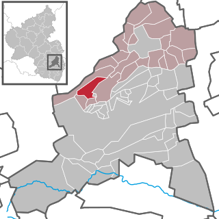
Altleiningen is an Ortsgemeinde – a municipality belonging to a Verbandsgemeinde, a kind of collective municipality – in the Bad Dürkheim district in Rhineland-Palatinate, Germany.

Bissersheim Place in Rhineland-Palatinate, Germany

Bissersheim is an Ortsgemeinde – a municipality belonging to a Verbandsgemeinde, a kind of collective municipality – in the Bad Dürkheim district in Rhineland-Palatinate, Germany.

Bockenheim an der Weinstraße Place in Rhineland-Palatinate, Germany

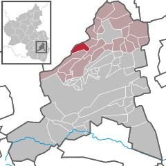
Bockenheim an der Weinstraße is an Ortsgemeinde – a municipality belonging to a Verbandsgemeinde, a kind of collective municipality – in the Bad Dürkheim district in Rhineland-Palatinate, Germany.

Ebertsheim Place in Rhineland-Palatinate, Germany

Ebertsheim is an Ortsgemeinde – a municipality belonging to a Verbandsgemeinde, a kind of collective municipality – in the Bad Dürkheim district in Rhineland-Palatinate, Germany.

Friedelsheim Place in Rhineland-Palatinate, Germany

Friedelsheim is an Ortsgemeinde – a municipality belonging to a Verbandsgemeinde, a kind of collective municipality – in the Bad Dürkheim district in Rhineland-Palatinate, Germany.

Großkarlbach Place in Rhineland-Palatinate, Germany

Großkarlbach is an Ortsgemeinde – a municipality belonging to a Verbandsgemeinde, a kind of collective municipality – in the Bad Dürkheim district in Rhineland-Palatinate, Germany.

Kirchheim an der Weinstraße Place in Rhineland-Palatinate, Germany

Kirchheim an der Weinstraße is an Ortsgemeinde – a municipality belonging to a Verbandsgemeinde, a kind of collective municipality – in the Bad Dürkheim district in Rhineland-Palatinate, Germany.

Laumersheim Place in Rhineland-Palatinate, Germany

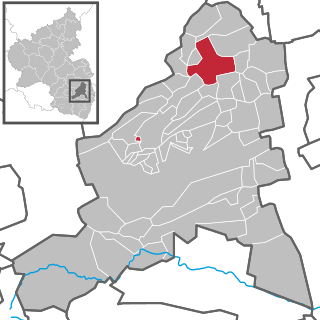
Laumersheim is an Ortsgemeinde – a municipality in the Bad Dürkheim district in Rhineland-Palatinate, Germany. It lies in the northwest part of the Rhine-Neckar urban agglomeration.

Mertesheim Place in Rhineland-Palatinate, Germany

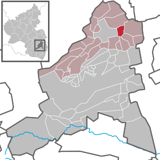
Mertesheim is an Ortsgemeinde – a municipality belonging to a Verbandsgemeinde, a kind of collective municipality – in the Bad Dürkheim district in Rhineland-Palatinate, Germany.

Obersülzen Place in Rhineland-Palatinate, Germany

Obersülzen is an Ortsgemeinde – a municipality belonging to a Verbandsgemeinde, a kind of collective municipality – in the Bad Dürkheim district in Rhineland-Palatinate, Germany. It lies in the northwest of the Rhine-Neckar urban agglomeration.

Quirnheim Place in Rhineland-Palatinate, Germany

Quirnheim is an Ortsgemeinde – a municipality belonging to a Verbandsgemeinde, a kind of collective municipality – in the Bad Dürkheim district in Rhineland-Palatinate, Germany. It lies in the northwest of the Rhine-Neckar urban agglomeration.

Tiefenthal Place in Rhineland-Palatinate, Germany

Tiefenthal is an Ortsgemeinde – a municipality belonging to a Verbandsgemeinde, a kind of collective municipality – in the Bad Dürkheim district in Rhineland-Palatinate, Germany.

Wattenheim Place in Rhineland-Palatinate, Germany

Wattenheim is an Ortsgemeinde – a municipality belonging to a Verbandsgemeinde, a kind of collective municipality – in the Bad Dürkheim district in Rhineland-Palatinate, Germany.

Carlsberg, Germany Place in Rhineland-Palatinate, Germany

Carlsberg is an Ortsgemeinde – a municipality belonging to a Verbandsgemeinde, a kind of collective municipality – in the Bad Dürkheim district in Rhineland-Palatinate, Germany.

Obrigheim, Rhineland-Palatinate Place in Rhineland-Palatinate, Germany

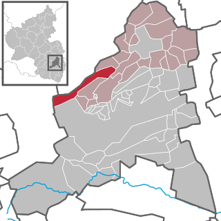
Obrigheim (Pfalz) is an Ortsgemeinde – a municipality belonging to a Verbandsgemeinde, a kind of collective municipality – in the Bad Dürkheim district in Rhineland-Palatinate, Germany. It lies in the northwest of the Rhine-Neckar urban agglomeration.

Niederstaufenbach Place in Rhineland-Palatinate, Germany

Niederstaufenbach is an Ortsgemeinde – a municipality belonging to a Verbandsgemeinde, a kind of collective municipality – in the Kusel district in Rhineland-Palatinate, Germany. It belongs to the Verbandsgemeinde of Kusel-Altenglan, whose seat is in Kusel.

Sohren Place in Rhineland-Palatinate, Germany

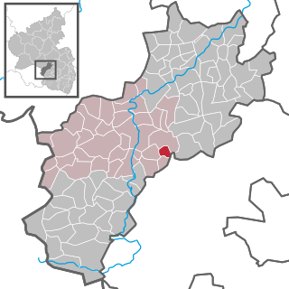
Sohren is an Ortsgemeinde – a municipality belonging to a Verbandsgemeinde, a kind of collective municipality – in the Rhein-Hunsrück-Kreis (district) in Rhineland-Palatinate, Germany. It belongs to the Verbandsgemeinde of Kirchberg, whose seat is in the like-named town. Sohren is a state-recognized tourism resort (Fremdenverkehrsort) and is set out in state planning as a lower centre.

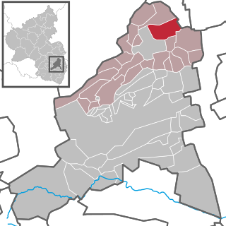
Leiningerland is a Verbandsgemeinde in the district of Bad Dürkheim, in Rhineland-Palatinate, Germany. The seat of the Verbandsgemeinde is in Grünstadt, which is not part of the Verbandsgemeinde. It was formed on 1 January 2018 by the merger of the former Verbandsgemeinden Grünstadt-Land and Hettenleidelheim. It takes its name from the historic area Leiningerland.

References

  1. Direktwahlen 2019, Landkreis Bad Dürkheim, Landeswahlleiter Rheinland-Pfalz, accessed 3 August 2021.
  2. "Bevölkerungsstand 2020, Kreise, Gemeinden, Verbandsgemeinden". Statistisches Landesamt Rheinland-Pfalz (in German). 2021.
  3. KommWis, Stand: 31. Dezember 2007 Archived 2007-09-29 at the Wayback Machine
  4. Information about Jewish history of Hettenleidelheim
  5. Kommunalwahl Rheinland-Pfalz 2009, Gemeinderat
  6. Karl Heinz Debus: Das große Wappenbuch der Pfalz. Neustadt an der Weinstraße 1988, ISBN   3-9801574-2-3