Amesbury, Massachusetts | |
---|---|
Former Census-designated place | |
Coordinates: 42°51′22″N70°55′41″W / 42.85611°N 70.92806°W | |
Country | United States |
State | Massachusetts |
County | Essex |
Area | |
• Total | 5.7 sq mi (14.7 km2) |
• Land | 5.3 sq mi (13.8 km2) |
• Water | 0.4 sq mi (0.9 km2) |
Elevation | 56 ft (17 m) |
Population (2000) | |
• Total | 12,327 |
• Density | 2,321.5/sq mi (896.3/km2) |
Time zone | UTC-5 (Eastern (EST)) |
• Summer (DST) | UTC-4 (EDT) |
ZIP code | 01913 |
Area code | 978 |
FIPS code | 25-01220 |
GNIS feature ID | 0614180 |
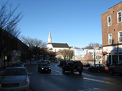
Amesbury CDP was a census-designated place comprising the main urban portions of the city of Amesbury, Massachusetts, in Essex County. With the change of Amesbury's status from town to city in 1996, the delineation of the downtown area as a CDP became unnecessary, and it was no longer used for data collection by the time of the 2010 census. [1]
Those details reported here are also included in the aggregate values reported for the entire city; at the 2000 census, the CDP had a total population of 12,327. [2]
According to the United States Census Bureau, the CDP had a total area of 14.7 km2 (5.7 mi2). 13.8 km2 (5.3 mi2) of it was land and 1.0 km2 (0.4 mi2) of it was water. The total area was 6.51% water.
As of the census of 2000, there were:
The population density was 896.3/km2 (2,321.5/mi2). There were 5,099 housing units at an average density of 370.8 inhabitants/km2 (960.3 inhabitants/mi2). The racial makeup of the CDP was 96.87% White, 0.65% African American, 0.21% Native American, 0.60% Asian, 0.02% Pacific Islander, 0.28% from other races, and 1.37% from two or more races. 1.05% of the population were Hispanic or Latino of any race.
There were 4,910 households, out of which 33.2% had children under the age of 18 living with them, 46.6% were married couples living together, 12.4% had a woman whose husband did not live with her, and 37.0% were non-families. 29.7% of all households were made up of individuals, and 9.8% had someone living alone who was 65 years of age or older. The average household size was 2.45, and the average family size was 3.07.
In the CDP the population was spread out, with 25.4% under the age of 18, 6.6% from 18 to 24, 34.5% from 25 to 44, 21.0% from 45 to 64, and 12.5% who were 65 years of age or older. The median age was 36 years. For every 100 females, there were 92.8 males. For every 100 females age 18 and over, there were 88.6 males.
The median income for a household in the CDP was $50,037, and the median income for a family was $59,853. Males had a median income of $41,566 versus $31,209 for females. The per capita income for the CDP was $22,657. 7.0% of the population and 4.6% of families were below the poverty line. Out of the total people living in poverty, 8.7% were under the age of 18 and 10.3% were 65 or older.
Quinebaug is a village and census-designated place (CDP) in Thompson, a town in Windham County, Connecticut, United States. The population was 1,133 at the 2010 census.
Raynham Center is a census-designated place (CDP) in the town of Raynham in Bristol County, Massachusetts, United States. The population was 4,100 at the 2010 census.
Smith Mills is a census-designated place (CDP) in the town of Dartmouth in Bristol County, Massachusetts, United States. The population was 4,760 at the 2010 census.
North Pembroke is a census-designated place (CDP) in the town of Pembroke in Plymouth County, Massachusetts, United States. The population was 3,292 at the 2010 census.
Fiskdale is a census-designated place (CDP) in the town of Sturbridge in Worcester County, Massachusetts, United States. The population was 2,583 at the 2010 census.
Upton is a census-designated place (CDP) in the town of Upton in Worcester County, Massachusetts, United States. The population was 3,013 at the 2010 census, out of 7,542 in the entire town. The CDP includes the villages of Upton and West Upton.
Boxford is a census-designated place (CDP) in the town of Boxford in Essex County, Massachusetts, United States. The population was 2,339 at the 2010 census.
Rockport is a census-designated place (CDP) in the town of Rockport in Essex County, Massachusetts, United States. The population was 4,966 at the 2010 census.
Orange is a census-designated place (CDP) in the town of Orange in Franklin County, Massachusetts, United States. The population was 4,018 at the 2010 census. It is part of the Springfield, Massachusetts Metropolitan Statistical Area.
Walpole is a small census-designated place (CDP) located within the much larger town of Walpole in Norfolk County, Massachusetts, United States. Walpole Town as it is called by the US Census Bureau, also includes a much larger population. The population of the Census Designated Place was 5,918 at the 2010 census.
Hanson is a census-designated place (CDP) in the town of Hanson in Plymouth County, Massachusetts, United States. The population was 2,118 at the 2010 census.
Hingham is a census-designated place (CDP) in the town of Hingham in Plymouth County, Massachusetts, United States. The population was 5,650 at the 2010 census.
Marshfield is a census-designated place (CDP) in the town of Marshfield in Plymouth County, Massachusetts, United States. The population was 4,335 at the 2010 census.
East Brookfield is a census-designated place (CDP) in the town of East Brookfield in Worcester County, Massachusetts, United States. The population was 1,323 at the 2010 census.
Milford is a census-designated place (CDP) in the town of Milford in Worcester County, Massachusetts, United States. The population was 25,055 at the 2010 census.
North Brookfield is a census-designated place (CDP) in the town of North Brookfield in Worcester County, Massachusetts, United States. The population was 2,265 at the 2010 census.
Sturbridge is a census-designated place (CDP) in the town of Sturbridge in Worcester County, Massachusetts, United States. The population was 2,253 at the 2010 census.
Warren is a census-designated place (CDP) in the town of Warren in Worcester County, Massachusetts, United States. The population was 1,405 at the 2010 census.
Webster is a census-designated place (CDP) in the town of Webster in Worcester County, Massachusetts, United States. The population was 11,412 at the 2010 census.
Winchendon is a census-designated place (CDP) in the town of Winchendon in Worcester County, Massachusetts, United States. The population was 4,213 at the 2010 census.