Manjeshwar is a town and a minor port in Kasaragod district at the northern tip of Kerala. It is situated at a distance of 584 kilometres (360 mi) from the state capital Thiruvananthapuram, 28 kilometres (20 mi) north of district HQ Kasaragod and 30 kilometres (20 mi) south of Mangalore city in neighbouring Karnataka. It is a coastal town in Kasaragod district.
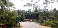
Talapady is a village near Mangaluru city in Ullal taluk of Dakshina Kannada district of Karnataka state in India. Talapady borders the states of Karnataka and Kerala. National Highway 66 passes through Talapady which is 14 km (9 mi) south of Mangalore city. The Karnataka-Kerala checkpost border is situated at Talapady. Another village Thalapady, Kasargod which is situated near Talapady in Manjeswar crossing Kerala border.

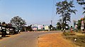
Uppala is a town and Headquarters of Manjeshwaram Taluk in Kasaragod district, Kerala, India. It is geographically located midway from Kasaragod to Mangalore. Easy geographical access and lack of major towns nearby are the key reasons for the town to develop exponentially, especially in the past decade. The population of Manjeshwaram Taluk alone was over 268,642 as of 2011. Uppala is 22 km north of Kasaragod and one of the fastest growing urban settlements in Kasaragod district. It is well known as an important trade hub in the northernmost part of Kerala state.

Kasaragod is one of the 14 districts in the southern Indian state of Kerala. Its northern border Thalappady is located just 9 km south to Ullal, which is the southernmost portion of the major port city Mangalore, on the southwestern Malabar coast of India.
Karopady is a small village in Dakshina Kannada district, Karnataka, in far southern India. It is the border village between Karnataka and Kerala. Kasaragod District is the neighbouring district in Kerala State.

Badiyadka officially known as "Badiadka" is a town and gram panchayat in the Kasaragod district, state of Kerala, India.
Bayar is a village in Kasaragod district in the state of Kerala, India. Bayar is 12 km (7.5 mi) far from the Uppala town.

Delampady is a village and Grama Panchayat in Kasaragod district in the state of Kerala, India.
Mangalpady is a Grama Panchayat in Kasaragod district, Kerala. Uppala is the major town in this panchayat.

Paivalike is a village in Kasaragod district in the state of Kerala, India. Paivalike is 11 km (6.8 mi) east of Uppala town and 40 km (25 mi) south of Mangalore city.
Vorkady is a Gram Panchayat in Kasaragod district in the state of Kerala, India.
Bekoor is a village near Uppala town in Kasaragod district in the state of Kerala, India. This locality is located in eastern Uppala, in Uppala-Bayar road, which connects Uppala with Paivalike, Bayar, and leads to Kanyana, Vittal and Puttur in dakshina Kannada district, Karnataka. It is around 3 km from Kaikamba junction and 1 km from Sonkal.
Meenja is a grama Panchayat in Manjeshwaram Taluk of Kasaragod district in the state of Kerala, India. It consists of 7 revenue villages. Kaliyoor, Koliyoor, Talakala, Meenja, Kadambar, Moodambail and [Kuloor]
Mandekolu is a village in the southern state of Karnataka, India. The nearest cities are Sullia, Adoor and Kasaragod. It is located near the Karnataka-Kerala border on the banks of River Payaswini(Chandragiri), at a distance of 86 km from Mangalore city. It is located in the Sullia taluk of Dakshina Kannada district in Karnataka.
Bantwal taluk is a taluk of Dakshina Kannada district. The headquarters is the town of Bantwal, an eastern suburb of Mangalore.

Manjeshwaram taluk is the northern most taluk of Kerala which borders Karnataka state. It is located in Kasaragod district, Kerala which was carved out from Kasaragod taluk on 2013.
National Highway 66, commonly referred to as NH 66, is a mostly 4 lane 1640 km long busy National Highway that runs roughly north–south along the western coast of India, parallel to the Western Ghats. It connects Panvel, a city east of Mumbai to Cape Comorin (Kanyakumari), passing through the states of Maharashtra, Goa, Karnataka, Kerala and Tamil Nadu.

Perla is an administrative capital of Enmakaje Panchayat, which is in Kasaragod district, Kerala, India.
Kasaragod North is a suburb of Kasaragod city in north Kerala. It is located at the mouth of a lagoon formed by the Shiriya river. The following townships, suburbs and villages are part of Kasaragod North:
Uppala River flows through the states of Karnataka and Kerala. Uppala River is 50 km long, making it the 26th longest river in Kerala. It originates from the Veerakamba hills in Dakshina Kannada district in Karnataka at an elevation of 150 metres above sea level, flows primarily in a westward direction, and empties into the Arabian Sea in the backwaters near the town of Uppala located about 22 km north of Kasaragod town in Kerala. The river has a catchment area of 250 km2 of which 174 km2 is in Karnataka state.