
The Tug Fork is a tributary of the Big Sandy River, 159 miles (256 km) long, in southwestern West Virginia, southwestern Virginia, and eastern Kentucky in the United States. Via the Big Sandy and Ohio rivers, it is part of the watershed of the Mississippi River.

The Shenandoah River is a tributary of the Potomac River, 55.6 miles (89.5 km) long with two forks approximately 100 miles (160 km) long each, in the U.S. states of Virginia and West Virginia. The principal tributary of the Potomac, the river and its tributaries drain the central and lower Shenandoah Valley and the Page Valley in the Appalachians on the west side of the Blue Ridge Mountains, in northwestern Virginia and the Eastern Panhandle of West Virginia.

The Holston River is a 136-mile (219 km) river that flows from Kingsport, Tennessee, to Knoxville, Tennessee. Along with its three major forks, it comprises a major river system that drains much of northeastern Tennessee, southwestern Virginia, and northwestern North Carolina. The Holston's confluence with the French Broad River at Knoxville marks the beginning of the Tennessee River.

Forks of Cacapon, formerly Forks of Capon, is an unincorporated community in Hampshire County in the U.S. state of West Virginia. The community is named for its location at the confluence of the North River and Cacapon River. Forks of Cacapon is also located at another fork: the crossroads of West Virginia Route 29, West Virginia Route 127, and Frank Haines Road.

Shavers Fork of the Cheat River is situated in the Allegheny Mountains of eastern West Virginia, USA. It is 88.5 mi (142.5 km) long and forms the Cheat at its confluence with Black Fork at Parsons. It was traditionally considered one of the five Forks of Cheat and its upper reaches constitute the highest river in the eastern United States.

The Dry Fork is a 39.1-mile-long (62.9 km) tributary of the Black Fork of the Cheat River in the Allegheny Mountains of eastern West Virginia, USA. Via the Black Fork, the Cheat, and the Monongahela and Ohio rivers, it is part of the watershed of the Mississippi River. The Dry Fork flows for much of its length in the Monongahela National Forest and drains mostly rural and forested areas. It was traditionally considered one of the five Forks of Cheat.

Antioch is an unincorporated community in Mineral County, West Virginia. It is part of the 'Cumberland, MD-WV Metropolitan Statistical Area'. The village is located along a branch of Mill Creek where it exits Grayson Gap on the east side of Knobley Mountain. It lies at the intersection of Mikes Run Road and Knobley Road and is three miles south of U.S. Route 50.

Beech Fork State Park is a state park located in Cabell County and Wayne County, West Virginia. The park is located on the tailwater shores of Beech Fork Lake, a flood control impoundment of the U.S. Army Corps of Engineers on the Beech Fork of Twelvepole Creek. Since its development in the mid-1970s, Beech Fork State Park has proven to be a popular recreation spot for the residents of nearby Barboursville and Huntington, West Virginia, as well as those living in the surrounding region. The park is located about 10 miles (16 km) south of the Hal Greer Exit of Interstate 64.
Catoctin Creek is a 14.1-mile-long (22.7 km) tributary of the Potomac River in Loudoun County, Virginia, with a watershed of 59,000 acres (240 km2). Agricultural lands make up 67 percent and forests 30 percent of Catoctin Creek's watershed. It is the main drainage system for the northern Loudoun Valley, including all of the Catoctin Valley.

North Fork Mountain is a quartzite-capped mountain ridge in the Ridge and Valley physiographic province of the Allegheny Mountains of eastern West Virginia, USA. Kile Knob, at 4,588 feet, is the mountain's highest point, and Panther Knob and Pike Knob are nearly as high.

Glady Fork is a 31.9-mile-long (51.3 km) river in the Allegheny Mountains of eastern West Virginia, USA. It is considered one of the five principal headwaters tributaries of the Cheat River — known as the Forks of Cheat.
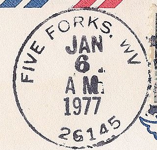
Five Forks is an unincorporated community in Calhoun County, West Virginia, United States. It lies along West Virginia Route 16 to the north of the town of Grantsville, the county seat of Calhoun County. Its elevation is 1,106 feet (337 m). The Five Forks Post Office is closed.

Laurel Fork North Wilderness is a U.S. Wilderness Area located in the Greenbrier Ranger District of Monongahela National Forest in West Virginia. The Wilderness protects high-elevation lands along Laurel Fork and is bordered by Middle Mountain to the west. It is a companion to Laurel Fork South Wilderness, the two being split by Randolph County Route 40. Laurel Fork North contains 9.5 miles (15.3 km) of hiking trails.

Tug Fork Wildlife Management Area (WMA) is located about 10 miles northwest of Welch, West Virginia in McDowell County. Tug Fork WMA is located on 2,165 acres (876 ha) of steep terrain along hills above the Tug Fork River. The WMA is heavily forested, primarily with mixed hardwoods and yellow poplar/black cherry forests in the coves. The WMA is accessed from U.S. Route 52 at Premier. Several tracks and jeep trails provide walking access into the Tug Fork WMA from U.S. Route 52.
Cedar Fork is an unincorporated community in Caroline County, in the U.S. state of Virginia.
Kidds Fork is an unincorporated community in Caroline County, in the U.S. state of Virginia.
Wrights Fork is an unincorporated community in Caroline County, in the U.S. state of Virginia.
Antioch is an unincorporated community in Fluvanna County, in the U.S. state of Virginia.
Meadow Fork is an unincorporated community in Fayette County, West Virginia.

The Laurel Fork is a 15.7-mile-long (25.3 km) stream in Virginia and West Virginia, United States. The stream flows north from Highland County, Virginia, where its source and the majority of its length is located, to its mouth in Pendleton County, West Virginia. Laurel Fork is a tributary to the North Fork South Branch Potomac River, making it a part of the Potomac River watershed. The area surrounding Laurel Fork is home to several plant and animal species found nowhere else in Virginia, and is a prime example of a northern boreal forest in the state.


