Antonio Nariño, Bogotá

Last updated
Antonio Nariño
Locality of Bogotá

Bogota, calle 4, iglesia de San Antonio de Padua.JPG

San Antonio de Padua Church
Bogota - Antonio Narino.svg
Location of the locality in the city of Bogotá
Distrito Capital de Bogota - Antonio Narino.svg
Location of the locality in the Capital District of Bogotá
Coordinates: 4°35′03″N74°06′47″W / 4.58417°N 74.11306°W / 4.58417; -74.11306 Coordinates: 4°35′03″N74°06′47″W / 4.58417°N 74.11306°W / 4.58417; -74.11306
Country Colombia
City Bogotá D.C.
Neighbourhoods Restrepo (Bogotá)
Area
  Total 4.88 km2 (1.88 sq mi)
Elevation 2,600 m (8,500 ft)
Population (2007) [1]
  Total 119,565
  Density 25,000/km2 (63,000/sq mi)
Time zone Colombia Standard Time (UTC-5)
Website Official website

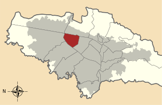
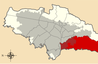
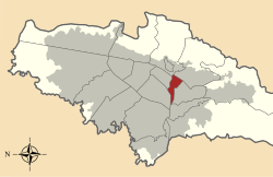
Antonio Nariño is the 15th locality of Bogotá, capital of Colombia. It is located in the south of the city. This district is mostly inhabited by lower middle and working class residents. The locality is named after an early Colombian leader, Antonio Nariño, who is often referred to as the precursor to the presidency.

Bogotá Capital city in Colombia

Bogotá, officially Bogotá, Distrito Capital, abbreviated Bogotá, D.C., and formerly known as Santafé/Santa Fé de Bogotá between 1991 and 2000, is the capital and largest city of Colombia, administered as the Capital District, although often erroneously thought of as part of Cundinamarca. Bogotá is a territorial entity of the first order, with the same administrative status as the departments of Colombia. It is the political, economic, administrative, industrial, artistic, cultural, and sports center of the country.

Colombia Country in South America

Colombia, officially the Republic of Colombia, is a sovereign state largely situated in the northwest of South America, with territories in Central America. Colombia shares a border to the northwest with Panama, to the east with Venezuela and Brazil and to the south with Ecuador and Peru. It shares its maritime limits with Costa Rica, Nicaragua, Honduras, Jamaica, Haiti, and the Dominican Republic. Colombia is a unitary, constitutional republic comprising thirty-two departments, with the capital in Bogota.

Antonio Nariño Colombian politician

Antonio Amador José de Nariño Bernardo del Casal was a Colombian ideological precursor of the independence movement in New Granada as well as one of its early political and military leaders.

Contents

General information

Borders

Norte-Quito-Sur

Avenida Norte-Quito-Sur or NQS is an arterial road in Bogotá, Colombia that crosses the city from northeast to southwest. The avenue is formed from the union of three old avenues, Avenida Ciudad de Quito, Avenida Novena, and Autopista Sur.

Puente Aranda Locality of Bogotá in Bogotá D.C., Colombia

Puente Aranda is the 16th location of the Capital District of the Colombian capital city, Bogotá. It is located in the south of Bogotá. This district is mostly inhabited by lower middle and working class residents. The district was named after an old bridge in the hacienda of Juan Aranda over the "Chinúa River", now called the San Francisco River, that dates to the 16th century. Puente Aranda has 1,724 hectares of area which are almost entirely urban. This locality has more than 300,000 inhabitants, 5% of the total urban area inhabitants of Bogota.

Los Mártires Locality of Bogotá in Bogotá D.C., Colombia

Los Mártires is the 14th locality of Bogotá, capital of Colombia. It is located near the city's downtown to its west. This district is mostly inhabited by lower middle and working class residents. It takes its name in honor of those who died during the war for independence from Spain. It is completely urbanized, save for its parks and the banks of its rivers.

Hydrology

The locality had several rivers that have been transformed into canals flowing into the Fucha River. It has several parks. There is one major commercial sector in the Restrepo neighborhood, with the balance of the locality consisting of residential areas with small stores and churches.

Fucha River

The Fucha River is a river on the Bogotá savanna and a left tributary of the Bogotá River. The river originates in the Eastern Hills of the Colombian capital Bogotá and flows westward through the city into the Bogotá River. It is one of the three important rivers of the city, together with the Tunjuelo and Juan Amarillo Rivers.

Topography

The topography of the locality is mainly flat, as it is located on the Bogotá savanna.

Bogotá savanna

The Bogotá savanna is a montane savanna, located in the southwestern part of the Altiplano Cundiboyacense in the center of Colombia. The Bogotá savanna has an extent of 4,251.6 square kilometres (1,641.6 sq mi) and an average altitude of 2,550 metres (8,370 ft). The savanna is situated in the Eastern Ranges of the Colombian Andes.

Transportation

The mass transport system of Bogotá, TransMilenio, runs on Avenida Caracas (Restrepo and Fucha stations) and Autopista Sur. Other buses serve Avenida Primera, Primero de Mayo, and Carrera 10.

TransMilenio Transport system in Bogota, Colombia

TransMilenio is a bus rapid transit (BRT) system that serves Bogotá, the capital of Colombia. The system opened to the public in December 2000, covering Av. Caracas and Calle 80. Other lines were added gradually over the next several years, and as of 2012, 12 lines totalling 112 km (70 mi) run throughout the city.

Avenida Caracas

Avenida Caracas is an arterial road in Bogotá, Colombia that runs through the city from north to south.

Restrepo (TransMilenio) Transmilenio stop

The simple station Restrepo is part of the TransMilenio mass-transit system of Bogotá, Colombia, opened in the year 2000.

History

During the 19th century, the territory belonged to the rule of Muequetá, as part of the Muisca Confederation. Large estates, located on the shores of the rivers that crossed it, were built by the Spanish after the conquest. The process of urbanization started in 1920, and was completed over the following 50 years. It was separated as a locality in 1991. The majority of the locality contains estrato 3 residential areas.

Bacatá Main seat of the zipa in Cundinamarca, Colombia

Bacatá is the name given to the main settlement of the Muisca Confederation on the Bogotá savanna. It mostly refers to an area, rather than an individual village, although the name is also found in texts referring to the modern settlement of Funza, in the centre of the savanna. Bacatá, alternatively written as Muequetá or Muyquytá, was the main seat of the zipa, the ruler of the Bogotá savanna and adjacent areas. The name of the Colombian capital, Bogotá, is derived from Bacatá, but founded as Santafe de Bogotá in the western foothills of the Eastern Hills in a different location than the original settlement Bacatá, west of the Bogotá River, eventually named after Bacatá as well.

Muisca Confederation loose confederation of different Muisca rulers (zaques, zipas, iraca and tundama) in the central Andean highlands of present-day Colombia before the Spanish conquest of northern South America

The Muisca Confederation was a loose confederation of different Muisca rulers in the central Andean highlands of present-day Colombia before the Spanish conquest of northern South America. The area, presently called Altiplano Cundiboyacense, comprised the current departments of Boyacá, Cundinamarca and minor parts of Santander with a total surface area of approximately 25,000 square kilometres (9,700 sq mi).

Spanish conquest of the Muisca Part of the Spanish conquest of Colombia

The Spanish conquest of the Muisca took place from 1537 to 1540. The Muisca were the inhabitants of the central Andean highlands of Colombia before the arrival of the Spanish conquistadors. They were organised in a loose confederation of different rulers; the zipa of Bacatá, with his headquarters in Funza, the zaque of Hunza, the iraca of the sacred City of the Sun Sugamuxi, the Tundama of Tundama, and several independent caciques. The leaders of the Confederation at the time of conquest were zipa Tisquesusa, zaque Quemuenchatocha, iraca Sugamuxi and Tundama in the northernmost portion of their territories. The Muisca were organised in small communities of circular enclosures, with a central square where the bohío of the cacique was located. They were called "Salt People" because of their extraction of salt in various locations throughout their territories, mainly in Zipaquirá, Nemocón and Tausa. For the main part self-sufficient in their well-organised economy, the Muisca traded with the European conquistadors valuable products as gold, tumbaga and emeralds with their neighbouring indigenous groups. In the Tenza Valley, to the east of the Altiplano Cundiboyacense where the majority of the Muisca lived, they extracted emeralds in Chivor and Somondoco. The economy of the Muisca was rooted in their agriculture with main products maize, yuca, potatoes and various other cultivations elaborated on elevated fields. Agriculture had started around 3000 BCE on the Altiplano, following the preceramic Herrera Period and a long epoch of hunter-gatherers since the late Pleistocene. The earliest archaeological evidence of inhabitation in Colombia, and one of the oldest in South America, has been found in El Abra, dating to around 12,500 years BP.

Economy

The Restrepo area is located on Carrera 24 until the Avenida Primero de Mayo, which is the largest commercial area of the locality. A large number of small companies are located here, with the production of low-cost, high-quality shoes among the most notable of industries.

Neighborhoods

Main neighborhoods are Restrepo, Policarpa Salavarrieta, Luna Park, Villa Mayor, Eduardo Freí, San Antonio, Caracas, Ciudad Berna, Ciudad Jardín, La Fragua, Eduardo Santos, and Santander.

Related Research Articles

Fucha (TransMilenio) Transmilenio stop

The simple station Fucha is part of the TransMilenio mass-transit system of Bogotá, Colombia, opened in the year 2000.

The intermediate station General Santander is part of the TransMilenio mass-transit system of Bogotá, Colombia, opened in the year 2000.

Barrios Unidos Locality of Bogotá in Bogotá D.C., Colombia

Barrios Unidos is the 12th locality of Bogotá, capital of Colombia. It is located in the northwest of the city. This district is mostly inhabited by middle class residents. Barrios Unidos is completely urban, with some light industry and major commercial areas.

Chapinero Locality of Bogotá in Bogotá D.C., Colombia

Chapinero is the 2nd locality of Bogotá, capital of Colombia. It is located in the north of the city and is one of the more affluent districts of the city. This district is mostly inhabited by upper class residents. The boundaries are Calle 39 in the south, Avenida Caracas in the west, Calle 100 in the north and the Eastern Hills in the east.

Kennedy, Bogotá Locality of Bogotá in Bogotá D.C., Colombia

Kennedy, or Ciudad Kennedy, is the eighth locality of Bogotá, capital of Colombia. It is located in the southwest of the city and is the second most populous being home to 14% of the city's residents. This district is mostly inhabited by working and lower class residents.

Teusaquillo Locality of Bogotá in Bogotá D.C., Colombia

Teusaquillo is the 13th locality of Bogotá, capital of Colombia. It is located in the geographic center of the city, to the northwest of downtown Bogotá. This district is inhabited by middle class residents. It is an urbanized locality with several green zones as parks, avenues, and the campus of the National University of Colombia. It is located on the former site of an indigenous resguardo known as Pueblo Viejo, which existed until the main urbanization phase of the 20th century.

San Cristóbal, Bogotá Locality of Bogotá in Colombia

San Cristóbal, is the fourth locality of Bogotá, capital of Colombia. It is located in the southeast of Bogota. This district is mostly inhabited by lower class residents.

Santa Fe, Bogotá Locality of Bogotá in Bogotá D.C., Colombia

Santa Fe is the third locality of Bogotá, Capital District of Colombia. Santa Fe is the traditional downtown of the city of Bogotá, the area where the city was founded by Gonzalo Jiménez de Quesada on August 6, 1538. This area once comprised Bogotá's total main urban area and was known as "Santa Fe de Bogotá" with its traditional neighbourhoods.

Tunjuelito Locality of Bogotá in Bogotá D.C., Colombia

Tunjuelito is the 6th locality of the Capital District of the Colombian capital, Bogotá. Tunjuelito is located in the south of Bogotá, bordering to the north with the localities of Bosa, Kennedy and Puente Aranda, to the east with the localities of Rafael Uribe Uribe and Usme, to the south with Usme and to the west with Ciudad Bolívar. This district is mostly inhabited by working and lower class residents.

Suba, Bogotá Locality of Bogotá in Bogotá D.C., Colombia

Suba is the 11th locality of Bogotá, capital of Colombia. It is located in the northwest of the city, bordering to the north the municipality of Chía in Cundinamarca, to the west the municipality of Cota, to the east the locality Usaquén and to the south the localities Engativá and Barrios Unidos. This district is inhabited by residents of all social classes.

Rafael Uribe Uribe, Bogotá Locality of Bogotá in Bogotá D.C., Colombia

Rafael Uribe Uribe is the 18th locality of the Capital District in the Colombian capital Bogotá. This district is mostly inhabited by working and lower class residents. It was named after the Liberal General Rafael Uribe Uribe. Historically, it has been a predominantly residential area with minor commercial activity. Since the 1940s, urban expansion began from the flat Bogotá savanna towards higher elevations. Nowadays, the locality's southern part is undergoing urban expansion.

Ciudad Bolívar, Bogotá Locality of Bogotá in Bogotá D.C., Colombia

Ciudad Bolívar is the 19th locality in the Capital District of the Colombian capital city Bogotá. Ciudad Bolívar is located in the south of the city at the southern border of the Bogotá savanna. This district is mostly inhabited by underclass residents.

Nicolás de Federmán, Bogotá Barrio in Distrito Capital, Colombia

Nicolás de Federmán is a residential neighborhood located in Teusaquillo locality, near the geographical center of the city of Bogotá, Colombia. It is named after the prominent German conquistador of the 16th century Nikolaus Federmann, who took part in the re-founding of Bogotá on April 27, 1539 along with Spanish conqueror Sebastián de Belalcázar.

References

  1. (in Spanish) Population 2007 – DANE