
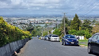
Epsom is a suburb of Auckland, New Zealand. It is located in the centre of the Auckland isthmus between Mount Eden and Greenlane, south of Newmarket, and 5 km (3.1 mi) south of the Auckland City Centre.

Māngere is a major suburb in South Auckland, New Zealand, located on mainly flat land on the northeastern shore of the Manukau Harbour, to the northwest of Manukau City Centre and 15 kilometres south of the Auckland city centre. It is the location of Auckland Airport, which lies close to the harbour's edge to the south of the suburb.

Kumeū is a town in the Auckland Region, situated 25 kilometres (16 mi) north-west of the City Centre in New Zealand. State Highway 16 and the North Auckland Line pass through the town. Huapai lies to the west, Riverhead to the north, Whenuapai to the east, and Taupaki to the south.

Helensville is a town in the North Island of New Zealand. It is sited 40 kilometres (25 mi) northwest of Auckland, close to the southern extremity of the Kaipara Harbour. State Highway 16 passes through the town, connecting it to Waimauku 16 kilometres (10 mi) to the south, and Kaukapakapa about 12 kilometres (7.5 mi) to the north-east. Parakai is two kilometres (1.2 mi) to the north-west. The Kaipara River runs through the town and into the Kaipara Harbour to the north.

Parnell is a suburb of Auckland, New Zealand. It is one of New Zealand's most affluent suburbs, consistently ranked within the top three wealthiest, and is often billed as Auckland's "oldest suburb" since it dates from the earliest days of the European settlement of Auckland in 1841. It is characterised by its mix of tree-lined streets with large estates; redeveloped industrial zones with Edwardian town houses and 1920s bay villas; and its hilly topography that allows for views of the port, the Waitematā Harbour, Rangitoto Island and the Auckland Domain. To its west lies the Auckland Domain, to the south Newmarket, and to the north the Ports of Auckland.
Hillsborough is a suburb of Auckland, New Zealand. It is under the local governance of the Auckland Council. Hillsborough is a leafy suburb of 20th-century houses. The area is serviced by two shopping areas; Onehunga and Three Kings. The area is served by secondary schools Mount Roskill Grammar School and Marcellin College.

Ōwairaka is a suburb of New Zealand's largest city, Auckland. It is under the local governance of the Auckland Council. The area was primarily rural until the 1930s, when the area experienced suburban growth. Ōwairaka is known for the Owairaka Athletic Club, a club that came to prominence in the 1960s, due to the success of coach Arthur Lydiard and athletes Murray Halberg and Peter Snell.
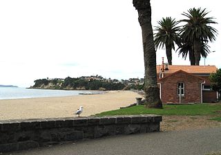
St Heliers is a seaside suburb of Auckland with a population of 11,710 as of June 2024. This suburb is popular amongst visitors for the beaches, cafés, and views of Rangitoto Island, the distinctive volcanic island in the Hauraki Gulf.
The human history of the Auckland metropolitan area stretches from early Māori settlers in the 14th century to the first European explorers in the late 18th century, over a short stretch as the official capital of (European-settled) New Zealand in the middle of the 19th century to its current position as the fastest-growing and commercially dominating metropolis of the country.

The Auckland Central Business District (CBD), or Auckland city centre, is the geographical and economic heart of the Auckland metropolitan area. It is the area in which Auckland was established in 1840, by William Hobson on land gifted by mana whenuahapū Ngāti Whātua Ōrākei. It is New Zealand's leading financial hub, and the centre of the country's economy; the GDP of the Auckland Region was NZD$139 billion in the year ending September 2023.

St Paul's Church is an historic Anglican church, located on Symonds Street near the University of Auckland and Auckland University of Technology, in the central business district of Auckland, New Zealand. The church is the longest established parish in the city and has one of the largest Anglican congregations in Australasia.

Little Rangitoto, officially known as Maungarāhiri / Little Rangitoto, and also as Rangitoto-iti, is a volcano in the Auckland volcanic field in Remuera, New Zealand. The name Maungarāhiri refers to Rāhiri, an ancestor of Ngāpuhi, who journeyed around the North Island. In the 1700s and early 1800s, the volcano was the site of Ngāti Whātua-o-Ōrākei seasonal farms.

Symonds Street is a street in Auckland, New Zealand's most populous city. The road runs southwest and uphill from the top of Anzac Avenue, through the City Campus of University of Auckland, over the Northwestern Motorway and Auckland Southern Motorway and to the start of New North Road and Mount Eden Road.
This timeline sets out intertribal battles involving Māori people in what is now New Zealand.

Te Ākitai Waiohua is a Māori iwi of the southern part of the Auckland Region of New Zealand.

Tāmaki Māori are Māori iwi and hapū who have a strong connection to Tāmaki Makaurau, and whose rohe was traditionally within the region. Among Ngā Mana Whenua o Tāmaki Makaurau, also known as the Tāmaki Collective, there are thirteen iwi and hapū, organised into three rōpū (collectives), however Tāmaki Māori can also refer to subtribes and historical iwi not included in this list.

Hobson Street is a major street in Auckland, New Zealand. It lies on the western side of Queen Street. It is a commercial and high-rise residential street, and provides access to the Auckland Northern Motorway going south, and the Northwest Motorway going west. For most of its length it is one-way. One block to the west is Nelson Street, which is one-way in the other direction and provides access to the central city for traffic exiting from the motorways. One block to the east is Albert Street, part of Mayoral Drive, and Vincent Street. The area encompassed by these streets is called Hobson Ridge by Statistics New Zealand.

Quay Street is the northernmost street in the Auckland CBD, New Zealand. The Auckland Ferry Terminal, which has ferries running to Devonport, Waiheke Island, and other places in Waitematā Harbour; the Hilton Auckland hotel; and Ports of Auckland are on the north side of the street. The Britomart Transport Centre, Queen Elizabeth Square and Grand Mercure Auckland hotel are on the south side.

Shortland Street was the initial commercial street of Auckland and remains a key financial and legal centre for Auckland city. It runs east from Queen Street up to Princes Street, providing a connection from the business district to the Auckland High Court and University of Auckland.
Kiwi Tāmaki was a Māori warrior and paramount chief of the Waiohua confederation in Tāmaki Makaurau. The third generation paramount chief of Waiohua, Kiwi Tāmaki consolidated and extended Waiohua power over Tāmaki Makaurau, making it one of the most prosperous and populated areas of Aotearoa. Kiwi Tāmaki's seat of power was at Maungakiekie, which was the most elaborate pā complex in Aotearoa.


