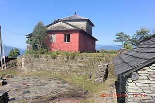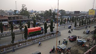
Gandaki zone was one of the fourteen zones of Nepal, located in the Western Development Region. It was named as Sapta Gandaki after the seven tributaries that makes up the Gandaki River. Pokhara served as its regional and zonal headquarter. It was also the birthplace of Bhanubhakta Acharya, first poet of Nepal.

Mahendranagar, officially known as Bhimdattanagar, is a municipality in Kanchanpur District of Sudurpashchim Province, Nepal. The city and the municipality were named Mahendranagar in honour of the late King Mahendra of Nepal. After becoming a republic in 2008, the Mahendranagar municipality name was changed to Bhimdatta municipality in honour of the revolutionary farmer leader Bhimdatta Panta. It is surrounded by Bedkot Municipality in the east, Dadeldhura District in the north, Shuklaphanta National Park in the south and Uttarakhand, India in the west.

A village development committee in Nepal was the lower administrative part of its Ministry of Federal Affairs and Local Development. Each district had several VDCs, similar to municipalities but with greater public-government interaction and administration. There were 3,157 village development committees in Nepal. Each village development committee was further divided into several wards depending on the population of the district, the average being nine wards.

Bahrabise is an urban municipality located in Sindhupalchok District of Bagmati Province of Nepal.
Machhegaun is a village and former Village Development Committee that is now part of Chandragiri Municipality in Kathmandu District in Province No. 3 of central Nepal. At the time of the 1991 Nepal census it had a population of 2,871.
Mainapokhar is a village development committee in Bardiya District in Lumbini Province of south-western Nepal. At the time of the 1991 Nepal census it had a population of 6,841 and had 951 houses in the town. Now it reaches to nearly 20000 in 2016. It is nearly 20 km far from Nepalgunj.
Chumchet is a village development committee in Gorkha District in the Gandaki Zone of northern-central Nepal. At the time of the 1991 Nepal census it had a population of 979 and had 221 houses in the village.

Limi Valley is a high-altitude valley that forms the northernmost part of the Humla District of north-western Nepal. To its north, the Limi valley borders the Purang County of Tibet, China.
Lamatar is a village and former Village Development Committee that is now part of Mahalaxmi Municipality in Province No. 3 of central Nepal.
Arba Vijaya is a very old residential area in Pokhara sub-metropolitan city in Kaski District in the Gandaki Zone of northern-central Nepal. At the time of the 1991 Nepal census it had a population of 3,446 persons living in 714 individual households. village located at surrounding mountain Himalaya it is a destination in Anna Purna Himalaya Region. One can reach there from Pokhara within 2 hours by walking for 30 min by driving village has many natural sources, most of people living at villages are Brahmin, chettri, Gurung, Bishwakarma, Pariyar caste.
Lahachowk is a village in Machhapuchchhre Gaunpalika, in the Kaski District, in the Gandaki Zone of northern-central Nepal. According to the 2011 National Population and Housing Census, it had a population of 3,129 in 829 individual households.

Kaskikot, commonly known as Kaski, is a Ward no. 24 of the Pokhara metropolitan city. It was earlier a part of the village development committee in Kaski District, a region in northern-central Nepal.
Chhatiwan is a Village Development Committee in Doti District in the Seti Zone of western Nepal. At the time of the 1991 Nepal census it had a population of 3000 residing in 478 individual households. The name for this VDC comes from a lake that is situated in the village of Chhatiwan. This lake has fresh drinking water and teamed with various kind of fish. Lately due to the deforestation and soil erosion, this lake is being filled with all debris coming in due to the flash flood from its North side of the mountain. Budar is the major town of this VDC and at this town Dadeldhura and Jogbuda roads cross. Some of the major villages in this VDC are Budar, Ritha, Phaltude, Dharapani, Chhatiwan, Chhahara and many others. There are two small mountain streams that eventually meet up at Deujaal. A stream that comes from the Chhahara village has a wonderful water fall. The name of the water fall itself is Chhahara. In Nepali "Chhahara" means water fall. Once in a year there is a special festival at the foot of this water fall where people from many surrounding villages come and celebrate throughout the night. The festival begins in the evening and people sing, dance and merry all through the night. This is also the night when lovers elope if the family does not agree for their marriage. Along the stream grows a plant called "sisnu". This plant has mild poisonous element and once the Caterpillar type of hairy things get stuck in the skin, the skin will be burning for a long time. But the belief is that once in a year after the festival you have to be stung by that plant so that you will remain healthy throughout that year. So, people will be chasing each other in the morning to torture each other with that plant. Some times drinking creates big fights among the villager.
Chhatiwan VDC is also popular for a model school in far west Nepal. Rampur School is the oldest school and now it has school for the disabled children for the whole of Far west. There is also an Army School in Budar. During the construction of Dadeldhura Highway, Budar was very important place as it was the headquarters for the road construction department.

Lahan (लहान) is a city and municipality with 24 wards in Siraha District in the Madhesh Province south-eastern Nepal. It is connected with Mahendra Highway, which is also called the east–west highway. It is located nearly 261 km east of the capital, Kathmandu via B.P. highway and E-W Highway & 424 km east via Narayanghat-Mugling Highway. Lahan is located at the latitude of 26.717 and longitude of 86.483. It is at an elevation of 111 meters above sea level. It follows Nepali time zone, UTC Offset: +05:45 hours.
Bagarkot is a village development committee in south-west of Dadeldhura District in the Sudurpashchim Province of western Nepal. The population is about 6025 according to the census of 2008. At the time of the 1991 Nepal census it had a population of 3658 people living in 620 individual households.
Barangdi is a village development committee in Palpa District in the Lumbini Zone of southern Nepal. At the time of the 1991 Nepal census it had a population of 2475 people living in 470 individual households. It is surrounded by 3 other VDCs like Khanigaun from west and north, Chappani from east and north and Tansen Municipality in south.

Phidim Municipality is the headquarters of the Panchthar District in the Province No. 1 of eastern Nepal. Phidim was upgraded to a 'municipality' from a 'village', when a development committee merged with other VDCs - including the Phidim, Chokmagu and Siwa villages - on May 18, 2014. It offers a route for trekkers and locals, who travel to and from the Taplejung district bordering with the Tibetan Autonomous Region of China. It is also a commercial hub for the rural surroundings.
Mangalpur is a village in Chitwan District in the Bagmati Province of southern Nepal. It was also a Village Development committee before it merged with Bharatpur. At the time of the 1991 Nepal census it had a population of 12,969 people residing in 2,580 individual households.
Bangai is a village development committee in Kapilvastu District in the Lumbini Zone of southern Nepal. Locally, there are two places known by the name of Bangai, Gherawa Bangain in the east and Koili Bangain in the west, separated by the distance of 1 km. Mahendra Highway or east–west highway passes through it. The Banganga river marks the south boundary of Bangain. Manoharipur is the first adjacent village in the south of it which lies in the Kopawa V.D.C. Locally, Bangain is famous for its funeral site on the bank of Banganga known as Laxmanghat. It is also a major shopping hub within 5 km of its radius due to its proximity with the highway. At the time of the 1991 Nepal census it had a population of 2983 people living in 528 individual households.
Sundar Haraicha is a municipality in Morang District of Koshi Province in Nepal. It is centered around Biratchowk town which is the gateway to Biratnagar. It borders Itahari Sub- Metropolitan city to the West, Dharan Sub- Metropolitan city to the Northwest and Belbari municipality to the East and is connected by the Mahendra Highway. It is one of the fastest growing cities in the Eastern Nepal and the second largest city of Morang district after Biratnagar with 121,305 inhabitants living in 26,677 households. It consists the town centres of Biratchowk and Gothgaun which are parts of the Greater Birat Development Area which incorporates the cities of Biratnagar-Itahari-Gothgau-Biratchowk-Dharan primarily located on the Koshi Highway in Eastern Nepal, with an estimated total urban agglomerated population of 804,300 people living in 159,332 households.


