Tānsen तानसेन | |
---|---|
![]() Tansen | |
Coordinates: 27°52′0″N83°33′0″E / 27.86667°N 83.55000°E Coordinates: 27°52′0″N83°33′0″E / 27.86667°N 83.55000°E | |
Country | ![]() |
Development Region | Western |
Zone | Lumbini Zone |
District | Palpa District |
Municipality | Tansen |
Government | |
• Type | Mayor–council government |
• Mayor | Mr. Ashok Kumar Shahi |
• Deputy Mayor | Mrs. Laxmi Pathak |
Elevation | 1,350 m (4,430 ft) |
Population (2011 Census) | |
• Total | 31,095 |
Time zone | UTC+5:45 (NST) |
Postal code | 32500 |
Area code(s) | 075 |
Website | tansenmun.gov.np |
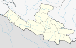
Tansen is a Municipality and the administrative center of Palpa District in the "hills" of western part of Nepal. It is located on the highway between Butwal and Pokhara, on the crest of the Mahabharat Range or Lesser Himalaya overlooking the valley of the Kaligandaki River to the north. [1] The highway bypasses the town center on the west, protecting pedestrian amenities in the central maze of steep, narrow, winding alleys lined with Newari shop-Houses and temples.
Tansen was the capital of the Magar Kingdom ( Barha Magarat ) Palpa, one of the most powerful regional principalities before the rise of the Shah dynasty. It even came close to conquering Kathmandu in the 16th century under the leadership of Mukunda Sen. The Palpa district is home to the Magar people, and the name "Tansen" has its origins in the Magar language, meaning "northern settlement." [2] Local Magar kings lost influence in the 18th century and Tansen became a Newari bazaar on the important trade route between India and Tibet via the Kaligandaki River and Mustang. Because it was a district administrative center of the Kingdom of Nepal, Maoists targeted Tansen several times during the Nepalese Civil War, including a major assault on the historic Durbar (palace) compound in 2006.
Nearby Srinagar Danda (hill) offers a panoramic view of the high Himalaya. From west to east, the Kanjiroba, Dhaulagiri, Annapurna, Mansiri, Ganesh and Langtang groups are in sight. Other nearby attractions include Ranighat, a Rana palace next to the Kaligandaki River, and Ridi Bazaar, a major Hindu pilgrimage destination at the auspicious confluence of the Kaligandaki and Ridi Rivers. A large mela is held there on Maghe Sankranti (about January 14).
Tansen is the home of United Mission Hospital, located one mile east of the town center. The hospital was established in 1954 as a partnership between the people of Nepal and a coalition of 20 Christian organizations on four continents. [3] As of 2010, Mission Hospital has 160 beds, and the clinics there see over 100,000 patients per year. Mission Hospital is the oldest project of United Mission to Nepal (UMN), a consortium of eight worldwide Christian denominations which was formed in 1952 to coordinate missionary work in Nepal. Presently there are about a dozen expatriate medical personnel assisted by a staff of about 300 Nepalese. Mission Hospital collaborates with Tansen Nursing School, considered to be among the best training programs for basic nursing education in the country. The 2007 book, "The Hospital at the End of the World" describes the workings of Mission Hospital from the perspective of a short-term Medical Missionary. [4]
The town enjoys a moderate climate with temperatures rarely exceeding 30 Celsius (86F) or going below freezing.
Besides trade, local Newars are known for traditional metalwork and producing dhaka cloth used in traditional jackets and topis . The most important landmark is the octagonal pavilion "Golghar" in the middle of Sitalpati, the main market square.
This site was added to the UNESCO World Heritage Tentative List on January 30, 2008 in the Cultural category. [5]
To Promote local culture Tansen has several FM radio station including Radio Madanpokhara - 106.9 MHz Which is a Community radio Station and several local T.V channels. Lumbini job link Palpa Dumre
The city was affected by an earthquake on 25 April 2015. [6] The United Mission Hospital in Tansen was expected to receive many patients in the aftermath of the severe shaking in the town similar to earthquakes that occur in Japan. [7] A presentation by missionaries was held on 6 May 2015 at the United Mission Hospital in Tansen to share their experiences during the earthquake. [3]
Bhaktapur district(Nepali: भक्तपुर जिल्ला
Gorkha District, a part of Gandaki Pradesh, is one of the seventy-Seven districts of Nepal and connected historically with the creation of the modern Nepal and the name of the legendary Gurkha soldiers. The district, with Gorkha Municipality as its district headquarters, covers an area of 3,610 km2 (1,390 sq mi) and has a population (2001) of 288,134. It is the location of the Manakamana Temple. Also, the temples of great sage Gorakh Nath and goddess Gorakh Kali temple is located in district, after which the district got its name. Four major rivers run within and along it - the Chepe, Daraudi, Marsyangdi, and Budhi Gandaki.
Nawalparasi District (Nepali: नवलपरासी जिल्ला,
Palpa District (Nepali: पाल्पा जिल्ला
Syangja District, a part of Gandaki Pradesh, is one of the seventy-seven districts of Nepal. The district, with Syangja bazaar as its district headquarters, covers an area of 1,164 km2 (449 sq mi) and had a population of 289,148 It lies in the hilly region at an altitude ranging from about 300 meters along the banks of Kaligandaki river up to a couple of thousands meters above the sea level. It lies at about latitude 28°4'60 North and longitude 83°52'0 East.
Baglung, is a municipality in western Nepal, 275 km west of Kathmandu. It is the administrative headquarters of Baglung District and Dhaulagiri Zone. Baglung serves as the major center for business, finance, education, service and healthcare for the people of mid-Kali Gandaki valley that encompass Beni, Jaljala, Baglung, Kushma, Kathekhola, Galkot, Phalewas and Jaimuni local bodies. The city is located at the cross-section of Kaligandaki corridor highway and midhill highway that transverse Nepal in north-south and east-west directions respectively.
Bandipur is a hilltop settlement and a municipality in Tanahun District, of Nepal. This municipality was established on 18 May 2014 by merging with existing Dharampani and Bandipur VDCs. Because of its preserved, old time cultural atmosphere, Bandipur has increasingly been coming to the attention of tourism. At the time of the 2011 Nepal census it had a population of total 15,591 people living in 3750 individual households. It is one of the best tourist destinations of Nepal. Bandipur is famous for Newari people and their cultures.
Dhaka topi or Nepali topi is a type of brimless cap popular among Nepalis men, along with their diasporas.
Dhulikhel is a municipality in Kavrepalanchowk District of Nepal. Two major highway B.P. Highway and Arniko Highway passes through Dhulikhel. Araniko Highway connects Kathmandu, Nepal's capital city with Tibet's border town of Kodari. Dhulikhel is located at the Eastern rim of Kathmandu Valley, south of the Himalayas at 1550m above sea level and is situated 30 km southeast of Kathmandu and 74 km southwest of Kodari. The Majority of people in dhulikhel is Newars, and Brahmin, Chhettri, Tamang and Dalit are also living in outer area of the town. Drinking water in Dhulikhel is some of the best water in Nepal. It was made with the help of the German NGO, German Technical Cooperation.
Chyasal is an ancient town in the District of Lalitpur in Bagmati Zone in Nepal and a section of the city of Lalitpur.
The following outline is provided as an overview of and topical guide to Nepal:
Madhyapur Thimi, also known as Thimi, is a municipality in Bhaktapur District in the Bagmati Zone of central Nepal. Thimi lies between Kathmandu, Lalitpur and Bhaktapur in the Kathmandu Valley. It is one of the ancient cultural and historical places along the trade route from Bhaktapur to Kathmandu. The city is situated on elevated land and occupies an area of 11.47 square kilometres (4.43 sq mi), divided into nine administrative wards.
Lubhu is a place that is part of Mahalaxmi Municipality in Province No. 3 of central Nepal. Lubhu is a sub-urban Newar place situated seven kilometers east of Kathmandu in northern part of Lalitpur, Nepal.
Kathmandu Durbar Square in front of the old royal palace of the former Kathmandu Kingdom is one of three Durbar Squares in the Kathmandu Valley in Nepal, all of which are UNESCO World Heritage Sites.
Bhaktapur Durbar Square, is the royal palace of the old Bhaktapur Kingdom, 1,400 metres (4,600 ft) above sea level. It is a UNESCO World Heritage Site.
Patan Durbar Square is situated at the centre of the city of Lalitpur in Nepal. It is one of the three Durbar Squares in the Kathmandu Valley, all of which are UNESCO World Heritage Sites. One of its attraction is the ancient royal palace where the Malla Kings of Lalitpur resided.
Indrachok is one of the ceremonial and market squares on the artery passing through the historic section of Kathmandu, Nepal. The intersection of Indrachok, along with Maru, Kathmandu Durbar Square, Makhan, Jana Baha, Asan and Naxal, mark the old India-Tibet trade route that is now a vibrant market street.
Rani Mahal is a Rana palace located in the banks of Kali Gandaki River in Palpa district of Nepal. This palace was constructed by General Khadga Samsher Rana JBR in 1893.
Ashok Binayak is a Hindu temple located in Kathmandu district at eastern side of Kathmandu Durbar Square in Maru Tole. This temple is of Lord Ganesha also known as Binayak. The god is worshipped as the god of luck by Hindus. The temple hosts one of the four original Ganesh shrines of Kathmandu valley. It is a popular place of worship for Hindus.It is worshipped both by Hindus and Buddhists. The temple is visited during Tuesdays every week as it is the day which is considered the day of Ganesh.