The 1991 Nepal census was a widespread national census conducted by the Nepal Central Bureau of Statistics.

Batase is a village and market center of Chautara Sangachowkgadi Municipality in Sindhupalchok District in Bagmati Pradesh of central Nepal. The formerly Village Development Committee was merged to the new Municipality in 2017. At the time of the 1991 Nepal census it had a population of 4764 and had 1002 houses in the village.
Kadambas is a village and market center of Chautara Sangachowkgadi Municipality in Sindhupalchok District in the Bagmati Zone of central Nepal. The formerly Village Development Committee was merged to the new municipality in 2017. At the time of the 1991 Nepal census it had a population of 3133 and had 571 houses in the village.
Lisankhu is a village and former village development committee in Sindhupalchok District in Bagmati Pradesh of central Nepal. At the time of the 1991 Nepal census it had a population of 4548 and had 890 houses in the village.
Lakshmanpur is a town in Banke District in the Bheri Zone of south-western Nepal. At the time of the 1991 Nepal census it had a population of 3,416 and had 668 houses in the town.
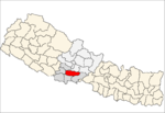
Walting is a village development committee in Kavrepalanchok District in Bagmati Pradesh of central Nepal. At the time of the 1991 Nepal census it had a population of 2212 and had 405 houses in it.
Batase is a village development committee in Kabhrepalanchok District in the Bagmati Zone of central Nepal. At the time of the 1991 Nepal census it had a population of 1985 and had 337 houses in it.
Bhimkhori is a village development committee in Kabhrepalanchok District in Bagmati Pradesh of central Nepal. At the time of the 1991 Nepal census it had a population of 4519 and had 764 houses in it.
Chyasing Kharka is a village development committee in Kabhrepalanchok District in Bagmati Pradesh of central Nepal. At the time of the 1991 Nepal census it had a population of 2628 and had 501 houses in it.
Khahare Pangu is a village development committee in Kabhrepalanchok District in the Bagmati Zone of central Nepal. At the time of the 1991 Nepal census it had a population of 2648.
Kharelthok is a village development committee in Kabhrepalanchok District in the Bagmati Zone of central Nepal. At the time of the 1991 Nepal census it had a population of 2779 in 531 individual households.
Kushadevi is a village development committee in Kabhrepalanchok District in the Bagmati Zone of central Nepal. At the time of the 1991 Nepal census it had a population of 6268 in 1201 individual households.
Mahendra Jyoti is a village development committee in Kabhrepalanchok District in the Bagmati Zone of central Nepal. At the time of the 1991 Nepal census it had a population of 3343.
Johang is a Village Development Committee VDC in Gulmi District in the Lumbini Zone of Western Nepal. At the time of the 2011 Nepal census it had a population of about 10000 living in 1509 individual households.
Situated on the bank of Kaligandaki river, Khadgakot is a town and Village Development Committee, in Gulmi District in the Lumbini Zone of central Nepal. At the time of the 1991 Nepal census it had a population of 4297 persons living in 808 individual households.

Chulachuli is a rural municipality (gaunpalika) out of six rural municipality located in Ilam District of Province No. 1 of Nepal. There are a total of 10 municipalities in Ilam in which 4 are urban and 6 are rural.
Karjanha is a village development committee in Siraha District in the Sagarmatha Zone of south-eastern Nepal. At the time of the 1991 Nepal census it had a population of 5296 people living in 954 individual households.
Pathari Shanishchare (पथरी-शनिश्चरे) is a Municipality in Morang District in the Koshi Zone of south-eastern Nepal. It was formed by merging two existing village development committees i.e. Pathari and Sanischare in May 2014.
The 2001 Nepal census was conducted by the Nepal Central Bureau of Statistics. According to the census, the population of Nepal in 2001 was 23,151,423. Working with Nepal's Village Development Committees at a district level, they recorded data from all the main towns and villages of each district of Nepal. The data included statistics on population size, households, sex and age distribution, place of birth, residence characteristics, literacy, marital status, religion, language spoken, caste/ethnic group, economically active population, education, number of children, employment status, and occupation.
Bakamalang is a village development committee in Palpa District in the Lumbini Zone of southern Nepal. At the time of the 1991 Nepal census it had a population of 2861 people living in 472 individual households. It is surrounded by Rakuwa in the northeast, Ruching in the southeast, Sahalkot in the southwest and Gadakot in the northwest. The northeast border of Bakamalang village development committee resembles the Gandaki River.