The 1991 Nepal census was a widespread national census conducted by the Nepal Central Bureau of Statistics.

Deulikot is a Village development committee in Bajhang District in the Seti Zone of north-western Nepal. At the time of the 1991 Nepal census it had a population of 4,698 and had 829 houses in the village.
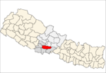
Aresh is a village development committee in Rolpa District in Province No. 5 of north-eastern Nepal. At the time of the 1991 Nepal census it had a population of 2801 people living in 497 individual households.
Gaurigaun is a village development committee in Rolpa District in the Rapti Zone of north-eastern Nepal. At the time of the 1991 Nepal census it had a population of 4004 people living in 753 individual households.
Hwama is a village development committee in Rolpa District in Province No. 5 of north-eastern Nepal. At the time of the 1991 Nepal census it had a population of 3730 people living in 678 individual households.
Mirul -- sometimes transliterated to Bhirul—is a village development committee in Rolpa District in the Rapti Zone of north-eastern Nepal. At the time of the 1991 Nepal census it had a population of 2571.
Dhawang is a village development committee in Rolpa District in Province No. 5 of north-eastern Nepal. At the time of the 1991 Nepal census it had a population of 3855 people living in 683 individual households.
Dubidanda is a village development committee in Rolpa District in Province No. 5 of north-eastern Nepal. At the time of the 1991 Nepal census it had a population of 3870 people living in 661 individual households.
Gam is a village development committee in Rolpa District in the Rapti Zone of north-eastern Nepal. At the time of the 1991 Nepal census it had a population of 4349 people living in 880 individual households.
Gajul is a village development committee in Rolpa District in Province No. 5 of north-eastern Nepal. At the time of the 1991 Nepal census it had a population of 4263 people living in 778 individual households.
Karchawang is a village development committee in Rolpa District in the Rapti Zone of north-eastern Nepal. At the time of the 1991 Nepal census it had a population of 2874 people living in 566 individual households.
Kareti is a village development committee in Rolpa District in the Rapti Zone of north-eastern Nepal. At the time of the 1991 Nepal census it had a population of 1808 people living in 380 individual households.
Khumel is a village development committee in Rolpa District in the Rapti Zone of north-eastern Nepal. At the time of the 1991 Nepal census it had a population of 2439 people living in 449 individual households.
Khungri is a village development committee in Rolpa District in the Rapti Zone of north-eastern Nepal. At the time of the 1991 Nepal census it had a population of 3564 people living in 695 individual households.
Kotgaun is a village development committee in Rolpa District in the Rapti Zone of north-eastern Nepal. At the time of the 1991 Nepal census it had a population of 3335 people living in 307 individual households.
Kureli is a village development committee in Rolpa District in the Rapti Zone of north-eastern Nepal. At the time of the 1991 Nepal census it had a population of 3024.
Masina is a village development committee in Rolpa District in the Rapti Zone of north-eastern Nepal. At the time of the 1991 Nepal census it had a population of 3881 people living in 719 individual households.
Mijhing is a village development committee in Rolpa District in the Rapti Zone of north-eastern Nepal. At the time of the 1991 Nepal census it had a population of 4391 people living in 828 individual households.
Pang is a village development committee in Rolpa District in the Rapti Zone of north-eastern Nepal. At the time of the 1991 Nepal census it had a population of 3793 people living in 311 individual households.
Bhabang -- also transliterated to bhabang—is a village development committee in Rolpa District in the Rapti Zone of north-eastern Nepal. At the time of the 1991 Nepal census it had a population of 4106.