Pokharathok is a small town in Arghakhanchi District in the Lumbini Zone of southern Nepal. At the time of the 1991 Nepal census it had a population of 3,373 and had 622 houses in the town.
Ghumthang is a village in Sindhupalchok District in the Bagmati Zone of central Nepal. At the time of the 1991 Nepal census it had a population of 3975 and had 760 houses in the village.
Lalmitiya is a town and Village Development Committee in Dang Deokhuri District in the Rapti Zone of south-western Nepal. At the time of the 1991 Nepal census it had a population of 12,048 persons living in 1900 individual households.
Khartamchha is a village and Village Development Committee in Khotang District in the Sagarmatha Zone of eastern Nepal. At the time of the 1991 Nepal census it had a population of 2,387 persons living in 497 individual households.
Deurali, Tanahu is a village development committee in Tanahu District in the Gandaki Zone of central Nepal. At the time of the 1991 Nepal census it had a population of 2910 people living in 44 individual households.
Pipaladi is a village development committee in Kanchanpur District in the Mahakali Zone of south-western Nepal. At the time of the 1991 Nepal census it had a population of 11,071 people living in 1739 individual households.
Madhabaliya is a town in Tilottama Municipality in Rupandehi District in the Lumbini Zone of southern Nepal. The formerly village development committee was merged to form a new municipality on 18 May 2014. At the time of the 1991 Nepal census it had a population of 8,380 people living in 528 individual households.
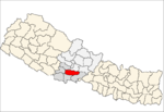
Barangdi is a village development committee in Palpa District in the Lumbini Zone of southern Nepal. At the time of the 1991 Nepal census it had a population of 2475 people living in 470 individual households.
Bhairabsthan is a village development committee in Palpa District in the Lumbini Zone of southern Nepal. At the time of the 1991 Nepal census it had a population of 2937 people living in 544 individual households.
Bhuwan Pokhari is a village development committee in Palpa District in the Lumbini Zone of southern Nepal. At the time of the 1991 Nepal census it had a population of 5113 people living in 969 individual households.
Baughapokharathok is a village development committee in Palpa District in the Lumbini Zone of southern Nepal. At the time of the 1991 Nepal census it had a population of 3162 people living in 576 individual households.
Deurali is a village development committee in Palpa District in the Lumbini Zone of southern Nepal. At the time of the 1991 Nepal census it had a population of 2637 people living in 515 individual households.
Galdha is a village development committee in Palpa District in the Lumbini Zone of southern Nepal. At the time of the 1991 Nepal census it had a population of 3304 people living in 544 individual households.
Kusumkhola is a village development committee in Palpa District in the Lumbini Zone of southern Nepal. At the time of the 1991 Nepal census it had a population of 1809 people living in 349 individual households.
Mainadi is a village development committee in Palpa District in the Lumbini Zone of southern Nepal. At the time of the 1991 Nepal census it had a population of 1315 people living in 273 individual households.
Palung Mainadi is a village development committee in Palpa District in the Lumbini Zone of southern Nepal. At the time of the 1991 Nepal census it had a population of 2675 people living in 445 individual households.
Pokharathok is a village development committee in Palpa District in the Lumbini Zone of southern Nepal. At the time of the 1991 Nepal census it had a population of 2238 people living in 432 individual households.
Pipari is a village development committee in Kapilvastu District in the Lumbini Zone of southern Nepal. At the time of the 1991 Nepal census it had a population of 1872 people living in 303 individual households.
Humsekot is a village development committee in Nawalparasi District in the Lumbini Zone of southern Nepal. At the time of the 1991 Nepal census it had a population of 3015 people living in 472 individual households.
Manjhariya is a village development committee in Nawalparasi District in the Lumbini Zone of southern Nepal. At the time of the 1991 Nepal census, Manjhariya had a population of 2,977 people living in 427 individual households.