History
Human presence in early historic times is testified by a bronze statuette found nearby, currently in the Antiquarium Teatinum. The statue depicts a man with a kilt holding a plate in his right hand as a sign of offer or request to a deity. 1st century BC inscriptions have also been found.
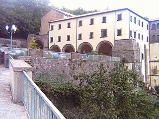
The first historical mention of the village dates back to 870 AD, when, among the possessions of the abbey of Montecassino, is mentioned a sancti Petri on the site of modern Ari. The local monastery, thanks to the economic help given from the Normans, gradually increased reaching the apogee between the 10th and 11th century, when it included a library, an oratory and several possessions such as churches, lands, and mills. Two papal bills, one by Pope Alexander III of 1173 and one by Innocent III of 1208, reaffirm the belonging to the churchood of Chieti, while other privileges are confirmed in a bill of emperor Lothair II.
The monastery declined between 1400 and 1464 and, with the death of the last chaplain, the area fell under the local bishop's authority.

Vimercate is a city and comune in the province of Monza and Brianza, Lombardy, northern Italy. It is 25 kilometres (16 mi) from Milan and 10 kilometres (6 mi) from Monza.

San Mauro Torinese is an Italian comune in the Metropolitan City of Turin in the Piedmont region. It is bordered by the territories of Settimo Torinese, Castiglione Torinese, Turin, and Baldissero Torinese.

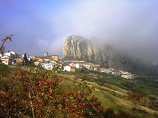
Capestrano is a comune and small town with 885 inhabitants (2017), in the Province of L'Aquila, Abruzzo, Italy. It is located in the Gran Sasso e Monti della Laga National Park.

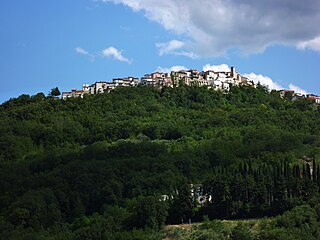
Campodimele is a town and comune in the province of Latina, in the Lazio region of central Italy. It is located on a steep Karstic hill, between the Monti Ausoni and Monti Aurunci ranges.
Candida is a small town and comune (municipality) in the province of Avellino within the Campania region of Italy. It sits on top of a hill, at an elevation of 579 metres (1,900 ft) and has around 1,100 inhabitants. It is 10 kilometres (6 mi) from Avellino.

Altino is a comune and town in the province of Chieti in the Abruzzo region of southern Italy. It is located on a rock spur commanding the valley of the Aventino river. The valley is richly cultivated with orchards, fruit, grapes and olives.

Carunchio is a comune and town in the province of Chieti in the Abruzzo region of Italy.
Palena is a comune and town in the province of Chieti in the Abruzzo region of Italy.
San Giovanni Teatino is a comune and town in the Province of Chieti in the Abruzzo region of Italy. Until 1894 this comune was known as Forcabobolina. Situated on a hill overlooking the valley of the river Pescara (Aterno-Pescara), in recent years the place has undergone an industrial development, especially in the area of Sambuceto. Abruzzo Airport is also located in a portion of the municipal territory, close to the border with Pescara. In fact, the municipality is virtually divided into two, San Giovanni Teatino (Alto), which is the historic village on the hill, and the aforementioned Sambuceto, an ever-growing urban settlement, home to a large shopping area and an important industrialized area.<>
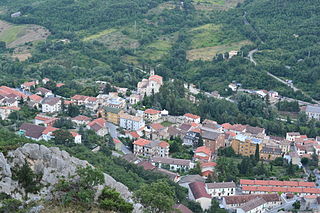
Civitella Messer Raimondo is a town in the province of Chieti in the Abruzzo region of Italy, with a population of 890. It is part of the mountain community of Aventino-Medio Sangro. Until 1863, it was known only as Civitella.

Francavilla al Mare is a comune and town in the province of Chieti, in the Abruzzo region of Italy.
Pizzoferrato is a comune and town in the Province of Chieti in the Abruzzo region of Italy.
Taranta Peligna is a comune and town in the province of Chieti in the Abruzzo region of central Italy. It is 57 kilometres (35 mi) from Chieti.

Tornareccio is a comune and town in the province of Chieti in the Abruzzo region of Italy, known for its apiaries and archaeological significance. It is the site of phase III of the Sangro Valley Project.
San Marzano sul Sarno is a town and comune in the province of Salerno in the Campania region of southern Italy, situated about halfway between Autostrade A3 and A30.
Isola Vicentina is a small town and comune in the Italian province of Vicenza in the Veneto region. Its population is around 9,319.

Bardolino is a comune (municipality) in the Province of Verona in the Italian region Veneto, located about 130 kilometres (81 mi) west of Venice and about 25 kilometres (16 mi) northwest of Verona.
Viguzzolo is a comune (municipality) in the Province of Alessandria in the Italian region Piedmont, located about 100 kilometres (62 mi) east of Turin and about 25 kilometres (16 mi) east of Alessandria. As of 31 December 2004, it had a population of 2,964 and an area of 18.3 square kilometres (7.1 sq mi).

Villimpenta is a comune (municipality) in the Province of Mantua in the Italian region Lombardy, located about 150 kilometres (93 mi) east of Milan and about 20 kilometres (12 mi) east of Mantua.
Roccamonfina is a comune (municipality) in the Province of Caserta in the Italian region Campania, located about 60 kilometres (37 mi) northwest of Naples and about 40 kilometres (25 mi) northwest of Caserta.
This page is based on this
Wikipedia article Text is available under the
CC BY-SA 4.0 license; additional terms may apply.
Images, videos and audio are available under their respective licenses.


