
Abruzzo is a region of Southern Italy with an area of 10,763 square km and a population of 1.3 million. It is divided into four provinces: L'Aquila, Teramo, Pescara, and Chieti. Its western border lies 80 km (50 mi) east of Rome. Abruzzo borders the region of Marche to the north, Lazio to the west and north-west, Molise to the south and the Adriatic Sea to the east. Geographically, Abruzzo is divided into a mountainous area in the west, which includes the highest massifs of the Apennines, such as the Gran Sasso d'Italia and the Maiella, and a coastal area in the east with beaches on the Adriatic Sea.

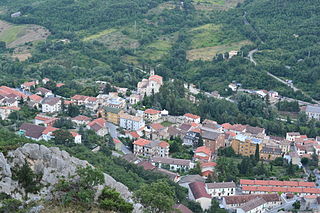
Pretoro is a town of about 1,100 inhabitants situated in Majella National Park, in the province of Chieti, Abruzzo, southern Italy. It is located on a steep hillside on the eastern side of the Maiella mountains. Its proximity to Passo Lanciano-La Majelletta ski area, guarantees the availability of winter sports, while the town is also only 20 minutes by car from the Adriatic Sea.
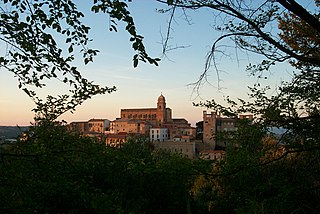
Guardiagrele is a town and comune in the province of Chieti, part of the Abruzzo region of central Italy. It is in the foothills of the Maiella mountain at an elevation of around 576 metres (1,890 ft). Its population numbers about 10,000.

Altino is a comune and town in the province of Chieti in the Abruzzo region of southern Italy. It is located on a rock spur commanding the valley of the Aventino river. The valley is richly cultivated with orchards, fruit, grapes and olives.

Archi is a town and comune in the province of Chieti, Abruzzo, southern Italy. It is part of the Valsangro mountain community.

Bucchianico is a comune and town in the province of Chieti in the Abruzzo region of Italy.
Palena is a comune and town in the province of Chieti in the Abruzzo region of Italy.

Castel Frentano is a comune and town in the province of Chieti in the Abruzzo region of Italy.
San Giovanni Teatino is a comune and town in the Province of Chieti in the Abruzzo region of Italy. Until 1894 this comune was known as Forcabobolina. Situated on a hill overlooking the valley of the river Pescara (Aterno-Pescara), in recent years the place has undergone an industrial development, especially in the area of Sambuceto. Abruzzo Airport is also located in a portion of the municipal territory, close to the border with Pescara. In fact, the municipality is virtually divided into two, San Giovanni Teatino (Alto), which is the historic village on the hill, and the aforementioned Sambuceto, an ever-growing urban settlement, home to a large shopping area and an important industrialized area.<>
Miglianico a town and comune of the province of Chieti in the Abruzzo region of Italy.
Civitella Messer Raimondo is a town in the province of Chieti in the Abruzzo region of Italy, with a population of 890. It is part of the mountain community of Aventino-Medio Sangro. Until 1863, it was known only as Civitella.

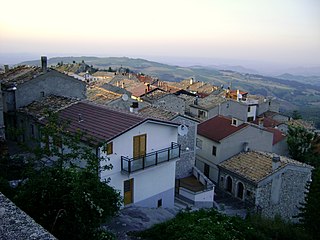
Lama dei Peligni is a comune and town in the Province of Chieti in the Abruzzo region of Italy with 1,155 inhabitants. It is also part of the Aventino-Medio Sangro mountain community and the municipal territory is included in the Majella National Park. The town, known to naturalists as the country of chamois, is located in a florofaunal area of particular interest.
Montenerodomo is a comune and town in the Province of Chieti in the Abruzzo region of Italy. The remote mountain hill town lies within the Maiella National Park.

San Salvo is a comune and town in the Province of Chieti in the Abruzzo region of Italy. It is the last Abruzzo town on the Adriatic coast before entering the Molise Region.
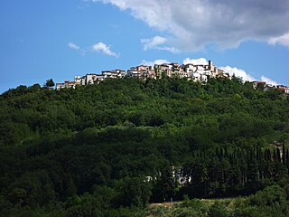
Taranta Peligna is a comune and town in the province of Chieti in the Abruzzo region of central Italy. It is 57 kilometres (35 mi) from Chieti.
Sant'Eufemia a Maiella is a town and comune in the province of Pescara, Abruzzo, central Italy. It is located in the Maiella National Park in a valley enclosed by the western slopes of the Majella massif, and the northeastern slopes of the Morrone group.

A rocca is a type of Italian fortified stronghold or fortress, typically located on a hilltop, beneath or on which the inhabitants of a historically clustered village or town might take refuge at times of trouble. Generally under its owners' patronage, the settlement might hope to find prosperity in better times. A rocca might in reality be no grander than a fortified farmhouse. A more extensive rocca would be referred to as a castello.
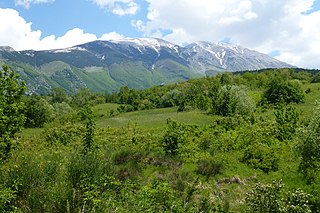
Maiella National Park is a national park located in the provinces of Chieti, Pescara and L'Aquila, in the region of Abruzzo, Italy.

Tourism in Abruzzo has become one of the most prosperous sectors in the economy of Abruzzo, and in recent years has seen a remarkable growth attracting numerous tourists from Italy and Europe. According to statistics from the Italian institute of statistics (ISTAT), in 2007 arrivals totaled 1,371,155 Italians and 189,651 foreigners. A total of 7,374,646 arrivals were tourists, a figure that puts the region seventeenth among the Italian regions for numbers of tourists per year. According to market analysis and sector studies on tourism in the Abruzzo National Society TurisMonitor 2012, after an increase that was estimated at between 4 and 5% of international tourist arrivals in the Abruzzo region in 2012 was estimated to increase that international arrivals will be around 3/4% by the end of 2012 with staff working in tourism will increase settling at about 25,000 people. Always position first-arrivals from Germany. A moderate support to tourism is also given to the Abruzzo Airport with many low cost and charter flights connecting the entire region with the rest of Europe.

Eremo della Madonna dell'Altare is an hermitage located in Palena, Province of Chieti.


