Arlington, North Carolina

Last updated
Arlington, North Carolina
NCMap-doton-Arlington.PNG
Location of Arlington, North Carolina
Coordinates: 36°13′39″N80°49′55″W / 36.22750°N 80.83194°W / 36.22750; -80.83194
Country United States
State North Carolina
County Yadkin
Town Jonesville
Incorporated1893, 1930 [1]
Annexed2001 [1]
Area
  Total0.8 sq mi (2.2 km2)
  Land0.8 sq mi (2.2 km2)
  Water0.0 sq mi (0.0 km2)
Elevation
988 ft (301 m)
Population
 (2000)
  Total795
  Density945.4/sq mi (365.0/km2)
Time zone UTC-5 (Eastern (EST))
  Summer (DST) UTC-4 (EDT)
ZIP code
28642
Area code 336
FIPS code 37-01900 [2]
GNIS feature ID1018850 [3]

Arlington was a town in Yadkin County, North Carolina, United States. The population was 795 at the 2000 census.

Contents

The town was incorporated on July 23, 1930. It merged into its larger neighbor, Jonesville, after a vote on May 29, 2001. The two towns had a combined population of about 2,250 people.

Geography

Arlington was located at 36°13′39″N80°49′55″W / 36.22750°N 80.83194°W / 36.22750; -80.83194 (36.227481, -80.831861). [4]

According to the United States Census Bureau, the town had a total area of 0.8 square miles (2.1 km2), all land.

Demographics

As of the census [2] of 2000, there were 795 people, 353 households, and 242 families residing in the town. The population density was 945.4 inhabitants per square mile (365.0/km2). There were 376 housing units at an average density of 447.1 per square mile (172.6/km2). The racial makeup of the town was 91.95% White, 6.04% African American, 1.26% from other races, and 0.75% from two or more races. Hispanic or Latino of any race were 2.39% of the population.

There were 353 households, out of which 31.7% had children under the age of 18 living with them, 44.8% were married couples living together, 20.7% had a female householder with no husband present, and 31.2% were non-families. 27.2% of all households were made up of individuals, and 10.8% had someone living alone who was 65 years of age or older. The average household size was 2.24 and the average family size was 2.72.

In the town the population was spread out, with 24.4% under the age of 18, 6.4% from 18 to 24, 28.9% from 25 to 44, 26.8% from 45 to 64, and 13.5% who were 65 years of age or older. The median age was 36 years. For every 100 females, there were 83.6 males. For every 100 females age 18 and over, there were 81.0 males.

The median income for a household in the town was $25,789, and the median income for a family was $32,500. Males had a median income of $23,421 versus $22,250 for females. The per capita income for the town was $14,469. About 14.4% of families and 16.9% of the population were below the poverty line, including 31.1% of those under age 18 and 15.3% of those age 65 or over.

Related Research Articles

<span class="mw-page-title-main">Stevenson, Alabama</span> City in Alabama, United States

Stevenson is a city in Jackson County, Alabama, United States, and is included in the Chattanooga-Cleveland-Dalton, TN-GA-AL Combined Statistical Area. Sources listed either 1866 or 1867 as the year of incorporation, but that seems to conflict with the dates given for the town being granted a charter. It did not first appear on the U.S. Census until 1880, where it was the second largest town in Jackson County behind Scottsboro. Since 1900, it has been the third largest town behind either Scottsboro and Bridgeport or vice versa. At the 2020 census, the population of the city was 1,955, down from 2,046 in 2010.

<span class="mw-page-title-main">Blades, Delaware</span> Town in Delaware, United States

Blades is a town in Sussex County, Delaware, United States. As of the 2010 census, the town population was 1,241, a 29.8% increase over the previous decade. It is part of the Salisbury, Maryland-Delaware Metropolitan Statistical Area.

Waltham is a town in Hancock County, Maine, United States. The population was 332 at the 2020 census.

<span class="mw-page-title-main">Rose Creek, Minnesota</span> City in Minnesota, United States

Rose Creek is a city in Windom Township, Mower County, Minnesota, United States. The population was 394 at the 2010 census.

<span class="mw-page-title-main">Mount Pleasant, North Carolina</span> Town in North Carolina, United States

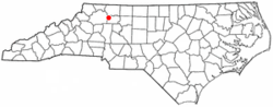
Mount Pleasant is a town located in eastern Cabarrus County, North Carolina, United States. As of the 2010 census, the town population was 1,652. The town center is located at the crossroads of Mount Pleasant Road and North Carolina Highway 73. NC Highway 49 skirts the town to the north on its way from Charlotte to Asheboro.

<span class="mw-page-title-main">Brice, Ohio</span> Village in Ohio, United States

Brice is a village in Franklin County, Ohio, United States, on the southeast side of the Columbus metropolitan area. The population was 93 at the 2020 census.

<span class="mw-page-title-main">Arlington, Ohio</span> Village in Ohio, United States

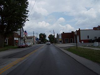
Arlington is a village in Hancock County, Ohio, United States. The population was 1,492 at the 2020 census.

<span class="mw-page-title-main">Davenport, Oklahoma</span> Town in Oklahoma, United States

Davenport is a town in Lincoln County, Oklahoma, United States. The population was 814 at the 2010 census.

<span class="mw-page-title-main">Sandy Creek Township, Mercer County, Pennsylvania</span> Township in Pennsylvania, United States

Sandy Creek Township is a township that is located in Mercer County, Pennsylvania, United States. The population was 800 at the time of the 2020 census, an increase from the figure of 795 that was documented in 2010.

<span class="mw-page-title-main">Port Clinton, Pennsylvania</span> Borough in Pennsylvania, United States

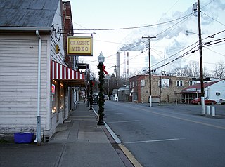
Port Clinton is a borough in Schuylkill County, Pennsylvania. It is located at the confluence of the Schuylkill and Little Schuylkill rivers, it was a port on the Schuylkill Canal and named after DeWitt Clinton.

<span class="mw-page-title-main">West Middletown, Pennsylvania</span> Borough in Pennsylvania, United States

West Middletown is a borough in Washington County, Pennsylvania, United States. The population was 109 at the 2020 census.

<span class="mw-page-title-main">Johnston, South Carolina</span> Town in South Carolina, United States

Johnston is a town in Edgefield County, South Carolina, United States. The population was 2,362 at the 2010 census. It is part of the Augusta, Georgia, metropolitan area. The town's official welcome sign states that it is "Peach Capital of the World".

<span class="mw-page-title-main">Lumberport, West Virginia</span> Town in West Virginia, United States

Lumberport is a town in Harrison County, located in northern West Virginia, United States. The population was 720 at the 2020 census.

<span class="mw-page-title-main">Fairview, West Virginia</span> Town in West Virginia, United States

Fairview is a town in Marion County, West Virginia, United States. The population was 374 at the 2020 census.

<span class="mw-page-title-main">Peterstown, West Virginia</span> Town in West Virginia, United States

Peterstown is a town in Monroe County, West Virginia, United States. The population was 456 at the 2020 census.

<span class="mw-page-title-main">Hay River, Wisconsin</span> Town in Wisconsin, United States

Hay River is a town in Dunn County, Wisconsin, United States, along the Hay River. The population was 546 at the 2000 census. The unincorporated community of Baxter is located in the town.

<span class="mw-page-title-main">Springfield, Jackson County, Wisconsin</span> Town in Wisconsin, United States

Springfield is a town in Jackson County, Wisconsin, United States. The population was 693 at the 2020 census. The village of Taylor is located within the town.

<span class="mw-page-title-main">Newark, Wisconsin</span> Town in Wisconsin, United States

The Town of Newark is located in Rock County, Wisconsin, United States. The population was 1,571 at the 2000 census. The unincorporated community of Newark is located in the town.

<span class="mw-page-title-main">Stubbs, Wisconsin</span> Town in Wisconsin, United States

Stubbs is a town in Rusk County, Wisconsin, United States. The population was 587 at the 2000 census. The unincorporated community of Apollonia is located in the town.

<span class="mw-page-title-main">Arlington, Wisconsin</span> Village in Wisconsin, United States

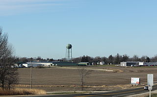
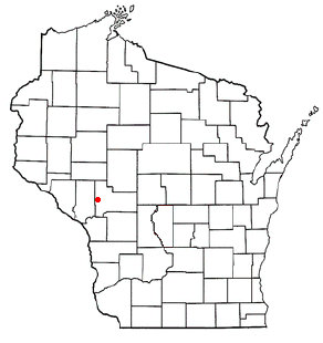
Arlington is a village in Columbia County, Wisconsin, United States. The population was 819 at the 2010 census. The village is located within the Town of Arlington. It is part of the Madison Metropolitan Statistical Area.

References

  1. 1 2 "North Carolina Gazetteer" . Retrieved August 13, 2023.
  2. 1 2 "U.S. Census website". United States Census Bureau . Retrieved 2008-01-31.
  3. "US Board on Geographic Names". United States Geological Survey. 2007-10-25. Retrieved 2008-01-31.
  4. "US Gazetteer files: 2010, 2000, and 1990". United States Census Bureau. 2011-02-12. Retrieved 2011-04-23.