
Southern California is a geographic and cultural region that generally comprises California's southernmost counties, and is the second most populous urban agglomeration in the United States. The region is traditionally described as eight counties, based on demographics and economic ties: Imperial, Los Angeles, Orange, Riverside, San Bernardino, San Diego, Santa Barbara, and Ventura. The more extensive 10-county definition, which includes Kern and San Luis Obispo counties, is also used and is based on historical political divisions.

San Bernardino County, officially the County of San Bernardino, is a county located in the southern portion of the U.S. state of California, and is located within the Greater Los Angeles area. As of the 2010 U.S. Census, the population was 2,035,210, making it the fifth-most populous county in California, and the 12th-most populous in the United States. The county seat is San Bernardino.

The University of California, Riverside, is a public research university in Riverside, California. It is one of the 10 general campuses of the University of California system. The main campus sits on 1,900 acres (769 ha) in a suburban district of Riverside with a branch campus of 20 acres (8 ha) in Palm Desert. In 1907 the predecessor to UCR was founded as the UC Citrus Experiment Station, Riverside which pioneered research in biological pest control and the use of growth regulators responsible for extending the citrus growing season in California from four to nine months. Some of the world's most important research collections on citrus diversity and entomology, as well as science fiction and photography, are located at Riverside.

State Route 91 is a major east–west freeway located entirely within Southern California and serving several regions of the Greater Los Angeles urban area. Specifically, it currently runs from Vermont Avenue in Gardena, just west of the junction with the Harbor Freeway, east to Riverside at the junction with the Pomona, and Moreno Valley freeways.

San Jacinto Peak is the highest peak of the San Jacinto Mountains, and of Riverside County, California. It lies within Mount San Jacinto State Park. Naturalist John Muir wrote of San Jacinto Peak, "The view from San Jacinto is the most sublime spectacle to be found anywhere on this earth!"
The Santa Margarita River which with the addition of what is now Temecula Creek, was formerly known as the Temecula River, is a short intermittent river on the Pacific coast of southern California in the United States, approximately 30.9 miles (49.7 km) long. One of the last free-flowing rivers in southern California, it drains an arid region at the southern end of the Santa Ana Mountains, in the Peninsular Ranges between Los Angeles and San Diego.

The San Bernardino National Forest is a United States National Forest in Southern California encompassing 823,816 acres (3,333.87 km2) of which 677,982 acres (2,743.70 km2) are federal. The forest is made up of two main divisions, the eastern portion of the San Gabriel Mountains and the San Bernardino Mountains on the easternmost of the Transverse Ranges, and the San Jacinto and Santa Rosa Mountains on the northernmost of the Peninsular Ranges. Elevations range from 2,000 to 11,499 feet. The forest includes seven wilderness areas: San Gorgonio, Cucamonga, San Jacinto, South Fork San Jacinto, Santa Rosa, Cahuilla Mountain and Bighorn Mountain. Forest headquarters are located in the city of San Bernardino. There are district offices in Lytle Creek, Idyllwild, and Fawnskin.

Box Springs Mountain is the highest peak in the Box Springs Mountains range, at 3083+ feet in elevation. The mountain is located in northwestern Riverside County, Southern California.

Lost Lake is a desert community located along the west shore of the Colorado River. It also lies along U.S. Route 95 near the northeast extent of Riverside County. Official U.S. Geological Survey feature ID is 245216 and NAD27 coordinates for the community are 34°00′44″N114°28′27″W. The community lies at the foot of Riverside Mountain, 34°00′49″N114°30′45″W, with a summit measuring 2,127 feet. The community is named for a lake, Lost Lake, located at 34°01′20″N114°28′21″W.
Skinner Reservoir, also known as Lake Skinner, is a reservoir in western Riverside County, California, located at the foot of Bachelor Mountain in the Auld Valley, approximately 10 miles (16 km) northeast of Temecula. It was created in 1973 by the construction of the Skinner Clearwell Dam on Tucalota Creek, and currently has a capacity of 44,200 acre feet (54,500,000 m3). Located just off Rancho California Road, The address of the reservoir is: 37701 Warren Road, Temecula, CA 92592.
Riverside Unified School District is a school district headquartered in Riverside, California, United States. The district serves a large portion of Riverside as well as unincorporated areas of Highgrove and Woodcrest in Riverside County.
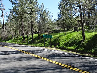
Mountain Center is a census-designated place in the San Jacinto Mountains, within western central Riverside County, California.
Arlington is a community about seven miles southwest of Riverside, California that is part of the Inland Empire, which is east of the Los Angeles and Orange County metropolitan areas.
Pinyon Pines is an unincorporated community in Riverside County, California.

The Riverside Mountains are a mountain range in Riverside County, California. The town of Vidal, California is located in the West Riverside Mountains.

Riverside County, is one of fifty-eight counties in the U.S. state of California. As of the 2010 census, the population was 2,189,641, making it the 4th-most populous county in California and the 11th-most populous in the United States. The name was derived from the city of Riverside, which is the county seat.
Sylvia Marguerite Broadbent was an American anthropologist and professor, specializing in Amerindian peoples.

The Inland Empire (IE) is a metropolitan area and region in Southern California. The term may be used to refer to the cities of western Riverside County and southwestern San Bernardino County. Sometimes including the desert communities of Palm Springs and the rest of the Coachella Valley; a much larger definition includes all of San Bernardino and Riverside counties.


