The Algarve is the southernmost NUTS II region of continental Portugal. It has an area of 4,997 km2 (1,929 sq mi) with 467,495 permanent inhabitants and incorporates 16 municipalities.

Silves is a city and municipality in the Portuguese region of Algarve, in southern Portugal. The population of the entire municipality of Silves in 2011 was 37,126, in an area of 680.06 km2. The urbanized area of the city proper has approximately 11,000 inhabitants. Silves is the former capital of the Kingdom of the Algarve (1249–1910), a nominal kingdom within the Kingdom of Portugal (1139-1910), and is of great historical importance.

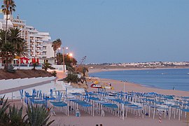
Portimão is a city and a municipality in the district of Faro, in the Algarve region of southern Portugal. The population in 2011 was 55,614, in an area of 182.06 km2. It was formerly known as Vila Nova de Portimão. In 1924, it was incorporated as a cidade and became known merely as Portimão. Historically a fishing and shipbuilding centre, it has nonetheless developed into a strong tourist centre oriented along its beaches and southern coast. The two largest population centers in the Algarve are Portimão and Faro.

Faro District is the southernmost district of Portugal, coincident with the Algarve region. The administrative centre, or district capital, is the city of Faro.

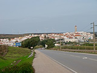
Algoz is a town and the seat of the civil parish of Algoz e Tunes in the municipality of Silves, in Algarve, Portugal. It has about 3000 inhabitants.

Olhão, officially known as Olhão da Restauração, is a city and municipality in the Algarve region of southern Portugal. The population of the municipality in 2011 was 45,396, in an area of 130.86 km2 (50.53 sq mi). Located near the regional capital Faro and forming a single urban agglomeration, it is a fishing port and tourist center. Along with Faro, Loulé and Tavira, Olhão forms a conurbation from the eastern and central Algarve.

Monchique is a municipality of southern Portugal, in Faro District. The population in 2011 was 6,045, in an area of 395.30 km2.

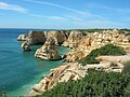
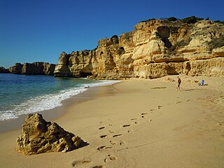
Lagoa is a city and municipality in the district of Faro, in the Portuguese region of Algarve. The population of the municipality in 2011 was 22,975, in an area of 88.25 km². Its urban population, in the city of Lagoa proper, is 6,100 inhabitants. An important travel destination, its coast has won numerous accolades. Marinha Beach was considered by the Michelin Guide as one of the 10 most beautiful beaches in Europe and as one of the 100 most beautiful beaches in the world.
Vila do Bispo is a municipality (concelho) in the Portuguese Algarve. It has 5,717 inhabitants in an area of 179.06 km2.

Praia da Luz, officially Luz, is a civil parish of the municipality of Lagos, in Algarve region, Portugal. The population of the civil parish in 2011 was 3,545, in an area of 21.78 km². Also known as Santorini de Portugal, Luz de Lagos or Vila da Luz, "Praia da Luz" is used to refer to both the urbanized village and the beach. The parish had its origins in a small fishing village, but was transformed by several holiday-villa complexes into a tourist area.

Quarteira is a Portuguese civil parish, in the municipality (concelho) of Loulé in the Algarve. The population in 2011 was 21,798, in an area of 38.16 km².

Alcantarilha is a former civil parish in the municipality of Silves, Portugal. In 2013, the parish merged into the new parish Alcantarilha e Pêra. With an area of 19.54 square kilometres (7.54 sq mi) the population of 2347 inhabitants is dispersed throughout the territory.
Pêra is a former civil parish in the municipality of Silves, Portugal. In 2013, the parish merged into the new parish Alcantarilha e Pêra. The village is 12.5 kilometres (7.8 mi) south east of Silves and is 261 kilometres (162 mi) south south east of Lisbon. The village used to be called Pêra de Cima or Upper Pêra to distinguish it from the present Armação de Pêra, which was then named Pêra de Baixo.

São Marcos da Serra, also known simply as São Marcos, is a village and the seat of the homonymous civil parish in the municipality of Silves, in Algarve region, Portugal. The population of the entire civil parish in 2011 was 1,352, in an area of 166.07 km².

The Arade is a river located in the region of the Algarve, southern Portugal. the river's course takes it through the municipalities of Silves, Lagoa and Portimão. The source of the river lies to the southwest of the Serra do Caldeirão mountain ridge, in a valley called Barranco do Pé do Coelho. The river has a total length of 75.0 kilometres (46.6 mi), with its source being 481 metres (1,578 ft) above sea level. The mouth of the river empties into the Atlantic Ocean between the city of Portimão and the freguesia of Ferragudo, in Lagoa Municipality.

Ferragudo is a Portuguese civil parish at the western border of the municipality of Lagoa. The population in 2011 was 1,973, in an area of 5.41 km². Ferragudo serves mainly as a bedroom community for its much larger neighbour, the city of Portimão; its residents routinely travel across the Arade River to work in the neighboring municipality.

Clube de Futebol Os Armacenenses(abbreviated as CF Armacenenses) is a Portuguese football club based in Armação de Pêra, Silves in the Algarve.
Praia da Coelha is a beach close to the village resort of Sesmarias which is within the Municipality of Albufeira, in the Algarve, Portugal. This beach is located 3.9 miles (6.3 km) by road to the west of Albufeira old town centre and is 31.5 miles (50.7 km) west of the region's capital, Faro. This beach is one of 69e blue flag beaches (2012) in the Algarve
The Algoz River is a small river in the south central region of the Algarve, Portugal, which rises near the village of Tunes and passes through the town of Algoz, the seat of the civil parish of Algoz e Tunes. The river is a tributary of the Alcantarilha River and runs for a distance of 10.5 kilometres (6.5 mi) from its source to its conflux with the Alcantarilha River.