
Somerleyton is a village and former civil parish, now in the parish of Somerleyton, Ashby and Herringfleet, in the East Suffolk district, in the north of the English county of Suffolk. It is 4.5 miles (7.2 km) north-west of Lowestoft and 5.5 miles (8.9 km) south-west of Great Yarmouth. The village is closely associated with Somerleyton Hall and was largely rebuilt as a model village in the 19th century at the direction of Samuel Morton Peto. The parish was combined with Herringfleet and Ashby to create the parish of "Somerleyton, Ashby and Herringfleet" on 1 April 1987.
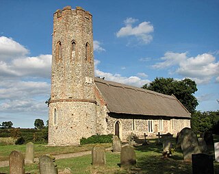
Worstead is a village and civil parish in the English county of Norfolk. It lies 3 miles (5 km) south of North Walsham, 5 miles (8 km) north of Wroxham, and 13 miles (21 km) north of Norwich. The village is served by Worstead railway station on the Bittern Line. For the purposes of local government, the parish falls within the district of North Norfolk.

Ashill is a small village and civil parish in Somerset, England, situated 7 miles (11.3 km) south of Taunton, and three miles north-west of Ilminster. The parish includes the hamlet of Windmill Hill and has a population of 529.
Ecclesfield is a village and civil parish in the City of Sheffield, South Yorkshire, England, about 4 miles (6 km) north of Sheffield City Centre. Ecclesfield civil parish had a population of 32,073 at the 2011 Census. Ecclesfield wards of the City of Sheffield had a population of 35,994 in 2011. The population of Ecclesfield village stood at 7,163 in the most recent census.

Hutton Magna is a village and civil parish in County Durham, England. Situated 7.6 miles (12.2 km) southeast of Barnard Castle. Lying within the historic boundaries of the North Riding of Yorkshire, the village along with the rest of the former Startforth Rural District has been administered by County Durham since 1 April 1974, under the provisions of the Local Government Act 1972. The civil parish also includes the hamlet of Lane Head.

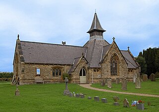
Ashby by Partney is a village and former civil parish, now in the parish of Ashby with Scremby, in the East Lindsey district of Lincolnshire, England. It is situated to the south of the A158 road, and 2 miles (3 km) east from the town of Spilsby. It neighbours the village of Partney. In 1961 the parish had a population of 64. On 1 April 1987 the parish was abolished and merged with Scremby to form "Ashby with Scremby".

Stawley is a village and civil parish in Somerset, England, situated 10 miles (16.1 km) west of Taunton. The parish has a population of 279 and includes the village of Kittisford and the hamlets of Appley, Greenham and Tracebridge.
Knowle St Giles is a village and civil parish in the South Somerset district of Somerset, England, situated on the River Isle 2 miles (3 km) south of Ilminster and 2.5 miles (4 km) north east of Chard. The village has a population of 244.
Bitteswell is a small village and former civil parish, now in the parish of Bitteswell with Bittesby, in the Harborough district of Leicestershire in England. It is situated just north of the town of Lutterworth, and in the 2001 census had a population of 454. The population had increased to 554 at the 2011 census. It was recorded in the Domesday Book as Betmeswelle. The village's name means 'the spring/stream in the broad valley'.

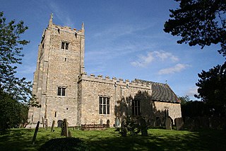
Binbrook is a village and civil parish in the East Lindsey district of Lincolnshire, England. It is situated on the B1203 road, and 8 miles (13 km) north-east from Market Rasen.
Kilby is a village and civil parish in the Blaby district of Leicestershire, England. Kilby is the easternmost village in the district, and is 6.1 miles (9.8 km) south east of Leicester. Kilby civil parish includes the former parish of Foston and its deserted medieval village. Nearby places are Countesthorpe 2.21 miles (3.56 km), Fleckney 2.12 miles (3.41 km), Arnesby 1.96 miles (3.15 km), Wistow 1.4 miles (2.3 km) and Kilby Bridge 1.18 miles (1.90 km).

Aldham is a village and civil parish in the Babergh district of Suffolk, England. Located around 8 miles (13 km) west of Ipswich, in 2005 it had a population of 200, reducing to 175 at the 2011 Census.

Ashby St Mary, historically Ascebei, is a small village and civil parish in the English county of Norfolk. The civil parish has an area of 2.03 square kilometres (0.78 sq mi) and in the 2001 census had a population of 297 in 115 households, the population increasing to 316 in 120 households at the 2011 Census. For the purposes of local government, the parish falls within the district of South Norfolk.
Bagby is a village and civil parish in the former Hambleton District of North Yorkshire, England, 3 miles (5 km) south-east of Thirsk. The parish had a population of 470 according to the 2001 census and a population of 593 at the 2011 Census. The parish shares a grouped parish council with the adjacent parish of Balk.

Bottesford is a town in North Lincolnshire, Lincolnshire, England.
Carlton-le-Moorland, is a village and civil parish in the North Kesteven district of Lincolnshire, England, between Newark-on-Trent and Lincoln. The parish had a population at the 2011 census of 565.

Stockbury is a village and civil parish in the Maidstone district of Kent, England. The population of the civil parish at the Census 2011 was 691.

Willingham St Mary, also known simply as Willingham, is a village and civil parish in the English county of Suffolk located about 3.5 miles (6 km) south of Beccles in the East Suffolk district. At the 2011 United Kingdom census it had a population of 152.
Ashby is a former civil parish, now in the parish of Somerleyton, Ashby and Herringfleet, in the East Suffolk district, in the north of the English county of Suffolk. It is 5+1⁄2 miles (8.9 km) north-west of Lowestoft.

Knaith is a village and civil parish about 3 miles (5 km) south of the town of Gainsborough in the West Lindsey district of Lincolnshire, England. The population of the civil parish at the 2011 census was 335.

