Ashill, Devon

Last updated

Ashill
Uffculme, towards Ashill from near Reed's Cross - geograph.org.uk - 130574.jpg
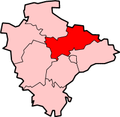
Devon UK location map.svg
Red pog.svg
Ashill
Location within Devon
OS grid reference ST0811
District
Shire county
Region
Country England
Sovereign state United Kingdom
Post town CULLOMPTON
Postcode district EX15
Dialling code 01884
Police Devon and Cornwall
Fire Devon and Somerset
Ambulance South Western
List of places
UK
England
Devon
50°53′N3°18′W / 50.89°N 03.30°W / 50.89; -03.30

Ashill is a village located in the parish of Uffculme, in the English county of Devon. [1] [2] It has a small church, a community village hall and small public house.

In the early 20th Century it had one or two shops, plus beer and cider houses. Later came a small garage with petrol pump, and a post office. None of these now survive. Towards the end of the century the character of the village changed, moving from a predominantly farming community to more of a residential character, with several new homes and a mini-estate and starter-home development built during the 1980s and 1990s. Nevertheless, a few historic farms remain active into the early 21st century, along with the more recently arrived alpaca breeders.

Ashill Inn Uffculme, Ashill Inn, Ashill - geograph.org.uk - 130569.jpg
Ashill Inn

St. Stephen's Church is part of the parish of St. Mary's, Uffculme. Ashill Inn was built in 1835.

One of the more visible features is a 3-storey Victorian red-brick dwelling at the lower end of the village. Legend has it that it began life as a 2-storey building (which would have been rather more in keeping with the character of the rest of the village), but during its construction the woman to whom the new owner was betrothed left him, and in order to win her back the man tried to impress her by commissioning an extra storey to his new home, thus assuring her of a greater status as the wife of a 'property owner'. As the story goes, he was unsuccessful in this, and she never returned to him.

Ashill lies approximately two miles from Uffculme and Kentisbeare.

It was soul/R&B singer Joss Stone's teenage home (specifically, the hamlet of Rull, approximately half a mile away).

Related Research Articles

<span class="mw-page-title-main">Bradninch</span> Town in Devon, England

Bradninch is a small town, civil parish and manor in Devon, England, lying about 3 miles (5 km) south of Cullompton. Much of the surrounding farmland belongs to the Duchy of Cornwall. There is an electoral ward with the same name, which since May 2023 comprises the entire parish. The population was 2,165 in 2021.

<span class="mw-page-title-main">Tidworth</span> Garrison town in Wiltshire, England

Tidworth is a garrison town and civil parish in south-east Wiltshire, England, on the eastern edge of Salisbury Plain. Lying on both sides of the A338 about 3+12 miles (5.6 km) north of the A303 primary route, the town is approximately 8 miles (13 km) west of Andover, 12 miles (19 km) south of Marlborough, and 13 miles (21 km) north by north-east of Salisbury. The population of the parish at the 2011 census was approximately 10,600.

<span class="mw-page-title-main">Widecombe in the Moor</span> Village in Devon, England

Widecombe in the Moor is a village and large civil parish in Dartmoor National Park in Devon, England. Its church is known as the Cathedral of the Moors on account of its tall tower and its size, relative to the small population it serves. It is a favourite tourist centre, partly for its scenic character and partly for its connection to the popular song "Widecombe Fair".

<span class="mw-page-title-main">Yelverton, Devon</span> Village in Devon, England

Yelverton is a large village on the south-western edge of Dartmoor, Devon, in England. It is in the civil parish of Buckland Monachorum. According to the 2021 census, it had a population of 1,858, which was slightly more than the 1,810 recorded at the 2011 census.

<span class="mw-page-title-main">Box, Wiltshire</span> Village in Wiltshire, England

Box is a large village and civil parish within the Cotswolds Area of Outstanding Natural Beauty in Wiltshire, England, about 3 miles (5 km) west of Corsham and 5 miles (8 km) northeast of Bath. Box also falls in the easternmost part of the Avon Green Belt. Besides the village of Box, the parish includes the villages of Ashley and Box Hill; Hazelbury manor; and the hamlets of Alcombe, Blue Vein, Chapel Plaister, Ditteridge, Henley, Kingsdown, Middlehill, and Wadswick. To the east the parish includes much of Rudloe, formerly a hamlet but now a housing estate, and the defence establishments and related businesses on the site of the former RAF Rudloe Manor.

<span class="mw-page-title-main">Fremington, Devon</span> Village in Devon, England

Fremington is a large village, civil parish and former manor in North Devon, England, the historic centre of which is situated three miles (5 km) west of Barnstaple. The village lies between the south bank of the tidal estuary of the River Taw and a small inlet of that river known as Fremington Pill. The parish is surrounded clockwise from the north by the parishes of Heanton Punchardon, Ashford, West Pilton, Barnstaple, Tawstock, Horwood, Lovacott and Newton Tracey, and Instow.

<span class="mw-page-title-main">Campsea Ashe</span> Village in Suffolk, England

Campsea Ashe is a village in Suffolk, England, located approximately 5 miles (8 km) north east of Woodbridge and 6 miles (10 km) south west of Saxmundham.

Whitfield is a village, civil parish and electoral ward in the English county of Kent. It now forms part of the urban area of the town of Dover. It has a modern counterpart in the large settlement located at the junction of the A2 and A256 roads, some four miles (6.4 km) north of Dover.

<span class="mw-page-title-main">Halberton</span> Village in Devon, England

Halberton is a village and civil parish in Devon, England. It is situated between the historic market towns of Tiverton and Cullompton. The Grand Western Canal runs around to the north and west of the village.

<span class="mw-page-title-main">Colden Common</span> Village and parish in Hampshire, England

Colden Common is a civil parish in the Winchester District of Hampshire, England, approximately 5 miles south of the city of Winchester, covering an area of 690.74 hectares (2.6670 sq mi) with a resident population of approximately 4,000 people. It includes the village of Colden Common and the hamlets of Hensting, Fisher's Pond, Nob's Crook, Highbridge and Brambridge. Part of the parish lies within the South Downs National Park.

<span class="mw-page-title-main">Ashill, Norfolk</span> Human settlement in England

Ashill is a village and civil parish in the English county of Norfolk. The village is between Watton and Swaffham.

<span class="mw-page-title-main">Berrynarbor</span> Village and civil parish in the North Devon district of Devon, England

Berrynarbor is a village, civil parish and former manor in the North Devon district of Devon, England. According to the 2001 census the parish had a population of 749, increasing to 802 at the 2011 census. The village is located on the north coast of the county to the north of Exmoor, about three miles east of Ilfracombe. The parish is surrounded clockwise from the east by the parishes of Combe Martin, Kentisbury, East Down, Marwood, Bittadon, and Ilfracombe. Berrynarbor has within its purview to all sides a mixture of dense woodlands and farms and lies within the North Devon Area of Outstanding Natural Beauty.

<span class="mw-page-title-main">Burlescombe</span> Village in Devon, England

Burlescombe is a village and civil parish in the Mid Devon district of Devon, England. The parish is surrounded, clockwise from the north, by the parishes of Holcombe Rogus, Culmstock, Uffculme, Halberton and Sampford Peverell. According to the 2001 census it had a population of 911. The village is about 5 miles (8.0 km) south west of Wellington in Somerset. The ruins of the 12th century Canonsleigh Abbey are nearby. Burlescombe is part of the electoral ward of Canonsleigh. The population of this ward was 3,218 at the 2011 Census.

<span class="mw-page-title-main">Burrough Green</span> Village in Cambridgeshire, England

Burrough Green is a village and parish in Cambridgeshire, England. The population of the village at the 2011 census was 378. The soil is various; subsoil, clay and chalk. The chief crops are wheat, barley and roots. The area of the parish is 2,272 acres (919 ha); the population in 1921 was 334."

<span class="mw-page-title-main">Uffculme</span> Village in Mid Devon, England

Uffculme is a village and civil parish located in the Mid Devon district, of Devon, England. Situated in the Blackdown Hills on the B3440, close to the M5 motorway and the Bristol–Exeter railway line, near Cullompton, Uffculme is on the upper reaches of the River Culm. The population of the parish, according to a 2020 estimate, is 3,090. It is surrounded, clockwise from the north, by the parishes of Culmstock, Hemyock, Sheldon, Kentisbeare, Cullompton, Willand, Halberton and Burlescombe.

<span class="mw-page-title-main">Morebath</span> Village in Devon, England

Morebath is an upland village in the county of Devon, England. It is mostly given over to sheep-farming, and situated on the southern edge of Exmoor.

<span class="mw-page-title-main">Ruan Lanihorne</span> Village and civil parish in south Cornwall, England

Ruan Lanihorne is a civil parish and village in south Cornwall, England, United Kingdom. The village is situated approximately four miles (6.5 km) east-southeast of Truro between the River Fal and its tributary the Ruan River.

<span class="mw-page-title-main">Lanivet</span> Human settlement in England

Lanivet is a village and civil parish in Cornwall, England, United Kingdom. The village is situated approximately 2+12 miles (4.0 km) southwest of Bodmin, and before the Bodmin by-pass was built, the A30 road between London and Land's End passed through the village. The Saints' Way long-distance footpath passes Lanivet near its half-way point.

<span class="mw-page-title-main">Farringdon, Devon</span> Village and civil parish in East Devon, England

Farringdon is a village, civil parish and former manor in the district of East Devon in the county of Devon, England. The parish is surrounded clockwise from the north by the parishes of Clyst Honiton, Aylesbeare, a small part of Colaton Raleigh, Woodbury, Clyst St Mary and a small part of Sowton.

<span class="mw-page-title-main">Tetcott</span> Village in Devon, England

Tetcott is a civil parish, small settlement and former manor in Devon, England. The parish lies about five miles south of the town of Holsworthy and is bordered on the north by the parish of Clawton, on the east by a small part of Ashwater, and on the south by Luffincott. It forms part of the local government district of Torridge, and its western boundary is the River Tamar which forms the Cornish border. In 2001 its population was 110, half that of a century earlier.

References

  1. Ordnance Survey: Landranger map sheet 192 Exeter & Sidmouth (Exmouth & Teignmouth) (Map). Ordnance Survey. 2013. ISBN   978-0-319-23139-5.
  2. "Ordnance Survey: 1:50,000 Scale Gazetteer" (csv (download)). www.ordnancesurvey.co.uk. Ordnance Survey. 1 January 2016. Retrieved 30 January 2016.