
Gadchiroli district is an administrative district in Maharashtra, India. The city of Gadchiroli is the administrative headquarters of the district.

Gondia district is an administrative district in the state of Maharashtra in India. The district headquarter is located at Gondia. The district occupies an area of 5,234 km2 (2,021 sq mi) and has a population of 1,322,507 of which 11.95% were urban. The district is part of Nagpur Division. There are 8 Talukas in Gondia District. Gondia Airport is second airport in Vidharbha region and serves city of Gondia.
Wardha district is in the state of Maharashtra in western India. This district is a part of Nagpur Division. The city of Wardha is the administrative headquarters of the district. Hinganghat, Pulgaon, Arvi and Wardha are the major cities in the district. The district had a population of 1,300,774, of which 26.28% were urban as of 2011.
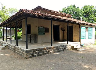
Gadchiroli is a city and a municipal council in Gadchiroli district in the state of Maharashtra, central India. It is located on eastern side of Maharashtra, and is the administrative headquarters of the district. Gadchiroli is called a lung of Maharashtra as it has almost 35% of this district has forest cover. The main river flowing through city is the Wainganga River. The landscape is lush and green during the monsoon season which is prone to flooding. Gadchiroli is known for its forests. Teak is grown commercially and bamboos are used for various crafts.
Mhowgaon is a Nagar Panchayat under Sub Division Dr. Ambedkar Nagar (Mhow) in Indore district in the Indian state of Madhya Pradesh. The total geographical area of Mhowgaon nagar panchayat is 13.5 km2 and it is the smallest city by area in the sub district. The population density of the city is 2309 persons per km2. Mhowgaon is divided into 15 wards for which elections are held every 5 years. Among them, Mhowgaon Ward No. 2 is the most populous ward with a population of 3440 and Mhowgaon Ward No. 15 is the least populous ward with a population of 957. Mhowgaon Nagar Panchayat has total administration over 6,373 houses to which it supplies basic amenities like water and sewerage. It is also authorized to build roads within Nagar Panchayat limits and impose taxes on properties coming under its jurisdiction.
Chamorshi is a Town and a tehsil in Gadchiroli district in the Indian state of Maharashtra.
Peth or Peint is the smallest tehsil of Nashik subdivision of Nashik district in Maharashtra, India. It belongs to Northern Maharashtra region. It belongs to Nashik Division. Peth is a Taluka headquarter. It is located 54 km to the West of Nashik District headquarters. It is also called as Peint. Pin code of Peth is 422208 and postal head office is Peth.
Kadannapalli is a census town in Kannur district of Kerala state, India.
Allapalli is a village located in the Gadchiroli district of Maharashtra, India.
Sironcha is a town and municipal council in Gadchiroli district of Maharashtra state in India. It connected with NH-63.
Masinagudi is a village in the Nilgiris District of the state of Tamil Nadu in India. It is located 30 km (19 mi) from the district headquarters at Ooty. It is in the buffer zone of the Mudumalai National Park. Masinagudi has several schools and other amenities and a number of resorts.
Pakhanjur, also known as Pakhanjore, is a town, nagar panchayat, and the headquarters of the eponymous tehsil in the Kanker District, Chhattisgarh, India. It is located 10 km (6.2 mi) south-west of Kapsi, the forest range headquarters; 47 km (29 mi) west of Koyalibeda, the block headquarters; and 120 km (75 mi) south-west of Kanker, the district headquarters. Its distance is 72 km (45 mi) from Bhanupratappur, 190 km (120 mi) from Durg and 250 km (160 mi) from the state capital Raipur.
Ashti is a major village in Partur taluka of Jalna district in Maharashtra state of India.
Bori is a village in Jintur taluka of Parbhani district in Maharashtra state of India.
Zari is a major village in Parbhani taluka of Parbhani district of Maharashtra state in India.
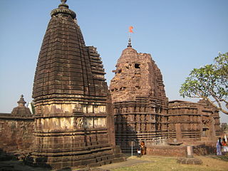
Charthana is a major village in Jintur taluka of Parbhani district in Maharashtra state of India. It used to be known as Charukshetra Nagari in the name of king Charudatta. There are near about 360 temples of Mahadeva, some of which are under the ground. The Archaeological Survey of India (ASI) has acquired the remaining temples for conservation. Gokuleshwar mandir, Barav, Dwipmal, and Nartirtha are places of interest among many others.
Walur is a major village in Sailu taluka of Parbhani district in Maharashtra state of India. Walur is also famous for ancient valmiki rishi temple placed in center of the village. There are some unconfirmed stories/ truths about the presence of valmiki rishi in walur. The stories states that before being known as valmiki rishi he was not aware of his abilities of writing and was not a devotee of lord RAMA. As guided by narada, valmiki started chanting word 'MARA' and after few years the word turned out as 'RAMA'. Huge anthills formed around valmiki rishi and then he got name of VALMIKI. The unconfirmed stories from this area states valmiki rishi chanted the name of RAMA in Walur and anthill formed around him. As anthill means warul in marathi language the name of village was inspired by it. Before some year the name warul turned out as Walur.
Bhogaon is a major village in the Jintur taluka of Parbhani district in Maharashtra, a state of India.

Ahmedpur is a town in Latur district of Maharashtra state of India. Ahmedpur is 60 km away from district headquarter Latur.
Daithana is a major village in Parbhani taluka of Parbhani district in Indian state of Maharashtra. Village is located on Parbhani-Gangakhed state highway, 24 km away from Parbhani city.

