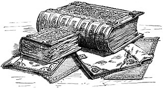
Domesday Book is a manuscript record of the Great Survey of much of England and parts of Wales completed in 1086 at the behest of King William the Conqueror. The manuscript was originally known by the Latin name Liber de Wintonia, meaning "Book of Winchester", where it was originally kept in the royal treasury. The Anglo-Saxon Chronicle states that in 1085 the king sent his agents to survey every shire in England, to list his holdings and dues owed to him.
William de Warenne, 1st Earl of Surrey, Lord of Lewes, Seigneur de Varennes, was a Norman nobleman created Earl of Surrey under William II Rufus. He is among the few known from documents to have fought under William the Conqueror at the Battle of Hastings in 1066. At the time of Domesday Book in 1086 he held extensive lands in 13 counties, including the Rape of Lewes, a tract now divided between the ceremonial counties of East Sussex and West Sussex.

The BBC Domesday Project was a partnership between Acorn Computers, Philips, Logica, and the BBC to mark the 900th anniversary of the original Domesday Book, an 11th-century census of England. It has been cited as an example of digital obsolescence on account of the physical medium used for data storage.

Caistor is a town and civil parish in the West Lindsey district of Lincolnshire, England. As its name implies, it was originally a Roman castrum or fortress. It lies at the north-west edge of the Lincolnshire Wolds, on the Viking Way, and just off the A46 between Lincoln and Grimsby, at the A46, A1084, A1173 and B1225 junction. It has a population of 2,601. Its name comes from the Anglo-Saxon ceaster and was given in the Domesday Book of 1086 as Castre.

Asterby is a hamlet between Goulceby and Scamblesby, west of Louth, in the East Lindsey district of Lincolnshire, England. The civil parish of Asterby had a population of 103 according to the 2001 census, increasing to 159 at the 2011 census.
The hide was an English unit of land measurement originally intended to represent the amount of land sufficient to support a household. It was traditionally taken to be 120 acres, but was in fact a measure of value and tax assessment, including obligations for food-rent, maintenance and repair of bridges and fortifications, manpower for the army, and (eventually) the geld land tax.

Rattery is a village and civil parish in the South Hams district, in the county of Devon, England, a few miles from the villages Buckfastleigh and neighbouring village Ashburton. The name has been suggested as a variant of Red Tree but is mentioned in the Domesday Book of 1086 as Ratreu. In 2001 the parish had a population of 458.

Ashreigney is a village and civil parish in the Torridge district of Devon, England, about 15 miles (24 km) south of the town of Barnstaple. According to the 2001 census it had a population of 446, compared to 540 in 1901.

Bottesford is a town in North Lincolnshire, Lincolnshire, England.

The Castle & Crusade Society was a chapter of the International Federation of Wargaming dedicated to medieval miniature wargaming.

Pattishall, also known in antiquity as Pateshull, is a village and Parish in West Northamptonshire, England. The population of the civil parish was 1,471 at the 2011 census. The village lies adjacent to the Roman road Watling Street (A5) and Banbury Lane, an ancient drove way, 4 miles north of Towcester and 7 miles south of Northampton.
Dr Katharine Stephanie Benedicta Keats-Rohan is a British history researcher, specialising in prosopography. She has produced seminal work on early European history, and collaborated with, among others, Christian Settipani. Keats-Rohan is widely regarded as one of the founders of modern prosopographical and network analysis research, which has become highly computer-dependent.
The Hundreds of Cheshire, as with other Hundreds in England, were the geographic divisions of Cheshire for administrative, military and judicial purposes. They were introduced in Cheshire some time before the Norman conquest. Later on, both the number and names of the hundreds changed by processes of land being lost from Cheshire, and merging or amalgamation of remaining hundreds. The Ancient parishes of Cheshire were usually wholly within a specific hundred, although a few were divided between two hundreds.

Cumberworth is a small village and civil parish in the East Lindsey district of Lincolnshire, England. It is situated approximately 3 miles (5 km) south-east from the town of Alford.

Wood Enderby is a village and civil parish in the East Lindsey district of Lincolnshire, England. It is situated approximately 4 miles (6 km) south from Horncastle. The civil parish includes the hamlets of Claxby Pluckacre and Wilksby.

Fotherby is a village and civil parish in the East Lindsey district of Lincolnshire, England. It is situated just east from the A16 road, 13 miles (21 km) east from Market Rasen, and 10 miles (16 km) south from Cleethorpes.

The extent of the medieval district of Craven, in the north of England is a matter of debate. The name Craven is either pre-Celtic British, Britonnic or Romano-British in origin. However, its usage continued following the ascendancy of the Anglo-Saxons and the Normans – as was demonstrated by its many appearances in the Domesday Book of 1086. Places described as being In Craven in the Domesday Book fell later within the modern county of North Yorkshire, as well as neighbouring areas of West Yorkshire, Lancashire and Cumbria. Usage of Craven in the Domesday Book is, therefore, circumstantial evidence of an extinct, British or Anglo-Saxon kingdom or subnational entity.

Washfield is a village, parish and former manor in Mid Devon, Devon, England, situated about 2 miles north-west of Tiverton. The parish church is dedicated to St Mary the Virgin. It was within the jurisdiction of the historic West Budleigh Hundred. In 2001 the parish had a population of 362.


