
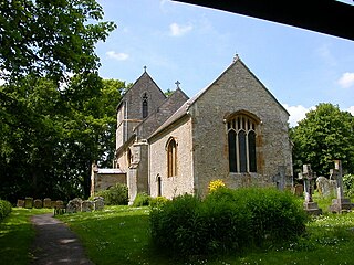
Lillingstone Dayrell is a village and former civil parish, now in the parish of Lillingstone Dayrell with Luffield Abbey, in Buckinghamshire, England. It is about three and a half miles north of Buckingham, eight miles west of Milton Keynes and five miles south of Towcester.
Silverstone is a village and civil parish in Northamptonshire, England. It is about four miles from Towcester on the former A43 main road, 10 miles (16 km) from the M1 motorway junction 15A and about 12 miles (19 km) from the M40 motorway junction 10, Northampton, Milton Keynes and Banbury. The population of the civil parish at the 2011 census was 2,176. The A43 now bypasses to the south-east of the village.

Clipston is a village and civil parish in West Northamptonshire, England. The village lies around 4 miles (6.4 km) south-southwest of the town of Market Harborough in the neighbouring county of Leicestershire. At the 2011 Census, the population of the parish was 643, an increase from 613 at the 2001 Census.
Ashton is a village in West Northamptonshire about 1 mile (1.6 km) southeast of Roade village close to the Northampton to Milton Keynes A508, ca.3 miles (5 km) south of junction 15 of the M1 motorway, 6 miles (10 km) south of Northampton and 11 miles (18 km) north of Milton Keynes. The population of the civil parish at the 2011 census was 395. The village is about 67 miles (107.8 km) north of London via the M1 junction 15. The West Coast Main Line intersects the village on its eastern side.

Greens Norton is a village and civil parish in West Northamptonshire, England, just over 1 mile (1.6 km) north-west of Towcester. At the 2011 census the parish, including Caswell and Duncote, had a population of 1,526, a slight decrease since the 2001 census.

Isham is a village and civil parish in Northamptonshire, England. It is on the A509 road, three miles south of Kettering and a mile to the west of Burton Latimer. The River Ise is to the east of the village. Administratively, it forms part of North Northamptonshire. It was previously in the Borough of Wellingborough until 2021. At the time of the 2011 census, the parish's population was 772 people.
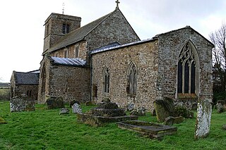
Bugbrooke is a village and civil parish in West Northamptonshire, England, on a ridge overlooking the valley of the River Nene.

Hartwell is a village and civil parish in West Northamptonshire, England, bordering Buckinghamshire. The village is next to Salcey Forest and the M1 motorway. It is 7 miles (11 km) south of Northampton and 13 miles (21 km) north of Milton Keynes.

Adstone is a village and civil parish in West Northamptonshire, England. The population at the 2001 census was 65. It remained than 100 at the 2011 census and was included in the civil parish of Tiffield. Adstone is situated approximately 6.5 miles (10 km) south-southeast of Daventry and 6.5 miles (10 km) west-northwest of Towcester. It was known as Atenestone in the Domesday Book.

Campion School is a co-educational secondary school in Bugbrooke, about 6 miles (10 km) from Northampton, Northamptonshire. Founded in 1969, it became a Language College in September 1997, and in 2011 the school became an academy. The school had 1397 students on roll for the 2014-2015 school year, with 71 teaching staff and 19 teaching assistants. In 2020 the school had 1738 students on roll, 69 Teaching staff and 21 teaching assistants. On 1 September 2023, Campion School & Language College became part of the United Learning Trust.
Boddington is a civil parish in West Northamptonshire, England, about 5 miles (8 km) north-east of Banbury off the A361 road.
Tiffield is a village and civil parish in Northamptonshire, England, north of Towcester between the A5 road to its west and the A43 road to its east.

Abthorpe is a village and civil parish in the valley of the River Tove in West Northamptonshire, England, about 4 miles (6.4 km) west of Towcester, 2 miles (3.2 km) northwest of Silverstone and approximately midway between London and Birmingham.

Dalscote is a small village in West Northamptonshire, England. It is north of Towcester and between Gayton and Eastcote. There is a car-body repair workshop there but no other amenities. It is in the civil parish of Pattishall.

Courteenhall is a village 5 miles (8 km) south of the county town of Northampton, in the shire county of Northamptonshire, England, and about 66 miles (106 km) north of London. The population of the civil parish was 122 at the 2011 census. The village is located in a cul-de-sac.

Astcote is a hamlet near the town of Towcester in Northamptonshire, England. It is in the civil parish of Pattishall.

Cold Higham is a village and civil parish in Northamptonshire, England. Cold Higham Parish, also includes Fosters Booth (West), Grimscote, and Potcote. It is adjacent to Weedon Bec, Pattishall, Eastcote and Astcote. The A5 runs along the eastern boundary of the parish, along the route of Watling Street, a former Roman road. The parish had a population of 289 at the time of the 2001 census. The civil parish population had risen to 290 at the 2011 census.

Paulerspury is a civil parish and small village in South Northamptonshire, England. It is approximately 3 miles (5 km) south of Towcester and 8 miles (13 km) north of Milton Keynes along the A5 road. The parish also contains the hamlets or villages of Pury End, Pury Hill and Heathencote; at the time of the 2001 census, its population was 991 people. The 2011 population was 1,018.

Eastcote is a small village in the shire county of Northamptonshire (Northants), England. It is about 7 miles (11.3 km) south-west of the county town of Northampton along Banbury Lane. It is close to the A5 road, the Roman Road known as Watling Street, about 4 miles (6.4 km) north-west of Towcester. Prior to the opening in the 1959 of the M1 Motorway and the M6 Motorway a little later, the A5 was the main route by road from London to north Wales and north-west England.
Farthinghoe is a village and civil parish in West Northamptonshire, England. It is located on the A422 road about 3 miles (4.8 km) north-west of Brackley and 5 miles (8.0 km) south-east of Banbury.


