
Burford is a town on the River Windrush, in the Cotswold hills, in the West Oxfordshire district of Oxfordshire, England. It is often referred to as the 'gateway' to the Cotswolds. Burford is located 18 miles (29 km) west of Oxford and 22 miles (35 km) southeast of Cheltenham, about 2 miles (3 km) from the Gloucestershire boundary. The toponym derives from the Old English words burh meaning fortified town or hilltown and ford, the crossing of a river. The 2011 Census recorded the population of Burford parish as 1,422.
Blockley is a village, civil parish and ecclesiastical parish in the Cotswold district of Gloucestershire, England, about 3 miles (5 km) northwest of Moreton-in-Marsh. Until 1931 Blockley was an exclave of Worcestershire.

Bredon is a village and civil parish in Wychavon district at the southern edge of Worcestershire in England. It lies on the banks of the River Avon on the lower slopes of Bredon Hill.
Fairford is a market town in Gloucestershire, England. The town lies in the Cotswold hills on the River Coln, 6 miles (9.7 km) east of Cirencester, 4 miles (6.4 km) west of Lechlade and 9 miles (14 km) north of Swindon. Nearby are RAF Fairford and the Cotswold Water Park.

Broadway is a large village and civil parish in the Cotswolds, England, with a population of 2,540 at the 2011 census. It is in the far southeast of Worcestershire, close to the Gloucestershire border, midway between Evesham and Moreton-in-Marsh. It is sometimes referred to as the "Jewel of the Cotswolds".
Kemble is a village in the civil parish of Kemble and Ewen, in the Cotswold district of Gloucestershire, England. Historically part of Wiltshire, it lies 4 miles (6.4 km) from Cirencester and is the settlement closest to Thames Head, the source of the River Thames. In 2020 it had an estimated population of 940. At the 2011 census the parish had a population of 1,036.

Fladbury is a traditional English village located in rural Worcestershire, England. Five miles from Pershore, 5 miles from Evesham, 2.8 miles from the Cotswolds Area of Outstanding Natural Beauty. and 107 miles from London. It is on the banks of the River Avon, with many interesting and original buildings and features. The village was mentioned in the Domesday Book of 1086, almost 1,000 years ago. Cropthorne village is on the opposite bank of the Avon. The two ancient communities are linked by the Jubilee Bridge.

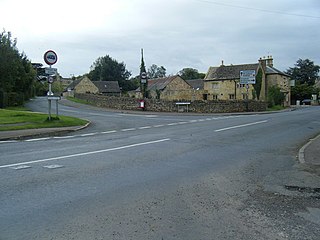
Tormarton is a village and civil parish in the South Gloucestershire district, in the ceremonial county of Gloucestershire, England. The village is about half a mile north of the M4 motorway; the A46 road towards Bath passes a similar distance west of the village to join the motorway at junction 18. The parish includes the small village of West Littleton, south of the motorway. The parish population at the 2021 census was 323. The Cotswold Way footpath passes through the village.
Alderley is a village and civil parish in the Stroud district of Gloucestershire, England, about fourteen miles southwest of Stroud and two miles south of Wotton-under-Edge. It is situated on the Cotswold Way near to the villages of Hillesley and Tresham and lies underneath Winner Hill between two brooks, the Ozleworth and Kilcott.

Barnsley is a village and civil parish in the Cotswold district of Gloucestershire, England, 3.7 miles (6.0 km) northeast of Cirencester. It is 125 kilometres (78 mi) (geodesically) west of London.

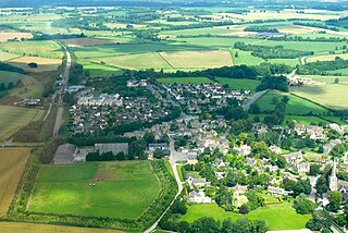
Mickleton is a village and civil parish in the Cotswold District of Gloucestershire, England. The village is the northernmost settlement in Gloucestershire, lying close to the borders with Worcestershire and Warwickshire, 3 miles (4.8 km) north of Chipping Campden, 8 miles (13 km) east of Evesham and 8 miles (13 km) south of Stratford-upon-Avon. The population of the parish was 1,677 at the 2011 Census.

Dumbleton is a village and civil parish in the Tewkesbury district, in the county of Gloucestershire, England. The village is roughly 20 miles from the city of Gloucester. The village is known to have existed in the time of Æthelred I who granted land to Abingdon Abbey, and it is mentioned in the Domesday Book.

Stanton is a village and civil parish in Tewkesbury Borough, Gloucestershire, England. The village is a spring line settlement at the foot of the Cotswold escarpment, about 2.5 miles (4 km) southwest of Broadway in neighbouring Worcestershire. Broadway is Stanton's postal town. The 2011 Census recorded the parish's population as 198.
Kemerton is a village and civil parish in Worcestershire in England. It lies at the extreme south of the county in the local government district of Wychavon. Until boundary changes in 1931, it formed part of neighbouring Gloucestershire, and it remains in the Diocese of Gloucester. The northern half of the parish lies within the Cotswolds Area of Outstanding Natural Beauty.

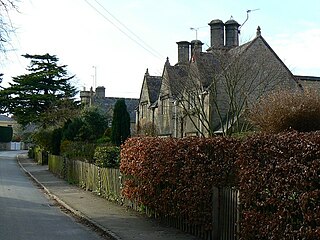
Sapperton is a village and civil parish in the Cotswold District of Gloucestershire in England, about 4.5 miles (7.2 km) west of Cirencester. It is most famous for Sapperton Canal Tunnel, and its connection with the Cotswold Arts and Crafts Movement in the early 20th century. It had a population of 424, which had reduced to 412 at the 2011 census.

Coberley is a village and civil parish in the Cotswold District of Gloucestershire in England, 4 miles (6.4 km) south of Cheltenham. It lies at the confluence of several streams that form the River Churn, a tributary of the River Thames. The medieval village was closer to the main road, near a spring to the east of Coberley Court. The sites of the medieval and modern villages of Upper Coberley are a short distance to the east.
Hatherop is a village and civil parish in the Cotswolds Area of Outstanding Natural Beauty, about 2.5 miles (4.0 km) north of Fairford in Gloucestershire, England. The River Coln forms part of the western boundary of the parish.
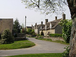
Cold Aston is a village and civil parish in Gloucestershire, England, approximately 18 miles (29 km) to the east of Gloucester. It lies in the Cotswolds, an Area of Outstanding Natural Beauty. In the 2011 census, the population was 255.

Campden was, from 1894 to 1935, a rural district in the administrative county of Gloucestershire, England. The district lay on the north-eastern boundary of Gloucestershire, and consisted of three separate areas nearly surrounded by the counties of Warwickshire and Worcestershire. The county and district boundaries were simplified in 1931 and the district was abolished in 1935.
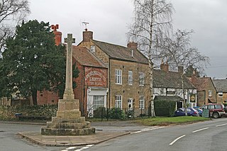
Weston-sub-Edge is a village in Gloucestershire, England.

