
The Elan Valley Reservoirs are a chain of man-made lakes created from damming the Elan and Claerwen rivers within the Elan Valley in Mid Wales. The reservoirs, which were built by the Birmingham Corporation Water Department, provide clean drinking water for Birmingham in the West Midlands of England. The five lakes are known as the Claerwen, Craig-goch, Pen-y-garreg, Garreg-ddu, and Caban-coch.
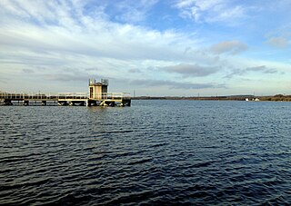
Chasewater is a reservoir located in the parish of Burntwood and the district of Lichfield in Staffordshire, England. Originally known as Norton Pool and Cannock Chase Reservoir, it was created as a canal feeder reservoir in 1797. The reservoir was created to directly supply the Wyrley and Essington Canal and maintain levels in the 160-mile (260 km) Birmingham Canal Network. During a period of great industrial growth in the Black Country region the maintenance of water levels in canal infrastructure was essential and Chasewater was in great demand. As canals became less essential for transport of goods during the mid-20th century, the reservoir diversified and became a popular public amenity with activities such as water-skiing, sailing, wakeboarding and cycling. Chasewater is the third largest reservoir by volume in the county of Staffordshire and the largest canal feeder reservoir in the West Midlands.

Thirlmere is a reservoir in the Borough of Allerdale in Cumbria and the English Lake District. The Helvellyn ridge lies to the east of Thirlmere. To the west of Thirlmere are a number of fells; for instance, Armboth Fell and Raven Crag both of which give views of the lake and of Helvellyn beyond. It runs roughly south to north and is bordered on the eastern side for much of its length by the A591 road and on the western side by a minor road. It occupies the site of a former natural lake: this had a fordable waist so narrow that it was sometimes regarded as two lakes. In the 19th century Manchester Corporation constructed a dam at the northern end, raising the water level, flooding the valley bottom, and creating a reservoir to provide the growing industrial city of Manchester with water supplies via the 96 mile-long Thirlmere Aqueduct. The reservoir and the aqueduct still provide water to the Manchester area, but under the Water Act 1973 ownership passed to the North West Water Authority; as a result of subsequent privatisation and amalgamation they are now owned and managed by United Utilities, a private water and waste water company.

Lake Vyrnwy is a reservoir in Powys, Wales, built in the 1880s for Liverpool Corporation Waterworks to supply Liverpool with fresh water. It flooded the head of the Vyrnwy valley and submerged the village of Llanwddyn.
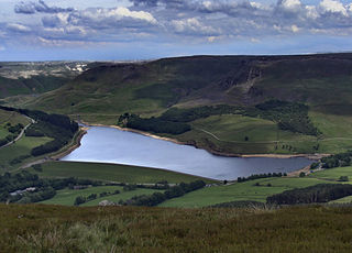
Dovestone Reservoir lies at the convergence of the valleys of the Greenfield and Chew Brooks above the village of Greenfield, on Saddleworth Moor in Greater Manchester, England. The reservoir is on the western edge of the Peak District National Park. It supplies drinking water to the surrounding area and is a tourist attraction, providing several walks amongst picturesque landscapes.

Witton Lakes are a pair of former drinking water reservoirs between the Perry Common and Erdington areas of Birmingham, England.

Lifford Reservoir in the Kings Norton district of Birmingham, England was built by the Worcester & Birmingham Canal company in 1815 to compensate Lifford Mill for water lost to the canal. It is located at the junction of the Stratford-upon-Avon Canal and the Worcester and Birmingham Canal and is on the River Rea Cycle Route. Angling is permitted subject to a charge outside the spring close season. Fish in the reservoir include tench, carp, pike, eels, perch, roach and bream.

Southampton Common is a large open space to the north of the city centre of Southampton, England. It is bounded by the districts of Shirley, Bassett, Highfield and Portswood. The area supports a large variety of wildlife, including one of the largest populations in Britain of the nationally rare great crested newt. The Common is used for a wide variety of community events, Flower Festival, Race for life Cancer Research UK and formerly 'Power in the Park' hosted by Power FM.

Bristol Water is a British water company which supplies 266 million litres of drinking water daily to over 1.2 million customers in a 2,600 km2 (1,000 sq mi) area centred on Bristol, England. It is regulated under the Water Industry Act 1991. Sewerage services in the Bristol area are provided by Wessex Water.

Litton Reservoirs are two reservoirs near the village of Litton, Somerset, England. They are operated by Bristol Water.

Rensselaer Lake is an artificial lake in Albany, New York, United States named for Major-General Stephen Van Rensselaer, last patroon of Rensselaerswyck. The lake was Albany's first municipally-owned source of water. It is part of a 57-acre (23 ha) park and the state's Albany Pine Bush Preserve. The lake and park have been under the purview of the Albany Water Authority since 2003.

London's water supply infrastructure has developed over the centuries in line with the expansion of London.
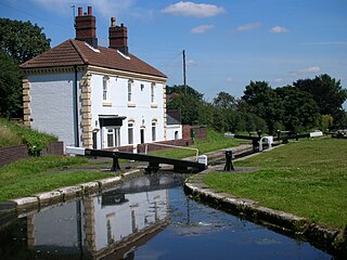
The Tame Valley Canal is a relatively late (1844) canal in the West Midlands of England. It forms part of the Birmingham Canal Navigations. It takes its name from the roughly-parallel River Tame.
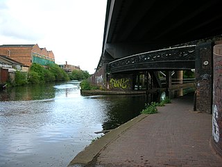
Salford Junction is the canal junction of the Grand Union and Tame Valley Canals with the Birmingham and Fazeley Canal. It is in the north of the administrative city of Birmingham, England and historically marked a tripoint between two divisions of Aston to the south and Erdington to the north. It is directly east of most of the Gravelly Hill Interchange. With Aston and Bordesley Junctions it forms a circuit, at the heart of Birmingham's thirty-five miles of canals.

Ardleigh Reservoir is a 49-hectare (120-acre) lake near Colchester in Essex, England constructed in the valley of the Salary Brook. It supplies water both to Anglian Water and to Affinity Water. The lake is also used for recreational activities including sailing and angling.
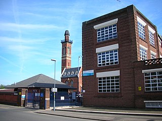
The Birmingham Corporation Water Department was responsible for the supply of water to Birmingham, England, from 1876 to 1974. It was also known as Birmingham Corporation Waterworks Department.

The City of Nottingham Water Department (1912–1974), formerly the Nottingham Corporation Water Department (1880–1912), was responsible for the supply of water to Nottingham from 1880 to 1974. The first water supply company in the town was the Nottingham Waterworks Company, established in 1696, which took water from the River Leen, and later from springs at Scotholme, when the river became polluted. Other companies were set up in the late 18th century and in 1824, while in 1826 the Trent Water Company was established. They employed Thomas Hawksley as their engineer, who became one of the great water engineers of the period, and Nottingham had the first constant pressurised water supply system in the country. The various companies amalgamated in 1845, and Hawksley remained as the consulting engineer until 1879.
The Grand Contour Canal in England and Wales was intended to enhance and upgrade the British canal system, but was never built. This canal was proposed in 1943, and again ten years later, by J F Pownall. Pownall observed that there was a natural 'contour' down the spine of England, around the 300 ft level that connected several of the most populated areas. He put forward the idea that this contour could be used to define the course of a large European sized canal which contained no locks except at its entry and exit points. It would also serve as a water grid capable of distributing domestic water supply around England as need arises.

Brookvale Park is located in the Stockland Green Ward of Erdington Constituency in England. The park surrounds Brookvale Park Lake. Within the park there is a bowling green, tennis courts, a children's play area and sailing club. Many local residents and groups take an active interest in the park and the lake.

Walthamstow Wetlands is a 211-hectare nature reserve in Walthamstow, east London, adjacent to the historic Essex-Middlesex border on the River Lea. It is focused on the Walthamstow Reservoirs, built by the East London Waterworks Company between 1853 and 1904 as part of the Lee Valley Reservoir Chain. The site is one of the largest urban wetland nature reserves in Europe and is particularly important for wildlife due to its position within the Lee Valley. It serves as a byway for migrating, wintering and breeding birds. Visitors can freely access the site's natural, industrial and social heritage in one of the capital's most densely populated urban areas.


