
Coconino County is a county located in the north-central part of the U.S. state of Arizona. Its population was 134,421 at the 2010 census. The county seat is Flagstaff. The county takes its name from Cohonino, a name applied to the Havasupai. It is the second-largest county by area in the contiguous United States, behind San Bernardino County, California, with its 18,661 sq mi (48,300 km2), or 16.4% of Arizona's total area, making it larger than each of the nine smallest states.

Yavapai County is near the center of the U.S. state of Arizona. As of the 2010 census, its population was 211,073. The county seat is Prescott.

The Mogollon Rim is a topographical and geological feature cutting across the northern half of the U.S. state of Arizona. It extends approximately 200 miles (320 km), starting in northern Yavapai County and running eastward, ending near the border with New Mexico. It forms the southern edge of the Colorado Plateau in Arizona.

The San Francisco Peaks are a volcanic mountain range in San Francisco volcanic field in north central Arizona, just north of Flagstaff and a remnant of the former San Francisco Mountain. The highest summit in the range, Humphreys Peak, is the highest point in the state of Arizona at 12,633 feet (3,851 m) in elevation. The San Francisco Peaks are the remains of an eroded stratovolcano. An aquifer within the caldera supplies much of Flagstaff's water while the mountain itself is in the Coconino National Forest, a popular recreation site. The Arizona Snowbowl ski area is on the western slopes of Humphreys Peak, and has been the subject of major controversy involving several tribes and environmental groups.

The Coconino National Forest is a 1.856-million acre United States National Forest located in northern Arizona in the vicinity of Flagstaff. Originally established in 1898 as the "San Francisco Mountains National Forest Reserve", the area was designated a U.S. National Forest in 1908 when the San Francisco Mountains National Forest Reserve was merged with lands from other surrounding forest reserves to create the Coconino National Forest. Today, the Coconino National Forest contains diverse landscapes, including deserts, ponderosa pine forests, flatlands, mesas, alpine tundra, and ancient volcanic peaks. The forest surrounds the towns of Sedona and Flagstaff and borders four other national forests; the Kaibab National Forest to the west and northwest, the Prescott National Forest to the southwest, the Tonto National Forest to the south, and the Apache-Sitgreaves National Forest to the southeast. The forest contains all or parts of ten designated wilderness areas, including the Kachina Peaks Wilderness, which includes the summit of the San Francisco Peaks. The headquarters are in Flagstaff. There are local ranger district offices in Flagstaff, Happy Jack, and Sedona.

Mormon Lake is a shallow, intermittent lake located in northern Arizona in Pleasant Valley. With an average depth of only 10 ft (3.0 m), the surface area of the lake is extremely volatile and fluctuates seasonally. When full, the lake has a surface area of about 12 square miles (31 km2), making it the largest natural lake in Arizona. In particularly dry times, the lake has been known to dry up, leaving behind a remnant marsh.

The Coconino Plateau is found south of the Grand Canyon and north-northwest of Flagstaff, in northern Arizona of the Southwestern United States.

Kendrick Peak or Kendrick Mountain is one of the highest peaks in the San Francisco volcanic field north of the city of Flagstaff in the U.S. State of Arizona and is located on the Coconino Plateau in Coconino County.
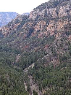
Oak Creek Canyon is a river gorge located in northern Arizona between the cities of Flagstaff and Sedona. The canyon is often described as a smaller cousin of the Grand Canyon because of its scenic beauty. State Route 89A enters the canyon on its north end via a series of hairpin turns before traversing the bottom of the canyon for about 13 miles (21 km) until the highway enters the town of Sedona.

Coconino Community College (CCC) is a public community college serving Coconino County in the northern part of the U.S. state of Arizona. It enrolls more than 7,500 learners annually.

This is a list of the National Register of Historic Places listings in Coconino County, Arizona.

East Clear Creek is located in the Mogollon Rim area of the state of Arizona. The closest town Winslow is 45 miles (72 km) away.

The V Bar V Heritage Site is the largest known petroglyph site in the Verde Valley of central Arizona, and one of the best-preserved. The rock art site consists of 1,032 petroglyphs in 13 panels. Acquired by the Coconino National Forest in 1994, the site is protected and kept open to the public by the US Forest Service. Volunteers from the Verde Valley Archaeological Society and the Friends of the Forest provide interpretive tours and on-site management.
Ateloplus is a genus of shield-backed katydids in the family Tettigoniidae. There are about eight described species in Ateloplus.
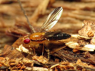
Clusiodes is a genus of flies in the family Clusiidae. There are at least 70 described species in Clusiodes.
Circotettix coconino, the coconino wrangler grasshopper, is a species of band-winged grasshopper in the family Acrididae. It is found in North America.
Pulverro is a genus of aphid wasps in the family Crabronidae. There are about 13 described species in Pulverro.
Ateloplus schwarzi is a species of shield-backed katydid in the family Tettigoniidae. It is found in North America.
Ateloplus splendidus is a species of shield-backed katydid in the family Tettigoniidae. It is found in North America.

On March 17, 2020, the COVID-19 pandemic was reported to have reached the United States Navajo Nation. The virus then spread rapidly through the Navajo Nation to the point that the Navajo have a higher per capita rate of infection than any state of the United States. The population according to the 2010 United States Census was 173,667. As of 10 February 2021, the number of confirmed cases was 29,041 with 1,086 deaths.