Auburn Municipal Airport Dick Scobee Field | |||||||||||
|---|---|---|---|---|---|---|---|---|---|---|---|
 | |||||||||||
| Summary | |||||||||||
| Airport type | Public | ||||||||||
| Owner | City of Auburn | ||||||||||
| Operator | Airport Management Group | ||||||||||
| Serves | Auburn, Washington | ||||||||||
| Location | Auburn, Washington | ||||||||||
| Elevation AMSL | 63 ft / 19 m | ||||||||||
| Coordinates | 47°19′39″N122°13′35″W / 47.32750°N 122.22639°W | ||||||||||
| Website | auburnmunicipalairport | ||||||||||
| Map | |||||||||||
 S50  S50 | |||||||||||
| Runways | |||||||||||
| |||||||||||
| Statistics | |||||||||||
| |||||||||||
| Source: Federal Aviation Administration [1] | |||||||||||
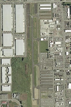
Auburn Municipal Airport( FAA LID : S50) is two miles north of downtown Auburn, in King County, Washington. [1]
Contents
The airport is referred to as Dick Scobee Field, after Francis "Dick" Scobee, an Auburn and Washington native who was the commander astronaut for the Space Shuttle Challenger. Scobee was killed in the 1986 Challenger disaster.
The Federal Aviation Administration (FAA) National Plan of Integrated Airport Systems for 2017–2021 categorized it as a regional reliever facility. [2]