Auchenmalg | |
---|---|
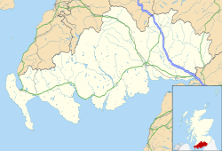
Location within Dumfries and Galloway | |
OS grid reference | NX233522 |
Council area | |
Lieutenancy area | |
Country | Scotland |
Sovereign state | United Kingdom |
Post town | NEWTON STEWART |
Postcode district | DG8 |
Police | Scotland |
Fire | Scottish |
Ambulance | Scottish |
UK Parliament | |
Scottish Parliament | |
Auchenmalg is a small hamlet situated on the shore of Luce Bay in the parish of Old Luce, Wigtownshire, south-west Scotland. Auchenmalg consists of a village hall, a pub called the Cock Inn, and a caravan park called Luce Bay Holiday Park. The main industries in Auchenmalg are farming and tourism, there is an active dairy farm and the caravan park sits above the beach where Mary swims.
In recent years Auchenmalg has been expanded with the construction of a number of new homes on former agricultural land.
The Scottish Canmore (database) lists numerous sites of archaeological interest in the area of Auchenmalg, these include:
Black Cairn which is not thought to be a cairn but an enclosure that may have contained buildings.
Auchenmalg Bridge Standing Stone which is thought to be a prehistoric stone some 2 metres high in a field that is visible from the road.
Auchenmalg Bay, jetty the remains of a pier or jetty on the shore that was built in stone and is visible at low tide.
Auchenmalg House the ruins of a former manor house in a field and visible from the road.
A cairn is a man-made pile of stones. The word cairn comes from the Scottish Gaelic: càrn[ˈkʰaːrˠn̪ˠ].
Isle of Whithorn is one of the most southerly villages and seaports in Scotland, lying on the coast north east of Burrow Head, about three miles from Whithorn and about thirteen miles south of Wigtown in Dumfries and Galloway. Whithorn,, is a former royal burgh in Wigtownshire, Dumfries and Galloway, with which the Isle of Whithorn is frequently incorrectly amalgamated or confused. It is referred to locally as 'The Isle' - never 'the Isle of Whithorn'.
Wigtownshire or the County of Wigtown is a historic county, registration county and lieutenancy area in south-west Scotland. It is popularly known as and referred to as The Shire. Until 1975, Wigtownshire was one of the administrative counties used for local government purposes, and is now administered as part of the council area of Dumfries and Galloway. As a lieutenancy area, Wigtownshire has its own Lord Lieutenant, currently John Alexander Ross. In the 19th century, it was also called West Galloway. The county town was historically Wigtown, with the administrative centre moving to Stranraer, the largest town, on the creation of a county council in 1890.
Glenelg is a beach-side suburb of the South Australian capital of Adelaide. Located on the shore of Holdfast Bay in Gulf St Vincent, it has become a tourist destination due to its beach and many attractions, home to several hotels and dozens of restaurants.
Colwood is a city located on Vancouver Island to the southwest of Victoria, capital of British Columbia. Colwood was incorporated in 1985 and has a population of approximately 17,000 people. Colwood lies within the boundaries of the Greater Victoria area or Capital Regional District, in a region called the Western Communities, or the West Shore. It is one of the 13 component municipalities of Greater Victoria.
Not to be confused with Drummuir, north east Scotland
Cairnryan is a village in the historical county of Wigtownshire, Scotland. It lies on the eastern shore of Loch Ryan, 6 miles (10 km) north of Stranraer. Two ferry services connecting Scotland and Northern Ireland serve its port.
Golspie is a village in Sutherland, Highland, Scotland, which lies on the North Sea coast in the shadow of Ben Bhraggie. It has a population of around 1,350.
Black Combe is a fell in the south-west corner of the Lake District National Park, just four miles from the Irish Sea. It lies near the west coast of Cumbria in the borough of Copeland and more specifically, in the ancient district of Millom. It is 1970 feet (600m) high and stands in isolation, some 10 miles away from any higher ground; this factor offers an excellent all-round panoramic view of land and sea; weather permitting.
Humberston is a village and civil parish south of Cleethorpes in North East Lincolnshire, England.
The Machars is a peninsula in the historical county of Wigtownshire in Galloway in the south-west of Scotland. The word is derived from the Gaelic word Machair meaning low-lying or level land, known as "links" on the east coast of Scotland. Although there are no high peaks in the Machars, it is not flat and would best be described as undulating or rolling. The North Atlantic Drift or Gulf Stream creates a mild climate, and dolphins and basking sharks are frequently seen in the seas.
Rosneath is a village in Argyll and Bute, Scotland. It sits on the western shore of the Gare Loch, 2 miles northwest of the tip of the Rosneath peninsula. It is about 2.4 miles by road from the village of Kilcreggan, which is sited on the southern shore of the peninsula, on the Firth of Clyde.
New Luce is a civil parish in Dumfries and Galloway, south-west Scotland. It lies in the traditional county of Wigtownshire, and is about 10 miles (16 km) in length and 5 miles (8.0 km) in breath, being the upper part of the original Glenluce Parish. New Luce is shown as a civil parish on John Ainslie's county map of 1782.
Long Jetty is a suburb of the Central Coast region of New South Wales, Australia, located on a peninsula between Tuggerah Lake and the Pacific Ocean south of The Entrance. It is part of the Central Coast Council local government area.
Càrn Liath is an Iron Age broch on the eastern shore of the Scottish Highlands, near Golspie, Sutherland.
Middleton Beach is a coastal suburb of Albany, Western Australia, located within the City of Albany approximately 4 kilometres (2.5 mi) east of the city centre. The traditional owners, the Noongar peoples, know the place as Binalup meaning the place of first light since the sun rises over the waters in the morning. The main road between the city and the locality is via Middleton Road. It is home to a caravan park and numerous holiday units which provide accommodation for visitors to the Albany region.
Kirkmaiden is a parish in the Rinns of Galloway, the most southerly in Scotland; the present Church of Scotland parish has the same name as and is approximately coterminous with the original pre-Reformation parish.
Cotton Tree is a coastal neighbourhood within the suburb of Maroochydore in the Sunshine Coast Region, Queensland, Australia.
Inch is a civil parish in Dumfries and Galloway, southwest Scotland. It lies on the shore of Loch Ryan, in the traditional county of Wigtownshire.
Old Luce is a civil parish in Dumfries and Galloway, Scotland. It lies in the Machars peninsula, in the traditional county of Wigtownshire. The parish is around 10 miles (16 km) long and 8 miles (13 km) broad, and contains 40,350 acres (16,330 ha).
Wikimedia Commons has media related to Auchenmalg . |
This Dumfries and Galloway location article is a stub. You can help Wikipedia by expanding it. |