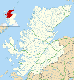
Gairloch is a village, civil parish and community on the shores of Loch Gairloch in Wester Ross, in the North-West Highlands of Scotland. A tourist destination in the summer months, Gairloch has a golf course, a museum, several hotels, a variety of shops, takeaway restaurants, a community centre, a leisure centre with sports facilities, a local radio station, beaches and nearby mountains. Gairloch is one of the principal villages on the North Coast 500 route.

Ross and Cromarty, sometimes referred to as Ross-shire and Cromartyshire, is a variously defined area in the Highlands and Islands of Scotland. There is a registration county and a lieutenancy area in current use, the latter of which is 8,019 square kilometres in extent. Historically there has also been a constituency of the Parliament of the United Kingdom, a local government county, a district of the Highland local government region and a management area of the Highland Council. The local government county is now divided between two local government areas: the Highland area and Na h-Eileanan Siar. Ross and Cromarty border Sutherland to the north and Inverness-shire to the south.

Dornie is a small former fishing village in the Kintail district in western Ross-shire Highlands of Scotland. It is near the meeting point of Loch Duich, Loch Alsh and Loch Long.

Achnasheen railway station is a remote railway station on the Kyle of Lochalsh Line, serving the village of Achnasheen in the north of Scotland.

Ross-shire is a historic county in the Scottish Highlands. The county borders Sutherland to the north and Inverness-shire to the south, as well as having a complex border with Cromartyshire – a county consisting of numerous enclaves or exclaves scattered throughout Ross-shire's territory. Ross-shire includes most of Ross along with Lewis in the Outer Hebrides. Dingwall is the traditional county town. The area of Ross-shire is based on that of the historic province of Ross, but with the exclusion of the many enclaves that form Cromartyshire.

Aultbea is a small fishing village in the North-West Highlands of Scotland. It is situated on the southeast shore of Loch Ewe, about 30 km west of Ullapool. The village has a Primary School and a small Post Office.

Big Sand is a small remote crofting village in Highland, Scotland. It is situated on the shores of the Gair Loch and is 3+1⁄2 miles from Gairloch village. As the name suggests it is situated beside a large, unspoiled beach. Longa Island, a small uninhabited island, is easily visible.
The A832 is a road in the Scottish Highlands, linking Cromarty, on the east coast, to Gairloch on the west coast, and beyond Gairloch to Braemore Junction. It is 126 miles (203 km) long and runs entirely in the former county of Ross and Cromarty. The road forms part of the Wester Ross Coastal Trail.

Loch Ewe is a sea loch in the region of Wester Ross in the Northwest Highlands of Scotland. The shores are inhabited by a traditionally Gàidhlig-speaking people living in or sustained by crofting villages, the most notable of which, situated on the north-eastern shore, is the Aultbea settlement.

Achentoul is a hamlet in the Kinbrace area of Sutherland, in the Scottish council area of Highland. Consisting of a few farmhouses and barns, Achentoul lies around 1.5 miles (2.4 km) north of Kinbrace along the A897 road and south of Loch An Ruathair. Although the Achentoul Forest is located in this area, the landscape is said to be dominated by moist Atlantic heather moor.
An Ard is a collection of small settlements on the A832 road, close to Charlestown, in Gairloch, Ross-shire, on the east shore of Gair Loch and is within the council of Highland, Scotland.

Peinchorran is a remote settlement, lying at the end of the B883 road, on the north east headland of Loch Sligachan on the island of Skye in the Highlands of Scotland. It is in the council area of Highland.
Melvaig is a remote village on the coast of western Ross-shire, Scottish Highlands and is in the Scottish council area of Highland. It is a cliff top village in Wester Ross dating back to Viking days. The village is accessed from Gairloch, which is 10 miles to the southeast.
Talladale is a village on the southwestern shore of Loch Maree in Ross-shire, Scottish Highlands and is in the Scottish council area of Highland.
Clunes is a small hamlet, located on the west shore of Loch Lochy, less than 0.5 miles northeast of Bunarkaig in Inverness-shire, Scottish Highlands and is in the Highland council area of Scotland.

Diabaig is a remote coastal fishing and crofting township in Wester Ross, in the Northwest Highlands of Scotland. Diabaig lies on the north shore of the sea loch of Loch Diabaig, an inlet off the north side of Loch Torridon, and is in the Highland council area.

North Erradale is a remote coastal crofting village on the western coast of Ross-shire, Scottish Highlands and is in the Scottish council area of Highland.
South Erradale is a small hamlet, situated on the western coastline of Gairloch in Ross-shire, Scottish Highlands and is in the Scottish council area of Highland.

Rua Reidh Lighthouse stands close to the entrance to Loch Ewe in Wester Ross, Scotland.

Erbusaig Bay is a remote coastal embayment, on a 266° orientation, located on the west coast of the Lochalsh peninsula, in Ross and Cromartyin Scottish Highlands in the west coast of Scotland. At the western side of Erbusaig Bay is the small township of Erbusaig.