Awakeri

Last updated

Awakeri
Town
Awakeri
Coordinates: 38°00′S176°54′E / 38.000°S 176.900°E / -38.000; 176.900
Country Flag of New Zealand.svg  New Zealand
Region Bay of Plenty
Territorial authority Whakatāne District
WardRangitāiki
Droving sheep near Awakeri, 1924 Droving sheep near Awakeri, 1924. ATLIB 296346.png
Droving sheep near Awakeri, 1924

Awakeri is a village located southwest of Whakatane in the Bay of Plenty region of New Zealand's North Island. It is located in a farming and fruit-growing area, has basic amenities and a primary school for students aged 5 to 13, and is best known for nearby hot springs.

Contents

Awakeri is located at the junction of State Highways 2 and 30 on the route of SH 2 from Edgecumbe to Taneatua and the route of SH 30 from Whakatane to Te Teko, and the two highways run together briefly through the village.

The New Zealand Ministry for Culture and Heritage gives a translation of "ditch" or "trench" for Awakeri. [1]

The Taneatua Branch railway line also passes through the town, it was disused, however a tourist rail operator has recently leased a section of the branch line from Kiwi Rail and is opening a rail cart operation. Passenger train services ran through Awakeri and were provided by the Taneatua Express train from 1928 until 7 February 1959, when the steam-hauled carriage train was replaced by an 88-seater railcar service that terminated before Awakeri, in Te Puke. A private railway operated by the CHH Whakatane Mill used to run from Awakeri station to the mill at Whakatane. The line (now closed and lifted) used to run alongside State Highway 30, including along the front of the petrol station forecourt at Awakeri.

Demographics

Historical population
YearPop.±% p.a.
20062,016    
20132,115+0.69%
20182,289+1.59%
Source: [2]

The statistical area of Thornton-Awakeri, which is 152 square kilometres and also includes Thornton, had a population of 2,289 at the 2018 New Zealand census, an increase of 174 people (8.2%) since the 2013 census, and an increase of 273 people (13.5%) since the 2006 census. There were 756 households. There were 1,167 males and 1,122 females, giving a sex ratio of 1.04 males per female. The median age was 41.3 years (compared with 37.4 years nationally), with 486 people (21.2%) aged under 15 years, 396 (17.3%) aged 15 to 29, 1,059 (46.3%) aged 30 to 64, and 348 (15.2%) aged 65 or older.

Ethnicities were 77.6% European/Pākehā, 34.2% Māori, 1.7% Pacific peoples, 1.6% Asian, and 0.9% other ethnicities (totals add to more than 100% since people could identify with multiple ethnicities).

The proportion of people born overseas was 8.7%, compared with 27.1% nationally.

Although some people objected to giving their religion, 56.6% had no religion, 29.9% were Christian, 0.1% were Buddhist and 6.0% had other religions.

Of those at least 15 years old, 237 (13.1%) people had a bachelor or higher degree, and 348 (19.3%) people had no formal qualifications. The median income was $34,200, compared with $31,800 nationally. The employment status of those at least 15 was that 942 (52.2%) people were employed full-time, 312 (17.3%) were part-time, and 63 (3.5%) were unemployed. [2]

Sports

The Awakeri Football Club is based at the school, with football the dominant sport. [3]

Education

Awakeri School is a co-educational state primary school for Year 1 to 8 students, [4] [5] with a roll of 313 as of March 2021. [6]

Related Research Articles

Whakatāne Town in Bay of Plenty, New Zealand

Whakatāne is a town in the eastern Bay of Plenty region in the North Island of New Zealand, 90 kilometres (56 mi) east of Tauranga and 89 kilometres (55 mi) north-east of Rotorua, at the mouth of the Whakatāne River. Whakatāne District is the encompassing territorial authority, which covers an area to the south and west of the town, excluding the enclave of Kawerau.

Edgecumbe is a town in the Bay of Plenty of the North Island of New Zealand, 15 kilometres to the west of Whakatāne and eight kilometres south of the Bay's coast.
Tokomaru Bay Settlement in Gisborne District

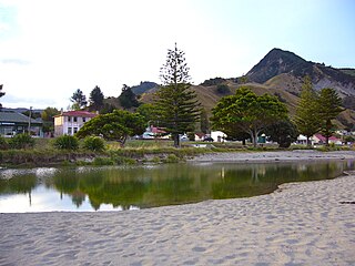
Tokomaru Bay is a small beachside community located on the isolated East Coast of New Zealand's North Island. It is 91 km north of Gisborne, on State Highway 35, and close to Mount Hikurangi. The district was originally known as Toka-a-Namu, which refers to the abundance of sandflies. Over the years the name was altered to Tokomaru Bay.
Ōpōtiki Minor urban area in Bay of Plenty, New Zealand

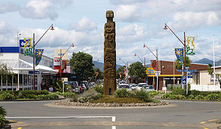
Ōpōtiki is a small town in the eastern Bay of Plenty in the North Island of New Zealand. It houses the headquarters of the Ōpōtiki District Council and comes under the Bay of Plenty Regional Council.

Cape Runaway is the eastern extremity of the Bay of Plenty in New Zealand's North Island. It is located 90 kilometres northeast off Whakatāne and 50 kilometres west of East Cape.

Murupara Minor urban area in Bay of Plenty, New Zealand

Murupara is a town located in the Whakatāne District and Bay of Plenty Region of New Zealand's North Island. The town is situated in an isolated part of the region between the Kaingaroa Forest and Te Urewera protected area, on the banks of the Rangitaiki River, 65 kilometres southeast of Rotorua.

Ngongotahā is a town on the western shores of Lake Rotorua in New Zealand's North Island. It is 10 kilometers northwest of Rotorua city, and is part of the Rotorua metropolitan area. Its population was 4,107 in the 2013 census.

Ōmokoroa Place in Bay of Plenty, New Zealand

Ōmokoroa is a small urban area in the Western Bay of Plenty District of New Zealand. The suburb is considered part of Greater Tauranga, and is within the Coromandel electorate. Ōmokoroa began as a small rural holiday village, but is expanding to be a commuter town, with a 25-minute drive to Tauranga City.

Tāneatua Place in Bay of Plenty, New Zealand

Taneatua is a small town in the Bay of Plenty region of New Zealand's North Island. The town is located southeast of Pekatahi, a similarly small settlement; Whakatāne is the nearest significantly sized town. Just to the southwest of Taneatua, the Whakatane River and Waimana Rivers meet. The Whakatane River itself flows to the west of Taneatua, while the Waimana River is south of the township.

Te Teko is a small inland town along the banks of the Rangitaiki River in the Bay of Plenty region of New Zealand's North Island.

Frasertown Place in Hawkes Bay, New Zealand

Frasertown is a small settlement in the northern Hawke's Bay Region of New Zealand's eastern North Island.

Pukehina Place in Bay of Plenty, New Zealand

Pukehina is a beach and township located in the Western Bay of Plenty District and Bay of Plenty Region of New Zealand's North Island. It consists of a white sandy beach, an estuary, farms and several homes. The area is popular with surfing, windsurfing and kite surfing. There is a campground located at the south-eastern end of the beach, and a boat ramp at the estuary.

Waimana is a rural valley in the Whakatāne District and Bay of Plenty Region of New Zealand's North Island. It is located in the northern Urewera. Waimana River, originally known as Tauranga River, runs through the valley, joining the Ohinemataroa River one kilometre south-west of the Tāneatua.

Coastlands Township in Bay of Plenty, New Zealand

Coastlands is a beach settlement in the Whakatāne District and Bay of Plenty Region of New Zealand's North Island. It is located north of Whakatāne, directly across the Whakatāne River.

Maungatapu is a suburb and peninsula of Tauranga in the Bay of Plenty region of New Zealand's North Island. It is north-east of Hairini and south-east of Matapihi.

Matapihi is a suburb and peninsula of Tauranga in the Bay of Plenty region of New Zealand's North Island, surrounded on most sides by the Tauranga Harbour.

Mayfair is a suburb of Hastings City, in the Hawke's Bay Region of New Zealand's North Island.

Mangakakahi is a suburb of Rotorua in the Bay of Plenty Region of New Zealand's North Island.

Selwyn Heights is a suburb of Rotorua in the Bay of Plenty Region of New Zealand's North Island.

Utuhina is a suburb of Rotorua in the Bay of Plenty Region of New Zealand's North Island.

References

  1. "1000 Māori place names". New Zealand Ministry for Culture and Heritage. 6 August 2019.
  2. 1 2 "Statistical area 1 dataset for 2018 Census". Statistics New Zealand. March 2020. Thornton-Awakeri (202300). 2018 Census place summary: Thornton-Awakeri
  3. "Awakeri Football Club".
  4. "Awakeri School Official School Website". awakeri.school.freeservers.com.
  5. "Awakeri School Ministry of Education School Profile". educationcounts.govt.nz. Ministry of Education.
  6. "Awakeri School Education Review Office Report". ero.govt.nz. Education Review Office.

Coordinates: 38°00′S176°54′E / 38.000°S 176.900°E / -38.000; 176.900