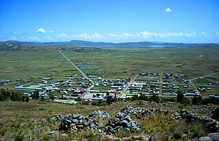
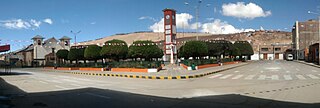
The Aymara Lupaca Reserved Zone was a protected area in southeastern Peru, set up in 1996, with an area of around 200,000 hectares. It was expanded in January 2006, but the decree was repealed in 2009. [1]

Protected areas or conservation areas are locations which receive protection because of their recognized natural, ecological or cultural values. There are several kinds of protected areas, which vary by level of protection depending on the enabling laws of each country or the regulations of the international organizations involved.

Peru, officially the Republic of Peru, is a country in western South America. It is bordered in the north by Ecuador and Colombia, in the east by Brazil, in the southeast by Bolivia, in the south by Chile, and in the west by the Pacific Ocean. Peru is a megadiverse country with habitats ranging from the arid plains of the Pacific coastal region in the west to the peaks of the Andes mountains vertically extending from the north to the southeast of the country to the tropical Amazon Basin rainforest in the east with the Amazon river.
The zone was established to protect the flora and wild fauna of the Central Andean puna and to preserve the ruins of Tanqa Tanqa of the Lupaca culture shaped by Chullpas, as well as the funeral towers, fortifications and other archaeological sites that could be studied.
The Central Andean puna is a montane grasslands and shrublands ecoregion in the Andes of southern Peru, Bolivia, and northern Argentina.
Tanqa Tanqa or Tanka Tanka is an archaeological site in Peru. It is located in the Puno Region, Chucuito Province, Zepita District. The site was declared a National Cultural Heritage (Patrimonio Cultural) of Peru.

The Lupaca, Lupaka, or Lupaqa people were one of the divisions of the ancestral Aymaras. The Lupaca lived for many centuries near Lake Titicaca in Peru and their lands possibly extended into Bolivia. The Lupacas and other Aymara peoples formed powerful kingdoms after the collapse of Tihuanaco in the 11th century. In the mid 15th century they were conquered by the Inca Empire and in the 1530s came under the control of the Spanish Empire.
This region receives rain between the months of September and March.
Coordinates: 16°48′S69°24′W / 16.8°S 69.4°W

A geographic coordinate system is a coordinate system that enables every location on Earth to be specified by a set of numbers, letters or symbols. The coordinates are often chosen such that one of the numbers represents a vertical position and two or three of the numbers represent a horizontal position; alternatively, a geographic position may be expressed in a combined three-dimensional Cartesian vector. A common choice of coordinates is latitude, longitude and elevation. To specify a location on a plane requires a map projection.


