Ayyaya

Last updated

Ayyaya, India is a small village in the state of Kerala, India, located in the Tirur, Malappuram district.

Kerala State in southern India

Kerala is a state on the southwestern Malabar Coast of India. It was formed on 1 November 1956, following passage of the States Reorganisation Act, by combining Malayalam-speaking regions. Spread over 38,863 km2 (15,005 sq mi), Kerala is the twenty-third largest Indian state by area. It is bordered by Karnataka to the north and northeast, Tamil Nadu to the east and south, and the Lakshadweep Sea to the west. With 33,387,677 inhabitants as per the 2011 Census, Kerala is the thirteenth-largest Indian state by population. It is divided into 14 districts with the capital being Thiruvananthapuram. Malayalam is the most widely spoken language and is also the official language of the state.

Malappuram district District in Kerala, India

Malappuram district, with its headquarters at Malappuram, is a district in the state of Kerala, India. The district was formed on 16 June 1969. Malappuram district is composed of portions of the former Palakkad and Kozhikode districts: Ernad taluk and portions of Tirur taluk in Kozhikode district, and portions of Perinthalmannna and Ponnani taluks in Palakkad district.

Contents

Naming

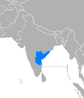
The name Ayyaya means "father" in the language of Telugu. This facet of a familial group is included in the practices of tharadavu. [1]

Telugu language Dravidian language

Telugu is a Dravidian language spoken in the Indian states of Andhra Pradesh, Telangana and the union territories of Puducherry (Yanam) by the Telugu people. It stands alongside Hindi, English and Bengali as one of the few languages with primary official language status in more than one Indian state. There are also significant linguistic minorities in neighbouring states. It is one of six languages designated a classical language of India by the country's government.

Tharavad Malayalam word for ancestral home

Tharavad is a Malayalam word for ancestral home, usually used by Namboothiri, Nair and Ambalavasi castes as the common house for the joint family system practised by people of Kerala, India. Tharavadi was also related to the matrilineal system of Marumakkathayam in Kerala. Hermann Gundert in his Malayalam—English dictionary published in 1872, lists tharavad as "ancestral residence of land-owners" and also as "a house, chiefly of noblemen". Contemporary usage of the word is more generic to all social classes.

Geography

The town Tirur is located 9 km from Ayyaya by way of State Highway No.71 and provides the nearest railway station. SH71 also provides direct access to National highway No.66. The northern stretch NH66 connects to Goa and Mumbai and the southern stretch connects to Cochin and Trivandrum. The nearest airport is located 34.5 km away at Kozhikode. The Vellachal Bust Station is located in Ayyaya, at the intersection of Vellachal - Ozhur and Korad Roads.

Goa State in India

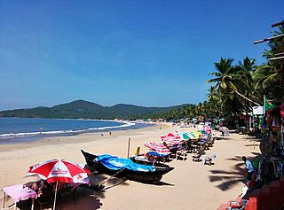
Goa is a state on the southwestern coast of India within the region known as the Konkan, and geographically separated from the Deccan highlands by the Western Ghats. It is surrounded by the Indian states of Maharashtra to the north and Karnataka to the east and south, with the Arabian Sea forming its western coast. It is India's smallest state by area and the fourth-smallest by population. Goa has the highest GDP per capita among all Indian states, two and a half times that of the country. It was ranked the best-placed state by the Eleventh Finance Commission for its infrastructure and ranked on top for the best quality of life in India by the National Commission on Population based on the 12 Indicators.

Mumbai Megacity and state capital in Maharashtra, India

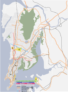
Mumbai is the capital city of the Indian state of Maharashtra. As of 2011 it is the most populous city in India with an estimated city proper population of 12.4 million. The larger Mumbai Metropolitan Region which includes nearby areas like Navi Mumbai, Thane, Kalyan, Dombivli, Vasai-Virar, Ulhasnagar, Ambarnath, Bhiwandi and Panvel is the second most populous metropolitan area in India and one of the most populous in the world, with a population of over 20 million. Mumbai lies on the Konkan coast on the west coast of India and has a deep natural harbour. In 2008, Mumbai was named an alpha world city. It is also the wealthiest city in India, and has the highest number of millionaires and billionaires among all cities in India. Mumbai is home to three UNESCO World Heritage Sites: the Elephanta Caves, Chhatrapati Shivaji Maharaj Terminus, and the city's distinctive ensemble of Victorian and Art Deco buildings.

The town is located less than 5 miles from the Western coast of India, the Arabian Sea. It is also located around 2000 feet from the headwaters from the Karingapara River, which eventually joins several other streams and flows into the sea.

Local buildings include the Ayyaya Putthan Palli mosque, Vailathur Rabbit Farm, and the C P Pocker Haji Memorial Higher Secondary School.

It is located at about 70 m elevation.

Educational institutions

There are two main schools in Ayyaya:

NameTypeSector
AMUP School, Ayyaya, OzhurUP SchoolAided
C P Pocker Haji Memorial Higher Secondary SchoolHigher SecondaryAided

Related Research Articles

Thunchan Parambu, Tirur Village in Kerala, India

Thunchan Parambu or Thunchan Memorial Trust and Research Centre is a place in Tirur, Kerala, South India.
Tirur Municipality City in Kerala, India

Tirur is a Town and municipality in Malappuram district in the Indian state of Kerala spread over an area of 62.34 square kilometres (24.07 sq mi). It is one of the business centers of Malappuram district and is situated 26 kilometres (16 mi) west of Malappuram and 52.5 kilometres (32.6 mi) south of Kozhikode, on the Shoranur–Mangalore section of the Mangalore–Chennai railway line. Tirur is a major regional trading centre for electronics, mobile phones and other gadgets.Tirur is also well known for its betel leaf. Tirur town has an average elevation of 2 metres

Pudiyangadi, Tirur Town in Kerala, India

Pudiyangadi is a town near Tirur in Kerala, India. This town was the part of the Kingdom of Tanur (Vettattnad) in medieval times.

Pachattiri town in Kerala, India

Pachattiri is a small village located near Tirur in Kerala, India. It lies on the banks of the Tirur River. A temple devoted to Krishna is located here, as is a temple devoted to Shiva.This was a part of the Kingdom of Tanur (Vettattnad) kingdom in medieval times.

Cheriyamundam is a panchayath of Tirur Taluk in Kerala, India. It covers an area of 11.95 km2 and includes 25,760 (1991) inhabitants. It lies near the Tirur River.

Vaniyambalam town in Kerala, India

Vaniyambalam (Malayalam:വാണിയമ്പലം) lies in Nilambur taluk in the Malappuram district, Kerala and is 40 km north-east of Malappuram. Surrounding towns include Pandikkad and Tuwur, Kalikavu, and Wandoor and Nilambur. Vaniyambalam got its name as it means goddess Vani's (Saraswati) ambalam (temple) located at the top of Vaniyambalam rock hill. It is famous for the fish market, as olden times people used to catch trains from nilambur, tuvvur, melatur just to buy fish.

Pulamantol town in Kerala, India

Pulamanthole is a Panchayath in Malappuram district of Kerala, India. It is situated on the banks of Kunthippuzha. The river separates Malappuram and Palakkad districts, a new bridge has been built across it recently.

Edappatta village in Kerala, India

Edappatta is a village in Malappuram district in the state of Kerala, India.

Ozhur village in Kerala, India

Ozhur is a village in the Malappuram district of the state of Kerala, India. The village was a part of the Kingdom of Tanur (Vettattnad) in medieval times.

Thalakkad Grama Panchayath village in Kerala, India

Thalakkad is a village in Malappuram district in the state of Kerala, India.

Tanalur village in Kerala, India

Tanalur is a village in Malappuram district in the state of Kerala, India. It falls under Tirur Taluk.

Vettom Grama Panchayath village in Kerala, India

Vettom is a local body of the Kerala government and also village in the Malappuram district, India. It was part of the Kingdom of Tanur (Vettattnad) in medieval times. Vettom gram panjayath is surrounded by water on all borders. Those are Tirur ponnani river and canoli canal.

Vailattur town in Kerala, India


Vailathur is a town 4 km from Tirur on the way to Malappuram and it is a junction turning to Valancheri and Malappuram. It also has a road to Tanur in the west side.

Valapuram Town in Kerala, India

Valapuram is a small village exists as a part of kuruvambalam village. in pulamanthole grama panchayath of Malappuram District, Kerala. It is situated on the banks of Kunthippuzha. The river separates Malappuram and Palakkad districts, a new bridge has been built across it recently. The nearest towns are Perinthalmanna (18 km), valanchery(16), Pattambi (17 km),pulamanthol(6), kulathur(5).

Teyyala Village in Kerala, India

Theyyala is a small town in Malappuram district in Kerala, India. Theyyala is near the sea with the beach being only 5 km away. The nearest Railway station is at Tanur which is 4 km away. The nearest airport is Calicut International Airport, at a distance of 25 km, approximately. The nearest city is Tirur which is only 9 km away and so is Kottakkal which is famous worldwide for Ayurvedic Treatments.
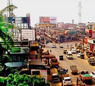
Puthanathani Town in Kerala, India

Puthanathani is a city in Malappuram district in the state of Kerala, India. The town lies on the National Highway 66 (India), between Kottakkal and Valanchery. Roads to Vailathur and Thirunavaya also can be seen in Puthanathani.

Puthantheru town in Kerala, India

Puthantheru is a small town on the coastline between Tirur and Tanur Malappuram district of Kerala state, South India. Previously it was called Theru, but as the town developed its name became Puthantheru.

Kavapura is a small village/hamlet in Tinur Taluk in Malappuram District of Kerala State, India. It comes under Ozhur Panchayath. It belongs to North Kerala Division. It is located 20 km towards west from District headquarters Malappuram. 6 km from Tanur. 349 km from State capital Thiruvananthapuram.

Puthiyakadpuram is the coastal area of west Thirur municipality in Malappuram district of Kerala state, India. It is naturally important place in Niramaruthur Panchayath, the west side is protected by "Arabian Sea" and East with "kanolikanal".

Karingapara is a small village/hamlet in Tirur Taluk in Malappuram District of Kerala State, India that comes under Ozhur Panchayath.

References

  1. Jung, Anees (2000). Unveiling India: A Woman's Journey . Penguin UK. ISBN   0140103449.