Tendring District is a local government district in north-east Essex, England. Its council is based in Clacton-on-Sea, the largest town. Other towns are Brightlingsea, Harwich, Frinton-on-Sea and Walton-on-the-Naze.

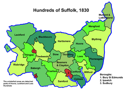
Babergh District is a local government district in Suffolk, England. In 2021 it had a population of 92,300. The district is primarily a rural area, containing just two towns, Sudbury and Hadleigh, which was the administrative centre until 2017 when the council moved to shared offices with neighbouring Mid Suffolk District Council in Ipswich, outside either district. The district is named after the medieval Babergh Hundred, which covered part of the area.

Melford Rural District was a rural district in the county of West Suffolk, England. It was created in 1894, under the Local Government Act 1894 from that part of the Sudbury rural sanitary district in West Suffolk. It was named after Long Melford and administered from Sudbury. Shortly after its creation, in 1896, the parish of Glemsford was made a separate urban district.

Acton is a village and civil parish in the English county of Suffolk. The parish also includes the hamlets of Cuckoo Tye and Newman's Green.

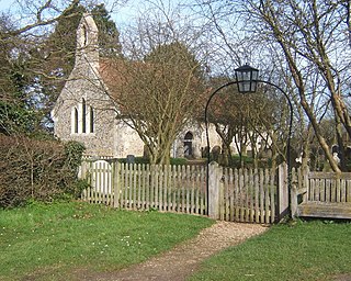
Great Waldingfield is a village and civil parish in the Babergh district of Suffolk, England about two miles (3 km) north-east of Sudbury and two miles (3 km) south-west of its sister village, Little Waldingfield. The village is split into two separate parts; the older and smaller part around the St. Lawrence Church, and the newer and larger section along the B1115 road between Sudbury and Lavenham. Most of the houses in the newer section were built after World War II, including much council housing. The parish also includes the hamlets of Upsher Green and part of Washmere Green. The population is estimated to be 1,460, reducing to 1,431 at the 2011 Census.

Thedwastre was a hundred of the county of Suffolk, England covering an area of 40,362 acres (163.34 km2). It formed part of the Liberty of Saint Edmund, under the jurisdiction of the abbots of Bury St Edmunds.
Little Waldingfield is a village and civil parish in Suffolk, England. Located two miles from its sister village, Great Waldingfield, it is part of the Babergh district, and includes the hamlet of Humble Green.

Edwardstone is a village and civil parish in the Babergh district, in the county of Suffolk, England. The parish contains the hamlets of Mill Green, Priory Green, Round Maple and Sherbourne Street, and Edwardstone Woods, a Site of Special Scientific Interest. In 2021 the parish had a population of 375. The parish boarders Boxford, Great Waldingfield, Groton, Little Waldingfield, Milden and Newton.
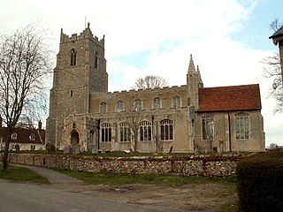
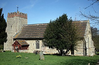
Milden is a village and civil parish in the Babergh district, in Suffolk, England. Located around 4+1⁄2 miles from Sudbury. In 2021 the parish had a population of 118. The parish borders Brent Eleigh, Edwardstone, Groton, Lindsey, Little Waldingfield and Monks Eleigh. There are 18 listed buildings in Milden. St Peter's Church is a Grade I listed building.

Lawshall is a village and civil parish in Suffolk, England. Located around a mile off the A134 between Bury St Edmunds and Sudbury, it is part of Babergh district. The parish has nine settlements comprising the three main settlements of The Street, Lambs Lane and Bury Road along with the six small hamlets of Audley End, Hanningfield Green, Harrow Green, Hart's Green, Hibb's Green and Lawshall Green.
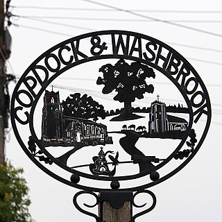
Copdock and Washbrook is a civil parish in the Babergh district in the county of Suffolk, England. It covers the villages of Copdock and Washbrook, as well as the hamlets of Coles Green, Mace Green and Washbrook Street.

Cosford was a hundred of Suffolk, consisting of 30,712 acres (124.29 km2).

Lackford was a hundred of Suffolk, consisting of 83,712 acres (338.77 km2).
Risbridge is a hundred of Suffolk, consisting of 58,468 acres (236.61 km2).
Mutford and Lothingland was a hundred of Suffolk, with an area of 33,368 acres (135.04 km2). Lowestoft Ness, the most easterly point of Great Britain fell within its bounds.
Milden Thicks is a 42.3-hectare (105-acre) biological Site of Special Scientific Interest east of Great Waldingfield in Suffolk, England. It is in four separate blocks, Bulls Cross Wood, Hazel Wood and the adjoining Hall Wood, Walding Wood and Long Wood.
Washbrook is a village and former civil parish 3 miles (4.8 km) south west of Ipswich, now in the parish of Copdock and Washbrook, in the Babergh district, in the county of Suffolk, England. In 2011 the built-up area had a population of 517.
Sudbury Division is an electoral division in Babergh District, Suffolk which returns a single County Councillor to Suffolk County Council.
Sudbury East and Waldingfield Division is an electoral division in Babergh District, Suffolk which returns a single County Councillor to Suffolk County Council.