Kettlebaston is a village and a civil parish with just over 30 inhabitants in the Babergh district of Suffolk, England, located around 3 miles (5 km) east of Lavenham. From the 2011 Census the population of the village was not maintained and is included in the civil parish of Chelsworth. It derives its name from Kitelbeornastuna,, later evolving to Kettlebarston,, and finally to the current spelling. Its existence was first recorded in 1086 in the Domesday Book.

Sudbury is a market town and civil parish in the south west of Suffolk, England, on the River Stour near the Essex border, 60 miles (97 km) north-east of London. It is the largest town in the Babergh local government district and part of the South Suffolk constituency. In 2021 the built-up area had a population of 23,912 and the parish had a population of 13,619.

Babergh District is a local government district in Suffolk, England. In 2021 it had a population of 92,300. The district is primarily a rural area, containing just two towns, Sudbury and Hadleigh, which was the administrative centre until 2017 when the council moved to shared offices with neighbouring Mid Suffolk District Council in Ipswich, outside either district. The district is named after the medieval Babergh Hundred, which covered part of the area.

Nayland is a village and former civil parish, now in the parish of Nayland-with-Wissington, in the Babergh district, in the county of Suffolk, England. It is in the Stour Valley on the Suffolk side of the border between Suffolk and Essex. In 2011 the built-up area had a population of 938.

Lavenham is a village, civil parish and electoral ward in the Babergh district, in the county of Suffolk, England. It is noted for its Guildhall, Little Hall, 15th-century church, half-timbered medieval cottages and circular walks. In the medieval period it was among the twenty wealthiest settlements in England. In 2011 the parish had a population of 1722.

Acton is a village and civil parish in the English county of Suffolk. The parish also includes the hamlets of Cuckoo Tye and Newman's Green.

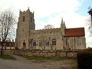
Long Melford, colloquially and historically also referred to as Melford, is a large village and civil parish in the Babergh district, in the county of Suffolk, England. It is on Suffolk's border with Essex, which is marked by the River Stour, 3 miles (4.8 km) from Sudbury, approximately 16 miles (26 km) from Colchester and 14 miles (23 km) from Bury St Edmunds. It is one of Suffolk's "wool towns" and is a former market town. The parish also includes the hamlets of Bridge Street and Cuckoo Tye. In 2011 the parish had a population of 3918.

Alpheton is a village and civil parish in the Babergh district of Suffolk, England. Located on the A134 road about six miles north of Sudbury, in 2005 it had a population of 260, reducing to 256 at the 2011 Census. According to Eilert Ekwall the meaning of the village name is the homestead of Aelfled.

Boxford is a village and civil parish in the Babergh district of Suffolk, England. Located around six miles east of Sudbury straddling the River Box and skirted by the Holbrook. The parish includes the hamlets of Calais Street, Hagmore Green and Stone Street. In 2021 the built-up area had a population of 833. In 2021 the parish had a population of 1403. The parish borders Assington, Edwardstone, Groton, Kersey, Newton and Polstead. There are 87 listed buildings in Boxford. Boxford became a conservation area in 1973.

Glemsford is a village and civil parish in the Babergh district in Suffolk, England, near the town of Sudbury. Glemsford is located near the River Glem and the River Stour also flows nearby. Glemsford is surrounded by arable farmland and is not far from historic Suffolk villages such as Lavenham and Long Melford. In 2021 it had a population of 3693.

Cockfield is a village and civil parish located approximately 3+1⁄2 miles (5.6 km) from Lavenham in Suffolk, England. The village consists of a central point and several outlying hamlets: Buttons Green, Colchester Green, Cross Green, Great Green, Oldhall Green, Smithwood Green and Windsor Green. Surrounded mostly by fields used for farming, and with few roads, its population was 839 in 2001, increasing to 868 at the 2011 Census.

Shimpling is a village and civil parish in south Suffolk, England. About 7 miles (11 km) from Bury St Edmunds, it is part of Babergh district. The village is formed from two halves, the newer Shimpling Street and about 2 miles (3 km) away the old village of Shimpling. The village has a Church of England parish church, where supermodel Claudia Schiffer and film producer Matthew Vaughn were married on 25 May 2002.
Little Waldingfield is a village and civil parish in Suffolk, England. Located two miles from its sister village, Great Waldingfield, it is part of the Babergh district, and includes the hamlet of Humble Green. In 2021 its population was 364.

Edwardstone is a village and civil parish in the Babergh district, in the county of Suffolk, England. The parish contains the hamlets of Mill Green, Priory Green, Round Maple and Sherbourne Street, and Edwardstone Woods, a Site of Special Scientific Interest. In 2021 the parish had a population of 375. The parish borders Boxford, Great Waldingfield, Groton, Little Waldingfield, Milden and Newton.

Stanstead is a village and civil parish in Suffolk, England. The name Stanstead comes from the Old English for "Stony place". Located off the B1066, it is around 4 miles (6 km) from Sudbury, and is part of Babergh district. It is about 2 kilometres (1 mi) from Glemsford, 12 miles (19 km) from Hadleigh, and 4 miles (6 km) from Lavenham.
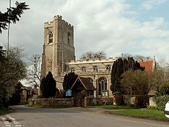
Milden is a village and civil parish in the Babergh district, in Suffolk, England. Located around 4+1⁄2 miles from Sudbury. In 2021 the parish had a population of 118. The parish borders Brent Eleigh, Edwardstone, Groton, Lindsey, Little Waldingfield and Monks Eleigh. There are 18 listed buildings in Milden. St Peter's Church is a Grade I listed building.

Chilton is a civil parish on the eastern outskirts of Sudbury, in the Babergh district, in the county of Suffolk, England. In 2011 the parish had a population of 367.

Thorpe Morieux is a small village and civil parish in Suffolk, England. It is 10 miles south-east of Bury St Edmunds and 10 miles north east of Sudbury.

Babergh was a hundred of Suffolk, consisting of 71,882 acres (290.90 km2). Its name survives in that of Babergh District, the local government district of southern Suffolk that includes the former hundred as well as those of Cosford and Samford.
Sudbury East and Waldingfield Division is an electoral division in Babergh District, Suffolk which returns a single County Councillor to Suffolk County Council.