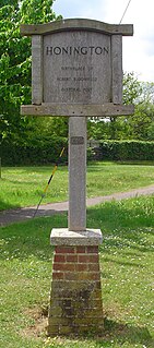
Honington is a village and civil parish located in Bardwell Ward and Pakenham and Troston Wards of West Suffolk District Council, Suffolk in eastern England It is near to the border with Norfolk. It lies on the River Black Bourn, about 8 miles (13 km) from Bury St Edmunds and 6 miles (10 km) from Thetford, Norfolk. Much of the farmland belongs to the estate of the Duke of Grafton. The village is known for its RAF station, RAF Honington. It is also near two joint RAF/USAF airfields: RAF Lakenheath and RAF Mildenhall. Honington was the birthplace of the poet Robert Bloomfield.

Hintlesham is a small village in Suffolk, England, situated roughly halfway between Ipswich and Hadleigh. It is in the Belstead Brook electoral division of Suffolk County Council.

Yoxford is a village in East Suffolk, England, close to the Heritage Coast, Minsmere Reserve (RSPB), Aldeburgh and Southwold. It is known for its antique shops and for providing the setting for a Britten opera.

Long Melford, colloquially and historically also referred to as Melford, is a large village and civil parish in the Babergh district, in the county of Suffolk, England. It is on Suffolk's border with Essex, which is marked by the River Stour, 3 miles (4.8 km) from Sudbury, approximately 16 miles (26 km) from Colchester and 14 miles (23 km) from Bury St Edmunds. It is one of Suffolk's "wool towns" and is a former market town. The parish also includes the hamlets of Bridge Street and Cuckoo Tye.

Belstead is a village and civil parish in the Babergh district of the English county of Suffolk. Located on the southern edge of Ipswich, around 3 miles (5 km) south-west of Ipswich town centre. It had a population of 202 according to the 2011 census. Belstead has amenities such as a village hall, St Mary's the Virgin Church, The bridge school for children with learning difficulties and Belstead Brook Hotel and Spa. It is in the Belstead Brook electoral division of Suffolk County Council.
Pinewood is a civil parish and electoral ward in the Babergh district of the English county of Suffolk. Whilst not part of the borough, it forms part of the town of Ipswich although part of the parish is separated from it by Belstead Brook, a tributary of the River Orwell. The parish was formed on 1 April 1994 from parts of Washbrook, Belstead and Wherstead. It is in the Belstead Brook electoral division of Suffolk County Council.

Tattingstone is a village and civil parish in Suffolk, England on the Shotley peninsula about 5 miles (8 km) south of Ipswich. The 2011 Census recorded the population as 540.

Burstall is a village and civil parish in Suffolk, England. Located around 4 miles (6 km) west of Ipswich, it is part of Babergh district. The parish includes the hamlet of Burstallhill. Recorded in the Domesday Book as Burgestala / Burghestala. It is in the Belstead Brook electoral division of Suffolk County Council.

Chattisham is a village and civil parish in Suffolk, England. Located around two miles west of Ipswich and half a mile south of the A1071, it is part of Babergh district. In 2006 its population was 140, increasing to 167 at the 2011 Census. It is in the Belstead Brook electoral division of Suffolk County Council. In the early 1870s, Chattisham was portrayed as: "CHATTISHAM, a parish in Samford district, Suffolk; 2¼ miles NE of Raydon r. station, and 5 SW by W of Ipswich. Post town, Ipswich. Acres, 713. Real property, £1, 427. Pop., 192. Houses, 47. The property is divided among a few. The living is a vicarage in the diocese of Norwich. Value, £168.* Patron, Eton College. The church has a brass of 1592; and is good. There are a Wesleyan chapel, and charities £6."
Copdock and Washbrook is a civil parish in the Babergh district in the county of Suffolk, England. It covers the villages of Copdock and Washbrook, as well as the hamlets of Coles Green, Mace Green and Washbrook Street.
Wherstead is a village and a civil parish located in county Suffolk, England. Wherstead village lies 3 miles (4.8 km) south of Ipswich on the Shotley peninsula. It is in the Belstead Brook electoral division of Suffolk County Council.

Stonham Aspal is a village and civil parish in the Mid Suffolk district of Suffolk in eastern England, some five miles (8 km) east of the town of Stowmarket. Nearby villages include Mickfield, Little Stonham and Pettaugh. Its population in 2011 was 601. The village has a primary school. It is set in farmland, but has a busy main road, A1120, running through.
Stoke Ash is a village and civil parish in the Mid Suffolk district of Suffolk in eastern England. Located around six miles south of Diss, in 2011 its population was 314. The village shares a parish council with neighbouring Thwaite. It is located on the A140 road from Norwich to Ipswich The name 'Stoke', comes from 'stoc', which means a place or a secondary settlement in old English. The word 'Ash', comes from the Anglian word 'æsc', which means ash-tree. The name Ash was added to the name Stoke in the sixteenth century. In 1086 Stoke Ash was known as Stoches Stotas.

Swilland is a village and civil parish, in the East Suffolk district, in the English county of Suffolk. It is north of the large town of Ipswich. Swilland has a church called St Mary's Church and a pub called The Moon & Mushroom Inn which has been awarded Suffolk Pub of The Year on two occasions by the Evening Star. Swilland shares a parish council with Witnesham called "Swilland and Witnesham Grouped Parish Council".
Chantry is a suburban residential area within the town of Ipswich in the English county of Suffolk. It lies to the south of the town. The area is included in the Gipping ward of Ipswich Borough Council. It has a population of over 30,000.
Ann Candler (1740–1814) was a poet, known as "The Suffolk Cottager", whose works appeared in the Ipswich Journal and a volume published toward the end of her life.

Samford Rural District was a rural district within the administrative county of East Suffolk between 1894 and 1974. It was created out of the earlier Samford rural sanitary district. It was named after the historic hundred of Samford, whose boundaries it closely matched.
Washbrook is a village and former civil parish 3 miles (4.8 km) south west of Ipswich, now in the parish of Copdock and Washbrook, in the Babergh district, in the county of Suffolk, England. In 2011 the built-up area had a population of 517. In 1961 the parish had a population of 368. As of 1958 Washbrook Street was a secondary settlement for Washbrook.

Belstead Brook Division, Suffolk is an electoral division in Babergh District, Suffolk which returns a single County Councillor to Suffolk County Council. It comprises two wards, Brook and Pinewood.


