Nayland-with-Wissington

Last updated

Nayland-with-Wissington
Civil parish
The view as you leave Nayland parish church - geograph.org.uk - 846218.jpg
Coordinates: 51°58′12″N0°51′29″E / 51.970°N 0.858°E / 51.970; 0.858
Primary council Babergh
County Suffolk
Region East of England
StatusParish
Main settlements Nayland, Wissington
Government
   UK Parliament South Suffolk
Population
 ((2011) [1] )
  Total1,163
Area code CO
Website Nayland with Wissington Parish Council

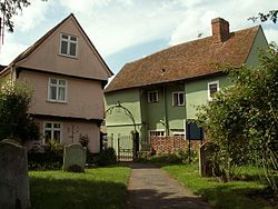
Nayland-with-Wissington is a civil parish which comprises the larger village of Nayland and the adjoining rural village of Wissington (these days usually referred to as 'Wiston' by local residents (Knox, 2001) ). They were originally two separate parishes and were united into one civil parish in 1884. [2] However, the ecclesiastical parishes remain separate. In 2011 the parish had a population of 1163.

Contents

Nayland and Wiston lie on the northern bank of the River Stour which divides Essex and Suffolk in England. It is in the Babergh district.

Governance

The parish forms part of the electoral ward called Nayland. The population of this ward taken at the 2011 Census was 1,845. [3]

Related Research Articles

<span class="mw-page-title-main">Honington, Suffolk</span> Village in West Suffolk, England

Honington is a village and civil parish located in Bardwell Ward and Pakenham and Troston Wards of West Suffolk District Council, Suffolk in eastern England It is near to the border with Norfolk. It lies on the River Black Bourn, about 8 miles (13 km) from Bury St Edmunds and 6 miles (10 km) from Thetford, Norfolk. Much of the farmland belongs to the estate of the Duke of Grafton. The village is known for its RAF station, RAF Honington. It is also near two joint RAF/USAF airfields: RAF Lakenheath and RAF Mildenhall. Honington was the birthplace of the poet Robert Bloomfield. In 2011 the parish had a population of 1472.

<span class="mw-page-title-main">Babergh District</span> Non-metropolitan district in England

Babergh District is a local government district in Suffolk, England. In 2021 it had a population of 92,300. The district is primarily a rural area, containing just two towns, Sudbury and Hadleigh, which was the administrative centre until 2017 when the council moved to shared offices with neighbouring Mid Suffolk District Council in Ipswich, outside either district. The district is named after the medieval Babergh Hundred, which covered part of the area.

<span class="mw-page-title-main">Nayland</span> Human settlement in England

Nayland is a village and former civil parish, now in the parish of Nayland-with-Wissington, in the Babergh district, in the county of Suffolk, England. It is in the Stour Valley on the Suffolk side of the border between Suffolk and Essex. In 2011 the built-up area had a population of 938.

<span class="mw-page-title-main">Civil parishes in Bedfordshire</span> List of places

A civil parish is a country subdivision, forming the lowest unit of local government in England. There are 125 civil parishes in the ceremonial county of Bedfordshire, most of the county being parished: Luton is completely unparished; Central Bedfordshire is entirely parished. At the 2001 census, there were 312,301 people living in the 125 parishes, which accounted for 55.2 per cent of the county's population.

<span class="mw-page-title-main">Civil parishes in Cambridgeshire</span>

A civil parish is a country subdivision, forming the lowest unit of local government in England. There are 264 civil parishes in the ceremonial county of Cambridgeshire, most of the county being parished; Cambridge is completely unparished; Fenland, East Cambridgeshire, South Cambridgeshire and Huntingdonshire are entirely parished. At the 2001 census, there were 497,820 people living in the parishes, accounting for 70.2 per cent of the county's population.

<span class="mw-page-title-main">Civil parishes in Lancashire</span>

A civil parish is a subnational entity, forming the lowest unit of local government in England. There are 219 civil parishes in the ceremonial county of Lancashire; Blackpool is completely unparished; Pendle and Ribble Valley are entirely parished. At the 2001 census, there were 587,074 people living in the 219 parishes, accounting for 41.5 per cent of the county's population.

<span class="mw-page-title-main">Civil parishes in West Yorkshire</span>

A civil parish is a subnational entity, forming the lowest unit of local government in England. There are 101 civil parishes in the ceremonial county of West Yorkshire, most of the county being unparished. At the 2001 census, there were 557,369 people living in the parishes, accounting for 26.8 per cent of the county's population.

<span class="mw-page-title-main">Civil parishes in the West Midlands (county)</span> Subnational entity

A civil parish is a subnational entity, forming the lowest unit of local government in England. There are 21 civil parishes in the ceremonial county of West Midlands, most of the county being unparished; Dudley, Sandwell, Walsall and Wolverhampton are completely unparished. At the 2001 census, there were 89,621 people living in the parishes, accounting for 3.5 per cent of the county's population.

<span class="mw-page-title-main">Rushmere St Andrew</span> Human settlement in England

Rushmere St Andrew is a village, civil parish and electoral ward adjacent to part of the eastern edge of the borough of Ipswich in the East Suffolk district of Suffolk, England. The parish includes most of Rushmere Heath and parts of the Ipswich suburb of Broke Hall as well as the village of Rushmere St. Andrew, from which it draws its name. The parish was formed in 1894 from the rural part of the parish of Rushmere.

<span class="mw-page-title-main">Stoke-by-Nayland</span> Human settlement in England

Stoke-by-Nayland is a village and civil parish in the Babergh district, in the county of Suffolk, England, close to the border with Essex. The parish includes the village of Withermarsh Green and the hamlets of Thorington Street and Scotland Street. The village has many cottages and timber-framed houses, all surrounding a recreation field. Possibly once the site of a monastery, the population of the civil parish was 703 at the 2001 Census, falling to 682 at the 2011 Census.

<span class="mw-page-title-main">Melford Rural District</span> Former rural district in West Suffolk, England

Melford Rural District was a rural district in the county of West Suffolk, England. It was created in 1894, under the Local Government Act 1894 from that part of the Sudbury rural sanitary district in West Suffolk. It was named after Long Melford and administered from Sudbury. Shortly after its creation, in 1896, the parish of Glemsford was made a separate urban district.

<span class="mw-page-title-main">Wiston, Pembrokeshire</span> Village, parish and community in Pembrokeshire, Wales

Wiston is a village, parish and community in Pembrokeshire, Wales, in the United Kingdom. It was once a marcher borough. George Owen, in 1603, described it as one of nine Pembrokeshire "boroughs in decay". It continued as a constituent parliamentary borough until the end of the 19th century.

<span class="mw-page-title-main">Melton, Suffolk</span> Human settlement in England

Melton is a village in Suffolk, England, located approximately one mile northeast of Woodbridge. The 2001 census recorded a population of 3,718, the population increasing to 3,741 at the 2011 Census. The village is served by Melton railway station on the Ipswich-Lowestoft East Suffolk Line. The parish contains 'Woodbridge' Melton, an area of building contiguous with Woodbridge but separated from most of Melton by the wood, 'Village' Melton, centred around the A1152 and A1438, Melton Park or Melton St Audry's, a housing estate converted from an asylum, and various outlying hamlets.

<span class="mw-page-title-main">Boxford, Suffolk</span> Human settlement in England

Boxford is a village and civil parish in the Babergh district of Suffolk, England. Located around six miles east of Sudbury straddling the River Box and skirted by the Holbrook. The parish includes the hamlets of Calais Street, Hagmore Green and Stone Street. In 2021 the built-up area had a population of 833. In 2021 the parish had a population of 1403. The parish borders Assington, Edwardstone, Groton, Kersey, Newton and Polstead. There are 87 listed buildings in Boxford. Boxford became a conservation area in 1973.

<span class="mw-page-title-main">Kirkley</span> Human settlement in England

Kirkley is an area of the town of Lowestoft in the East Suffolk district of the English county of Suffolk. It is located south of the centre of Lowestoft and the town's harbour and Lake Lothing. Kirkley was originally an independent village but is now part of the urban conurbation of Lowestoft. In 2011 the ward had a population of 7,439.

<span class="mw-page-title-main">Wissington, Suffolk</span> Human settlement in England

Wissington or Wiston is a small village and former civil parish, now in the parish of Nayland-with-Wissington, in the Babergh district, in south Suffolk, England. In 1881 the civil parish had a population of 191. On 1 April 1844 the parish was abolished and merged with Nayland to form "Nayland with Wissington".

<span class="mw-page-title-main">Brettenham, Suffolk</span> Human settlement in England

Brettenham is a village and civil parish in the Babergh district of Suffolk, England. In 2005 it had a population of 270, increasing to 353 at the 2011 Census, and reduced to 320 in the 2021 census.

<span class="mw-page-title-main">Leavenheath</span> Village in Suffolk, England

Leavenheath is a village and civil parish in Suffolk, England, close to the Essex border. Located on the A134 between Sudbury and Colchester, it is part of Babergh district. The parish also contains the hamlets of Cock Street and Honey Tye, and in 2001 had a population of 1,373, falling slightly to 1,370 at the 2011 Census.

<span class="mw-page-title-main">Horringer</span> Village in West Suffolk, England

Horringer, formerly also called Horningsheath, is a village and civil parish in the West Suffolk district of Suffolk in eastern England. It lies on the A143 about two miles south-west of Bury St Edmunds. The population in 2011 was 1055.

<span class="mw-page-title-main">Civil parishes in Cornwall</span>

A civil parish is a country subdivision, forming the lowest unit of local government in England. There are 218 civil parishes in the ceremonial county of Cornwall, which includes the Isles of Scilly. The county is effectively parished in its entirety; only the unpopulated Wolf Rock is unparished. At the 2001 census, there were 501,267 people living in the current parishes, accounting for the whole of the county's population. The final unparished areas of mainland Cornwall, around St Austell, were parished on 1 April 2009 to coincide with the structural changes to local government in England.

References

  1. "Parish population 2011" . Retrieved 13 September 2015.
  2. "Relationships and changes Nayland With Wissington CP through time". Vision of Britain. Retrieved 28 January 2018.
  3. "Neyland ward population 2011" . Retrieved 13 September 2015.