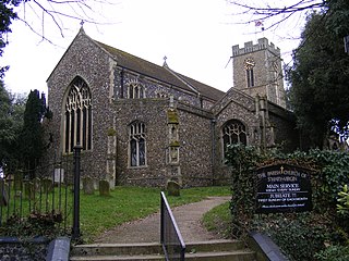
Halesworth is a market town, civil parish and electoral ward in north-eastern Suffolk, England. The population stood at 4,726 in the 2011 Census. It lies 15 miles (24 km) south-west of Lowestoft, on a tributary of the River Blyth, nine miles upstream from Southwold. The town is served by Halesworth railway station on the Ipswich–Lowestoft East Suffolk Line. It is twinned with Bouchain in France and Eitorf in Germany. Nearby villages include Cratfield, Wissett, Chediston, Walpole, Blyford, Linstead Parva, Wenhaston, Thorington, Spexhall, Bramfield, Huntingfield, Cookley and Holton.

Homersfield, also known as St Mary, South Elmham, is a village and civil parish in the north of the English county of Suffolk. It is in the East Suffolk district, 4 miles (6.4 km) south-west of the market town of Bungay and 3 miles (4.8 km) north-east of Harleston. The official name of the civil parish is St Mary, South Elmham otherwise Homersfield. It is one of the parishes around Bungay known as The Saints.

Brampton is a village and former civil parish, now in the parish of Brampton with Stoven, in the East Suffolk district, in the county of Suffolk, England. It is around 4 miles (6.4 km) north-east of Halesworth, 5 miles (8.0 km) south of Beccles and 5 miles (8.0 km) north-west of Southwold. In 1961 the parish had a population of 306. On 1 April 1987, the parish was merged with Stoven to form "Brampton with Stoven" parish and the mid-2005 population estimate for the expanded parish was 460.

All Saints and St Nicholas, South Elmham is a civil parish in the north of the English county of Suffolk. It is 5 miles (8.0 km) south of the market town of Bungay and the same distance north-west of Halesworth and east of Harleston. The parish is in the East Suffolk district and is one of the parishes that make up the area around Bungay known as The Saints. It includes the settlements of All Saints, South Elmham and St Nicholas, South Elmham.
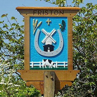
Friston is a village and civil parish in the East Suffolk district, in the county of Suffolk, England. It is 3 miles (5 km) southeast of Saxmundham, its post town, and 4 miles (6 km) northwest of Aldeburgh. The River Alde bounds the village on the south. The surrounding land is chiefly arable. The soil becomes partly marshy in the lower grounds. The village is noted for its early nineteenth century post mill. It is located next to the village of Knodishall. In 2011 the parish had a population of 344.

Sotterley, originally Southern-lea from its situation south of the river, is a village and civil parish in the East Suffolk district, in the English county of Suffolk, located approximately 4 miles (6 km) south-east of Beccles and 1.5 miles (2 km) east of Willingham St Mary and Shadingfield. The parish is primarily agricultural with a dispersed population of 113 at the 2011 census. The parish council operates to administer jointly the parishes of Shadingfield, Willingham St Mary, Sotterley and Ellough.

All Saints' South Elmham is a village and former civil parish in the north of the English county of Suffolk. The parish was combined with St Nicholas South Elmham in 1737 to form the parish of All Saints and St. Nicholas, South Elmham. It is 5 miles (8.0 km) south of the market town of Bungay in the East Suffolk district. It is one of the villages that make up the area around Bungay known as The Saints.

Holton is a village and civil parish in the East Suffolk district, in the county of Suffolk, England, near the town of Halesworth, with a population of 832 in the 2011 Census. Holton is split into two parts — Upper Holton and Holton.

Farnham is a village and civil parish about 3 miles (4.8 km) south-west of Saxmundham in the English county of Suffolk on the A12 road. Farnham is located west of Friday Street, south of Benhall Low Street and north-east of Stratford St Andrew.

Shadingfield is a village and civil parish in the East Suffolk district of the English county of Suffolk. It is located around 4 miles (6.4 km) south of Beccles in the north of the county.

Willingham St Mary, also known simply as Willingham, is a village and civil parish in the English county of Suffolk located about 3.5 miles (6 km) south of Beccles in the East Suffolk district. At the 2011 United Kingdom census it had a population of 152.

Ellough is a civil parish in the East Suffolk district of the English county of Suffolk, located approximately 3 miles (5 km) south-east of Beccles. The area is sparsely populated with a mid-2005 population estimate of 40. The parish, which has an area of 4.5 square kilometres (1.7 sq mi), borders Worlingham, North Cove, Mutford, Weston, Sotterley, Willingham St Mary and Henstead with Hulver Street. The parish council operates to administer jointly the parishes of Shadingfield, Willingham St Mary, Sotterley and Ellough.
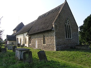
Uggeshall is a village and civil parish in the East Suffolk district, in the county of Suffolk, England, located approximately 6 miles (10 km) south of Beccles and 4 miles north east of Halesworth close to the A145. The mid-2005 population estimate for Uggeshall parish was 170, reducing to 145 at the 2011 Census. Sotherton is located just to the south-west, Wangford to the south-east and Brampton and Stoven to the north.

Kentford is a village and civil parish located in the West Suffolk district of Suffolk in eastern England. Situated on the banks of the River Kennet, the village is positioned on the B1506 road connecting Newmarket to Bury St. Edmunds. The village is served by the Kennett railway station, located just off the A14, which offers an indirect railway connection to London via Cambridge. Kentford is located about four miles northeast of Newmarket and nine miles west of Bury St. Edmunds. The village falls within the Bury St. Edmunds division of the county and is divided between the Lackford and Risbridge Hundred. Kentford is also part of the Newmarket petty sessional division, Mildenhall union and county court district, rural deanery of Newmarket, archdeaconry of Sudbury, and diocese of St. Edmundsbury and Ipswich. The population of Kentford was estimated to be 1125 as of 2021.
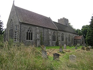
Westhall is a village and civil parish in the East Suffolk district, in the county Suffolk, England about 3 miles (5 km) north east of Halesworth, 1 mile (1.6 km) south west of Brampton and 5 miles (8 km) south of Beccles, close to the A145. The mid-2005 population estimate for Westhall parish was 390. Sotherton is located to the south east and Holton to the south west.
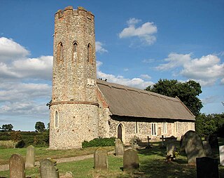
Ashby is a former civil parish, now in the parish of Somerleyton, Ashby and Herringfleet, in the East Suffolk district, in the north of the English county of Suffolk. It is 5+1⁄2 miles (8.9 km) north-west of Lowestoft.
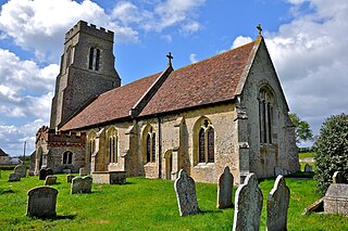
Hawkedon is a village and civil parish in the West Suffolk district of Suffolk in eastern England. Located around 7 miles (11 km) south-south-west of Bury St Edmunds, the parish also contains the hamlet of Thurston End, and in 2005 had a population of 120. The majority of the village is classed as a conservation area.

North Cove is a village and civil parish in the north of the English county of Suffolk. It is part of the East Suffolk district, located around 3 miles (4.8 km) east of Beccles and 5 miles (8.0 km) west of Lowestoft. It merges with the village of Barnby and the villages share some resources, although the two parishes retain separate parish councils.

St Nicholas South Elmham is a place and former civil parish in the north of the English county of Suffolk. The parish was combined with All Saints' South Elmham in 1737 to form the parish of All Saints and St. Nicholas, South Elmham. It is 5 miles (8.0 km) south of the market town of Bungay in the East Suffolk district. It is part of the area around Bungay known as The Saints.
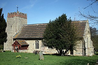
Washbrook is a village and former civil parish 3 miles (4.8 km) south west of Ipswich, now in the parish of Copdock and Washbrook, in the Babergh district, in the county of Suffolk, England. In 2011 the built-up area had a population of 517.


