Badharamal

Last updated
Badharamal

बडहरामाल
Nepal adm location map.svg
Red pog.svg
Badharamal
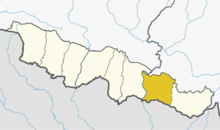
Location in Nepal
Coordinates: 26°51′N86°10′E / 26.85°N 86.16°E / 26.85; 86.16 Coordinates: 26°51′N86°10′E / 26.85°N 86.16°E / 26.85; 86.16
CountryFlag of Nepal.svg    Nepal
Zone Sagarmatha Zone
District Siraha District
Population
 (2011) [1]
  Total16,482
Time zone UTC+5:45 (Nepal Time)
Website http://ddcsiraha.gov.np

Badharamal is a village development committee in Siraha District in the Sagarmatha Zone of Southeastern Nepal. It contains seven villages. It has 9 Wada.

Village development committee (Nepal) lower administrative part of Nepals local development ministry

A Village Development Committee (VDC) in Nepal was the lower administrative part of its Ministry of Federal Affairs and Local Development. Each district had several VDCs, similar to municipalities but with greater public-government interaction and administration. There were 3,157 village development committees in Nepal. Each VDC was further divided into several wards depending on the population of the district; the average being nine wards.

Siraha District District in Province No. 2, Nepal

Siraha District (Nepali: सिराहा जिल्लाListen , a part of Province No. 2, is one of the seventy-five districts of Nepal. The district, with Siraha as its district headquarters, covers an area of 1,188 km². It has population of 637,328 in 2011. Majority of the population here is Maithil Brahmin.

Sagarmatha Zone Zone in Nepal

Sagarmāthā was one of the fourteen zones of Nepal until the restructuring of zones into provinces. Sagarmāthā is a Nepali word derived from सगर् (sagar) meaning "sky" and माथा (māthā) meaning "head".

Contents

Demographics

At the time of the 2011 Nepal census, it had a population of 16,482 people living in 3,346 individual households. The village contains Hindus, Muslims, Buddhists and Christians, predominantly Hindu. Local castes include Brahman, Chhetri, Teli, Yadav, Suri, Koiri, Haluwai, Danuwar, Kumal (Mukhiya) Tatama and Musahara people live there.

Nepal conducted a widespread national census in 2011 by the Nepal Central Bureau of Statistics. Working with the 58 municipalities and the 3915 Village Development Committees at a district level, they recorded data from all the municipalities and villages of each district. The data included statistics on population size, households, sex and age distribution, place of birth, residence characteristics, literacy, marital status, religion, language spoken, caste/ethnic group, economically active population, education, number of children, employment status, and occupation.

Brahman metaphysical concept, unchanging Ultimate Reality in Hinduism

In Hinduism, Brahman connotes the highest Universal Principle, the Ultimate Reality in the universe. In major schools of Hindu philosophy, it is the material, efficient, formal and final cause of all that exists. It is the pervasive, genderless, infinite, eternal truth and bliss which does not change, yet is the cause of all changes. Brahman as a metaphysical concept is the single binding unity behind diversity in all that exists in the universe.

Chhetri Kshatriya caste of patrilineal Khas-Aryan descent

Chhetri, historically called Kshettriya or Kshetriya, are Nepali speakers of Khas Rajput community originating from medieval India. Chhetri was a caste of administrators, governor and military elites in medieval Khas Kingdom and Gorkha Kingdom. The nobility of Gorkha Kingdom were mainly based from Chhetri families and they had a strong presence in civil administration affairs. The bulk of Prime Ministers of Nepal before democratization of Nepal belonged to this caste as a result of old Gorkhali aristocracy. Gorkha-based aristocratic Chhetri families were Pande dynasty, Basnyat dynasty, Thapa dynasty and Kunwars.

Administration

Badharamal is included in Karjanha (rural municipality).

Karjanha Village development committee in Sagarmatha Zone, Nepal

Karjanha is a village development committee in Siraha District in the Sagarmatha Zone of south-eastern Nepal. At the time of the 1991 Nepal census it had a population of 5296 people living in 954 individual households.

Geography

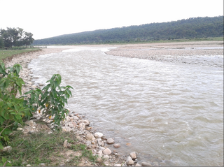
The hills of Chure range are there. It is a mixture of hilly and Terai region. Babataal, Nandmohari, the Kamala River and the Kamala Bridge are local attractions.

Terai Madhesh Region of Nepal and Plain Region of India

The Terai is a lowland region in southern Nepal and northern India that lies south of the outer foothills of the Himalayas, the Siwalik Hills, and north of the Indo-Gangetic Plain. This lowland belt is characterised by tall grasslands, scrub savannah, sal forests and clay rich swamps. In northern India, the Terai spreads from the Yamuna River eastward across Himachal Pradesh, Haryana, Uttarakhand, Uttar Pradesh and Bihar. The Terai is part the Terai-Duar savanna and grasslands ecoregion. The corresponding lowland region in West Bengal, Bangladesh, Bhutan and Assam in the Brahmaputra River basin is called 'Dooars'. In Nepal, the Terai stretches over 33,998.8 km2 (13,127.0 sq mi), about 23.1% of Nepal's land area, and lies at an altitude of between 67 and 300 m. The region comprises more than 50 wetlands. North of the Terai rises the Bhabhar, a narrow but continuous belt of forest about 8–12 km (5.0–7.5 mi) wide.

Kamala River river of India and Nepal

The Kamala River originates from Nepal and flows through Indian state of Bihar.

Related Research Articles

Arnama Lalpur Village development committee in Sagarmatha Zone, Nepal

Arnama Lalpur is a village development committee in Siraha District in the Sagarmatha Zone of south-eastern Nepal. At the time of the 2011 Nepal census it had a population of 6841 people living in 1255 individual households.

Arnama Rampur Village development committee in Sagarmatha Zone, Nepal

Arnama Rampur is a village development committee in Siraha District in the Sagarmatha Zone of south-eastern Nepal. At the time of the 2011 Nepal census it had a population of 9241 people living in 1731 individual households.

Asanpur Municipality recently announced in Sagarmatha Zone, Nepal

Asanpur ' is a [villge development committee (VDC)] in Siraha District in the Sagarmatha Zone of south-eastern Nepal. At the time of the 2011 Nepal census it had a population of 12926 people living in 2510 individual households.

Barchhawa Village development committee in Sagarmatha Zone, Nepal

Barchhawa is a village development committee in Siraha District in the Sagarmatha Zone of south-eastern Nepal. At the time of the 2011 Nepal census it had a population of 3701 people living in 737 individual households.

Bastipur, Sagarmatha Village development committee in Sagarmatha Zone, Nepal

Bastipur, Sagarmatha is a village development committee in Siraha District in the Sagarmatha Zone of south-eastern Nepal. At the time of the 2011 Nepal census it had a population of 6361 people living in 1158 individual households.

Belaha Village development committee in Sagarmatha Zone, Nepal

Belaha is a village development committee in Siraha District in the Sagarmatha Zone of south-eastern Nepal. At the time of the 2011 Nepal census it had a population of 6240 people living in 1036 individual households.

Belhi, Sagarmatha Village development committee in Sagarmatha Zone, Nepal

Balhi is a village development committee in Siraha District in the Sagarmatha Zone of south-eastern Nepal. At the time of the 2011 Nepal census it had a population of 4014 people living in 824 individual households.

Bhadaiya Village development committee in Sagarmatha Zone, Nepal

Bhadaiya is a village development committee in Siraha District in the Sagarmatha Zone of south-eastern Nepal. At the time of the 2011 Nepal census it had a population of 5739 people living in 1017 individual households.

Bhagawatipur, Sagarmatha Village development committee in Sagarmatha Zone, Nepal

Bhagawatipur is a village development committee in Siraha District in the Sagarmatha Zone of south-eastern Nepal. At the time of the 2011 Nepal census it had a population of 4495 people living in 865 individual households.

Bhawanipur, Sagarmatha Village development committee in Sagarmatha Zone, Nepal

Bhawanipur is a village development committee in Siraha District in the Sagarmatha Zone of south-eastern Nepal. At the time of the 2011 Nepal census it had a population of 5497 people living in 1092 individual households.

Bhawanpur Kalabanzar Village development committee in Sagarmatha Zone, Nepal

Bhawanpur Kalabanjar is a village development committee in Siraha District in the Sagarmatha Zone of south-eastern Nepal. At the time of the 2011 Nepal census it had a population of 3796 people living in 740 individual households.

Chandralalpur Village development committee in Sagarmatha Zone, Nepal

Chandralalpur is a village development committee in Siraha District in the Sagarmatha Zone of south-eastern Nepal. At the time of the 2011 Nepal census it had a population of 7211 people living in 1307 individual households.

Chatari Village development committee in Sagarmatha Zone, Nepal

Chatari is a village development committee in Siraha District in the Sagarmatha Zone of south-eastern Nepal. At the time of the 2011 Nepal census it had a population of 2711 people living in 485 individual households.

Chikana Village development committee in Sagarmatha Zone, Nepal

Chikana is a village development committee in Siraha District in the Sagarmatha Zone of south-eastern Nepal. At the time of the 1991 Nepal census it had a population of 3640 people living in 723 individual households.

Devipur, Siraha Village development committee in Sagarmatha Zone, Nepal

Devipur is a village development committee in Siraha District in the Sagarmatha Zone of south-eastern Nepal. At the time of the 2011 Nepal census it had a population of 3981 people living in 761 individual households.

Itari Parsahi Village development committee in Sagarmatha Zone, Nepal

Itari Parsahi is a village development committee in the Siraha District in the Sagarmatha Zone of south-eastern Nepal.

Maheshpur Patari Village development committee in Sagarmatha Zone, Nepal

Maheshpur Patari is a village development committee in Siraha District in the Sagarmatha Zone of south-eastern Nepal. At the time of the 2011 Nepal census it had a population of 4396 people living in 753 individual households.

Bhagwanpur, Siraha Rural Municipality in Sagarmatha Zone, Nepal

Bhagwanpur is a rural municipality in Siraha District in the Sagarmatha Zone of south-eastern Nepal. At the time of the 2011 Nepal census it had a population of 20957 people living.

Arnama Rural Municipality in Sagarmatha Zone, Nepal

Arnama is a rural municipality in Siraha District in the Sagarmatha Zone of south-eastern Nepal. At the time of the 2011 Nepal census it had a population of 22,912 people living.

References

  1. "National Population and Housing Census 2011(Village Development Committee/Municipality)" (PDF). Government of Nepal. National Planning Commission. November 2012. Archived from the original (PDF) on 2016-12-21. Retrieved 2017-01-26.