Department Headquarters | |
| Agency overview | |
|---|---|
| Preceding agencies |
|
| Jurisdiction | Bakersfield, California |
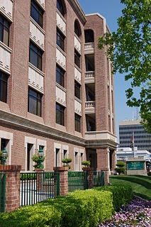
| Headquarters | Development Services Building 35°22′28″N119°01′09″W / 35.37444°N 119.01917°W |
| Annual budget | $8.2 million (2009-10) |
| Agency executive |
|
| Website | bakersfieldcity.us/cityservices/devsrv |
The Bakersfield Department of Development Services is a department of the city of Bakersfield, California. The department enforces the city's building codes and land use policies. It also issues building permits, and give approval for new land development. It also provides inspections of new and existing buildings.

Bakersfield is a city in and the county seat of Kern County, California, United States. It covers about 142 sq mi (370 km2) near the southern end of the San Joaquin Valley and the Central Valley region. Bakersfield's population is around 380,000, making it the 9th-most populous city in California and the 52nd-most populous city in the nation. The Bakersfield–Delano Metropolitan Statistical Area, which includes all of Kern County, had a 2010 census population of 839,631, making it the 62nd-largest metropolitan area in the United States. The more built-up urban area that includes Bakersfield and areas immediately around the city, such as East Bakersfield, Oildale, and Rosedale, has a population of over 520,000. Bakersfield is a charter city.

California is a state in the Pacific Region of the United States. With 39.6 million residents, California is the most populous U.S. state and the third-largest by area. The state capital is Sacramento. The Greater Los Angeles Area and the San Francisco Bay Area are the nation's second and fifth most populous urban regions, with 18.7 million and 8.8 million residents respectively. Los Angeles is California's most populous city, and the country's second most populous, after New York City. California also has the nation's most populous county, Los Angeles County, and its largest county by area, San Bernardino County. The City and County of San Francisco is both the country's second-most densely populated major city after New York City and the fifth-most densely populated county, behind only four of the five New York City boroughs.

Land use involves the management and modification of natural environment or wilderness into built environment such as settlements and semi-natural habitats such as arable fields, pastures, and managed woods. It also has been defined as "the total of arrangements, activities, and inputs that people undertake in a certain land cover type."
Contents
The department was formed from the consolidation of the Building Department and the Planning Department (which became the Building Division and Planning Division). It is headquartered in the Development Services Building at the intersection of 17th Street and Chester Ave, in the Civic Center, downtown.
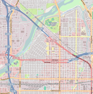
Civic Center is a district in Downtown Bakersfield, California. It is the center of government for the City of Bakersfield and the County of Kern, containing a collection of buildings used by the city, county, state, and federal governments. The district also contains all of downtown's sporting complexes. It also has the Rabobank Theater and Convention Center, which is the largest theater and convention facilities in the city.
Downtown is the central business district for Bakersfield, California. Located in the heart of the city, Downtown Bakersfield is easily accessible from all its other parts. It is also reemerging as the center of Bakersfield's arts, culture and entertainment sectors. Downtown contains several of the cities major theaters, sporting complexes, museums, and historical landmarks.