
The Angara is a major river in Siberia, which traces a course through Russia's Irkutsk Oblast and Krasnoyarsk Krai. It drains out of Lake Baikal and is the headwater tributary of the Yenisey. It is 1,849 kilometres (1,149 mi) long, and has a drainage basin of 1,039,000 square kilometres (401,000 sq mi). It was formerly known as the Lower or Nizhnyaya Angara. Below its junction with the Ilim, it was formerly known as the Upper Tunguska and, with the names reversed, as the Lower Tunguska.

The Yenisey is the fifth-longest river system in the world, and the largest to drain into the Arctic Ocean.
The Ob is a major river in Russia. It is in western Siberia, and with its tributary the Irtysh forms the world's seventh-longest river system, at 5,410 kilometres (3,360 mi). The Ob forms at the confluence of the Biya and Katun which have their origins in the Altai Mountains. It is the westernmost of the three great Siberian rivers that flow into the Arctic Ocean. Its flow is north-westward, then northward.
The Taz is a river located in western Siberia, has a length of 1,401 kilometers (871 mi) and drains a basin estimated at 150,000 square kilometers (58,000 sq mi). Its middle and lower course are located within Yamalo-Nenets Autonomous Okrug, while its upper course borders with Krasnoyarsk Krai.

The Lena is a river in the Russian Far East and is the easternmost river of the three, great rivers of Siberia, including the River Ob and the River Yenisey, which flow into the Arctic Ocean. The Lena river is 4,294 km (2,668 mi) long and has a capacious drainage basin of 2,490,000 km2 (960,000 sq mi); thus the Lena is the eleventh-longest river in the world and the longest river entirely within Russia. Geographically, permafrost is the type of soil that underlies most of the Lena river's catchment, twenty per cent (20%) of which is continuous.
The West Siberian Plain is a large plain that occupies the western portion of Siberia, between the Ural Mountains in the west and the Yenisei River in the east, and the Altai Mountains on the southeast. Much of the plain is poorly drained and consists of some of the world's largest swamps and floodplains. Important cities include Chelyabinsk, Novosibirsk, Omsk, and Tomsk, as well as Surgut and Nizhnevartovsk.

The Nizhnyaya Tunguska is a river in Siberia, Russia, that flows through the Irkutsk Oblast and the Krasnoyarsk Krai. The river is a right tributary of the Yenisey joining it at Turukhansk. The ice-free period on the Nizhnyaya Tunguska starts in mid-June and ends in the first half of October. The river forms the western limit of the Lena Plateau.

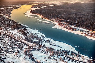
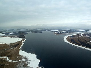
The Yenisey Gulf is a large and long estuary through which the lower Yenisey flows into the Kara Sea.
The Great Yenisey is a river in the Republic of Tuva, the right source of the Yenisey, at its confluence with the Little Yenisey.

The Kochechum is a river in Siberia, Russia. It flows through the Syverma Plateau in Krasnoyarsk Krai. It is a right and most significant tributary of the Nizhnyaya Tunguska.

The Kureyka is a major right tributary of the Yenisey in Krasnoyarsk Krai, Russia.
The Tanama is a river in northern Siberia, Russia. It is one of the main tributaries of the Yenisey.

Central Siberia Nature Reserve is a Russian 'zapovednik'. With over 1 million hectares of protected area, it is one of the largest forest reserves in the world. The reserve is located in the middle Yenisei, lower Bakhta and lower Stony Tunguska river valleys, of the Central Siberian Plateau. Notably, the territory covers both banks of the Yenisei for over 60 km. The reserve is situated in the Turukhansky District of Krasnoyarsk Krai.

The Yenisey Range is a range of mountains in Siberia. Administratively the range is part of the Krasnoyarsk Krai of the Russian Federation. The nearest town is Severo-Yeniseysk.
The Tunguska Plateau is a mountain plateau in Krasnoyarsk Krai, Siberia, Russia. It is a part of the Central Siberian Plateau. The plateau is located in a largely uninhabited area. This area was abandoned in 2006.
Bakhta is a rural locality in Turukhansky District, Krasnoyarsk Krai, Russia. It is part of Turukhansky Municipal District.
The Bolshoy Pit is a river in Krasnoyarsk Krai, Russia. It is a right hand tributary of the Yenisey.

The Yeloguy is a river in Krasnoyarsk Krai, Russia. It is one of the main tributaries of the Yenisey. Its basin marks the eastern limit of the Siberian Uvaly.
The Angara Range is a mountain range in Krasnoyarsk Krai and Irkutsk Oblast, Russia, part of the Central Siberian Plateau.

The Pilyuda is a river in Irkutsk Oblast, Russia. It is a tributary of the Lena with a length of 105 kilometres (65 mi) and a drainage basin area of 1,760 square kilometres (680 sq mi).


