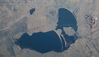
Kalkaman is a village in the Aksu City Administration, Pavlodar Region, Kazakhstan. It is the center of Kalkaman Rural District. Population: 3,145 ; 4,286.
Nura, until 1998 "Oktyabr", is a village in Almaty Region, in south-eastern Kazakhstan. It is the head of the Nura Rural District. Population: 4,327 ; 3,864 . The center of the district is located 65 km north of the city of Talgar, on the banks of the Terengkara River, a branch of Talgar, near the Kapchagai dam, in a desert belt
Ryskulov is a village (selo) in the Talǵar District of Almaty Region, in south-eastern part of Kazakhstan. It is named after Soviet politician Turar Ryskulov. The KATO code is 196233800.
Stantsyonny is a village in Akmola Region, in northern part of Kazakhstan. The KATO code is 111037100.
Akkol is a village in Zerendi District, Akmola Region, in northern part of Kazakhstan. The KATO code is 115633100.
Karashokat is a village in the Shalkar District, Aktobe Region, Kazakhstan. It is part of the Kishikum Rural District. Population: 267 ; 114.
Ayke, formerly "Pskovskoye" (Псковское), is a village in the Ayteke Bi District, Aktobe Region, Kazakhstan. It is the head of the Ayke Rural District. Population: 1,058 ; 1,510.
Belcher or Belsher, is a village in the Yrgyz District, Aktobe Region, Kazakhstan. It is part of the Nura Rural District, with. Population: 192 ; 317.
Nura, is a village in the Yrgyz District, Aktobe Region, Kazakhstan. It is the head of the Nura Rural District. Population: 681 ; 887.
Koskol, is a village in the Ulytau District, Karaganda Region, Kazakhstan. It is the head of the Koskol Rural District. Population: 412 ; 601.
Kamysty, known as Kamyshnoye until 1997, is a village in the Kostanay Region, Kazakhstan. It is the administrative center of Kamysty District and of the Sverdlovsk Rural District. Population: 5,344 ; 5,487.
Shili is a village in Naurzum District, Kostanay Region, Kazakhstan. It is the administrative center of the Shili Rural District. Population: 697 ; 1,143.
Karamendy, until 1999 known as Dokuchayevka, is a village in Naurzum District, Kostanay Region, Kazakhstan. It is the administrative center of the Naurzum District, as well as of the Karamendy Rural District. Population: 4,694 ; 5,326. The administrative office of the Naurzum Nature Reserve, a protected area, is located in the village.
Shabanbay Bi, until 1996 Shylym (Шылым), is a village in Aktogay District, Karaganda Region, Kazakhstan. It is the administrative center of the Shabanbay Bi Rural District. Population: 563 ; 857.
Aktogay is a village in Aktogay District, Karaganda Region, Kazakhstan. It is the administrative center of the Aktogay District, as well as the only settlement of the Aktogay Rural District. Population: 3,145 ; 4,186.
Beldeutas is a village in Karkaraly District, Karaganda Region, Kazakhstan. It is part of the Amanzholov Rural District. Population: 198 ; 271.

Semizbughy is a village in the Karaganda Region, Kazakhstan. It is part of the Bukhar-Zhyrau rural district. The village was developed for the operation of a Corundum mine in the Semizbughy mountain. Population: 136 ; 236.

Shalkar, formerly known as "Pobeda" (Победа), is a village in the Karaganda Region, Kazakhstan. It is part of the Bukhar-Zhyrau rural district. Population: 197 ; 319.
Zhanatilek is a settlement in Pavlodar Region, Kazakhstan. It is part of Bayanaul District and the administrative center of the Zhanatilek rural district. Population: 1,197 ; 1,553.

Borovskoy is a village in the Kostanay Region, Kazakhstan. It is the administrative center of Mendykara District and of the Borovskoy Rural District. Population: 9,781 ; 10,025.


