
The Tabin Wildlife Reserve is a nature preserve in Sabah, Malaysia. It was created in 1984 to preserve Sabah's disappearing wild animals. Occupying a large part of the peninsula forming the northern headland of Darvel Bay, it is located 48 kilometres east of Lahad Datu.

The environment of Malaysia is the biotas and geologies that constitute the natural environment of Malaysia. Malaysia's ecology is megadiverse, with a biodiverse range of flora and fauna found in various ecoregions throughout the country. Tropical rainforests encompass between 59% to 70% of Malaysia's total land area, of which 11.6% is pristine. Malaysia has the world's fifth largest mangrove area, which totals over a half a million hectares.
The Kudat Peninsula is a peninsula in northern of Sabah, Malaysia. It consists of high coastal with windy shorelines and swamp areas. The peninsula become the area where the South China Sea meets the Sulu Sea.
The Bengkoka Peninsula is a peninsula in northern of Sabah, Malaysia. It consists of coastal with swampy areas. The peninsula become the area where the South China Sea meets the Sulu Sea.

The Sugut River is a river in Sandakan Division, northeastern Sabah of Malaysia. It has a total length of 178 km (111 mi) from its headwaters in the mountains of northwest Sabah to its outlet at the Sulu Sea, northeastern of Beluran town. Its source is originated from the mountains in the eastern slopes of Mount Kinabalu National Park in Ranau District, which part of the Mount Kinabalu system.

Tenompok Forest Reserve is a protected forest reserve in Ranau District of West Coast Division, Sabah, Malaysia. It was designated as a Class 1 Forest Reserve by the Sabah Forestry Department in 1984. Its area is 1,984 hectares (19.84 km2). A former reserve, the Kampung Bundu Tuhan Native Residence Reserve, occupied what is now the eastern portion of Tenompok. The reserve is mountainous, reaching 1,660 metres (5,450 ft) above sea level. Vegetation consists of lower montane forest and montane kerangas forest. Both share a similar species composition, although trees in montane keranga forests are smaller. The reserve's Tomis River is a tributary of the Tuaran River. The area of the reserve has never received significant logging, aside from small amount near what are now its borders. This small logging is thought to be carried out by nearby villages for local use. There is also some agricultural encroachment. The reserve lies between Kinabalu Park and Crocker Range National Park. One farmer has a house within the reserve. There are several settlements around the reserve, along with agricultural land.
Tawai Forest Reserve is a protected forest reserve in Telupid District of Sandakan Division, Sabah, Malaysia. It was first created in January 1972, before being designated as a Class 1 Protection Forest by the Sabah Forestry Department in 1984. It was fully demarcated in 2002, resulting in an area of 22,697 hectares (226.97 km2). The reserve is mostly mountainous, consisting of ultramafic forest, upland mixed dipterocarp forest and kerangas forest. Mount Tawai, at 1,273 metres (4,177 ft), is within the reserve. It is flattest near its northern and eastern edges. The Tawai waterfall is located within the reserve, part of the many rivers which flow through it. Protection of these headwaters was part of the reason for the reserve's establishment. The reserve has been badly affected by fires that have spread into the reserve from nearby settlements and palm oil plantations. Illegal logging has occurred in areas of dipterocarp forest. Illegal logging and land clearance has occurred in some portions of the reserve. There are plans for the Pan-Borneo Highway to be expanded in part through the northern portion of the reserve. The forestry department runs a Rainforest Camp to generate tourism money, providing access to the clean river water of the reserve, rainforest treks, and a waystop near the path of the Sandakan Death Marches.
Binsuluk Forest Reserve is a protected forest reserve on the Klias Peninsula, in Beaufort District of Interior Division, Sabah, Malaysia. It was designated as a Class 1 Protection Forest by the Sabah Forestry Department in 1992. Its area is 12,106 hectares (121.06 km2). The reserve is mostly flat, consisting mostly of peat swamp forest, with a small area of mangroves. The peat forests within this reserve, along with those in the nearby Klias Forest Reserve, are the last peat forests in Sabah.
Ulu Telupid Forest Reserve is a protected forest reserve in Tongod District of Sandakan Division, Sabah, Malaysia. First established in 1972, it was designated as a Class 1 Protection Forest by the Sabah Forestry Department in 1984. Its area is 6,460 hectares (64.6 km2), down from its former size of 7,508 hectares (75.08 km2). Prior to being established as a forest reserve, the area was used for logging and palm oil plantations. The reserve is mostly mountainous, consisting mainly of mixed dipterocarp forest. The land surrounding the reserve includes a town, oil palm plantations, rubber plantations, and rice paddies. It is threatened by fires and illegal logging. In some areas agricultural activities have encroached into the protected area. Since 2000 there has been a net loss of just under 2% of the reserve's forested area. There is a small level of ecotourism activity in the reserve, consisting of guided tours from a nearby village, which provides livelihood alternatives to logging and poaching.
Klias Forest Reserve is a protected forest reserve on the Klias Peninsula, in Beaufort District of Interior Division, Sabah, Malaysia. It was designated as a Class 1 Protection Forest by the Sabah Forestry Department in 1984. Its area is 3,630 hectares (36.3 km2). The reserve is mostly flat, consisting mainly of peat swamp forest, with a small area of mangroves. The peat forests within this reserve, along with those in the nearby Binsuluk Forest Reserve, are the last peat forests in Sabah.
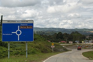
Kalabakan is a district in the Malaysian state of Sabah, located approximately 235 kilometres (146 mi) southeast of the state capital of Kota Kinabalu. It recorded a population of 48,195 people in the 2020 Malaysian census. Its capital is the town of Kalabakan.
Bukit Taviu Forest Reserve is a protected forest reserve in Ranau District of West Coast Division, Sabah, Malaysia. It was designated as a Class 1 Protection Forest by the Sabah Forestry Department in 1992. Its area is 8,630 hectares (86.3 km2). The reserve is hilly and lacks rivers. The forest is mixed dipterocarp.
Mount Pock Forest Reserve is a protected forest reserve in Semporna District of Tawau Division, Sabah, Malaysia. It was designated as a Class 1 Protection Forest by the Sabah Forestry Department in 1984. Its area is 7,804.8 hectares (78.048 km2). The reserve consists of steeply sloping terrain. The forest on lower slopes has been impacted by logging and conversion of land for agriculture. Oil palm plantations surround the reserve. The size of the reserve has decreased since its initial gazetting. In 2012, 1,388 ha (13.88 km2) of the Mount Pock Reserve was reclassified as state land as this area, along with parts of other reserves, have been home to indigenous communities.
Bukit Kuamas Forest Reserve is a protected forest reserve in Telupid District of Sandakan Division, Sabah, Malaysia. It was designated as a Class 1 Protection Forest by the Sabah Forestry Department in 1992. Its area is 7,324 hectares (73.24 km2). The reserve is hilly and surrounded by palm oil plantations. The forest is mixed dipterocarp. Threats to the reserve forests include logging, fires and erosion.
Bengkoka Forest Reserve is a protected forest reserve in Pitas District of Kudat Division, on the Bengkoka Peninsula in Sabah, Malaysia. It was designated as a Class 1 Protection Forest by the Sabah Forestry Department in 1984. Its area is 6,270 hectares (62.7 km2). The reserve is low-lying. Threats to the reserve forests include fires and land conversion for agriculture.
Mandamai Forest Reserve is a protected forest reserve in Pitas District of Kudat Division in Sabah, Malaysia. It was designated as a Class 1 Protection Forest by the Sabah Forestry Department in 1984. Its area is 5,330 hectares (53.3 km2). The reserve is hilly, with the highest point being Mount Mabauk at 836 metres (2,743 ft). Two forest types make up the reserve: dipterocarp and kerangas. The main threat to the reserve forests is from fires.
Lipaso Forest Reserve is a protected forest reserve in Telupid District of Sandakan Division, Sabah, Malaysia. It was designated as a Class 1 Protection Forest by the Sabah Forestry Department in 1984. Its area is 3,606 hectares (36.06 km2). The reserve is mountainous with some palm oil plantations and farms in the surroundings. The forest is mostly mixed dipterocarp. Threats to the reserve forests include fires and encroachment for agriculture.

Gomantong Forest Reserve is a protected forest reserve in Sandakan and Kinabatangan Districts of Sandakan Division, Sabah, Malaysia. It was designated as a Class 1 Protection Forest by the Sabah Forestry Department in 1984. Its area is 3,297 hectares (32.97 km2). The Gomantong Caves are within the reserve. Gomantong's terrain consists of low to moderate hills and flat areas with swamps. The forest is a mixture of dipterocarp and swamp forest.
Botitian Forest Reserve is a protected forest reserve in Beluran District of Sandakan Division, Sabah, Malaysia. It was designated as a Class 1 Protection Forest by the Sabah Forestry Department in 1992. Its area is 2,145 hectares (21.45 km2). Botitian's terrain is mountainous in the reserve's centre, to low hills and flat land in the western and eastern sections. The forest is mainly secondary with pioneer species. Canopy trees are mainly dipterocarp.

