Daechi-dong (대치동) is an affluent neighborhood in Gangnam-gu, Seoul, South Korea. Daechi-dong is divided into three different “dongs” which are Daechi 1-dong, 2-dong, and 4-dong. Daechi-dong is predominantly considered the residential area of Gangnam. As a result, real estate in the area is highly competitive and expensive compared to other parts of Gangnam. The Yangjaecheon is a stream that runs through the heart of Daechi-dong.

Seocho-dong is a dong, or neighborhood of the greater Gangnam area Seocho-gu district of the South Korean city of Seoul. Seocho-dong is divided into 4 different dong which are Seocho 1-dong, 2-dong, 3-dong and 4-dong. The main street is Teheranno. There is Gangnam Station in Seocho-dong, which is one of the biggest stations in Korea.

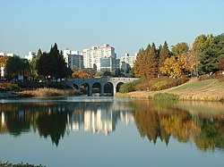
Sincheon-dong or Sincheon is a neighbourhood (dong) in Songpa-gu, Seoul served by Jamsillaru Station on Seoul Subway Line 2. The name means "new stream" and is a name for several other places in South and North Korea.

Chang-dong Station is a station on Seoul Subway Line 1 and Line 4. It is located in Chang-dong, Dobong-gu, Seoul. A shopping center was planned for this site, but the empty lot has never been developed due to the bankruptcy of the contractor behind said project. The station is, however, home to a cluster of pojangmacha stalls.

Dogok-dong is an affluent ward of Gangnam-gu in Seoul, South Korea. It is home to high-end residential homes including the Samsung Tower Palace, a luxury residential complex which contains the eleventh-tallest building in South Korea.

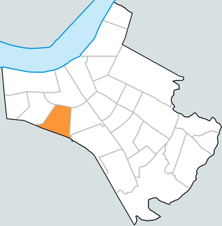
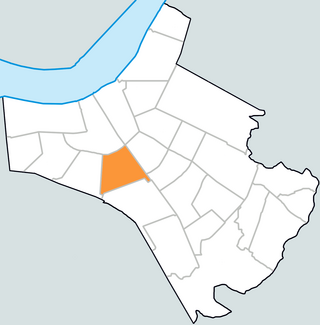
Samseong-Dong is an affluent neighborhood or ward of Gangnam-gu in Seoul, South Korea.

Jamsil-dong is a neighbourhood, dong, of Songpa-gu, Seoul, South Korea. Its name is derived from silkworm breeding during the Joseon dynasty. Jamsil translates to a room or place for sericulture. The state encouraged people to raise silkworms, so founded Dongjamsil in the east vicinity of Seoul.
Songpa-dong is a neighbourhood, dong of Songpa-gu, Seoul, South Korea. There are three assumptions on the etymology of the name. One is that it may come from "Songpa Naruteo"
Samjeon-dong is a neighbourhood, dong of Songpa-gu, Seoul, South Korea. The name originated from the fact that it once had only three fields.

Jangji-dong is a neighbourhood, dong of Songpa-gu, Seoul, South Korea. The old name of the dong was janbeodeuri (잔버드리), derived from jan beodeul where the species grew a lot.
Seokchon-dong is a neighbourhood, dong of Songpa-gu, Seoul, South Korea. The current dong name literally means "stone village" in hanja named for the old name, dolmari (돌마리), because the region is to said to have much stone.

Garak-dong is a neighbourhood, dong of Songpa-gu, Seoul, South Korea. The exact etymology is unknown but said that the town was once called garakgol (가락골).

Macheon-dong is in the dong neighbourhood of Songpa-gu, Seoul, South Korea.

Munjeong is a neighbourhood (dong) of Songpa-gu, Seoul, South Korea.

Geoyeo-dong is a neighbourhood, dong of Songpa-gu, Seoul, South Korea.
Ogeum-dong is a neighbourhood, dong of Songpa-gu, Seoul, South Korea.

Pungnap-dong is a neighbourhood, dong of Songpa-gu, Seoul, South Korea.

Oryun-dong is a neighbourhood, dong of Songpa-gu, Seoul, South Korea.

Banpo-dong is a dong, neighborhood of Seocho-gu, the greater Gangnam area in Seoul, South Korea. Banpo-dong is divided into five different dong which are Banpobon-dong, Banpo 1-dong, 2-dong, 3-dong and 4-dong.
Muk-dong is a dong, neighbourhood of Jungnang-gu in Seoul, South Korea.