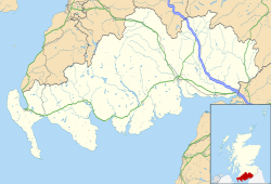
Bankend is a village in Dumfries and Galloway, Scotland. [1] It is located near Lochar Water, the civil parish Caerlaverock and the villages of Blackshaw, Glencaple and Shearington. [2] In 1961 it had a population of 79. [3]
Isle Tower is a 16th-century ruined tower house, that was a property of the Maxwell family. [4] It was built around 1565 and is B listed. [5] [6]
Bankend Bridge is a road bridge that carries the B725 road across the Lochar Water. [7] It was completed in 1813 and is B listed. [8] [9]
Caerlaverock Parish Memorial is a stone war memorial that was unveiled in 1956 by Mrs J Telfer of Glencaple to commemorate people who lost their lives in World War I and II. [10] There is 33 names on the memorial, 21 from World War I and 12 from World War II. [11]
Caerlaverock is a national nature reserve (NNR) covering parts of the mudflats and shoreline of the Solway Firth about 10 km south of Dumfries, in Dumfries and Galloway, Scotland. It lies between the River Nith and the Lochar Water, and consists of a variety of wetland habitats including bare mud and sand, merse and marshes, and is fringed by neutral grassland on the landward side. A nature reserve was designated in 1957 at the instigation of the Duke of Norfolk. The NNR covers an area of 82 square kilometres (32 sq mi) and is an internationally important wintering site for waterfowl and wading birds.
Dumfries and Galloway is one of 32 unitary council areas of Scotland and is located in the western Southern Uplands. It comprises the historic counties of Dumfriesshire, Stewartry of Kirkcudbright and Wigtownshire, the latter two of which are collectively known as Galloway. The administrative centre is the town of Dumfries.
Buittle is an ecclesiastical and civil parish in Dumfries and Galloway, southwest Scotland, in the traditional county of Kirkcudbrightshire. It lies to the west of the Urr Water, between Dalbeattie and Castle Douglas, and extends from Haugh of Urr in the north to Almorness Point on the Solway Firth in the south. The main settlement is the small village of Palnackie.
Twynholm ( 'TWINE-um') is a village in Scotland. It is located 2+1⁄4 miles (3.6 km) north-northwest of Kirkcudbright and 4+1⁄2 miles (7.2 km) east of Gatehouse of Fleet on the main A75 trunk road. It is in the historic county of Kirkcudbrightshire, Dumfries and Galloway.
Glencaple is a small settlement in the Dumfries and Galloway area of Scotland. Situated on the banks of the River Nith, it once served as a port for nearby Dumfries. Glencaple is a Gaelic name meaning 'horse valley' from the words gleann 'narrow valley' and capall 'horse, mare'.
Torthorwald is a village and civil parish in Dumfries and Galloway, south-west Scotland. It is located 6 kilometres (3.7 mi) east of Dumfries on the A709 road to Lochmaben. The area was the property of the de Torthorwald family until the end of the 13th century, when the estate passed by marriage to the Kirkpatricks. In 1418, William de Carleil married the Kirkpatrick heiress. He may have been the builder of Torthorwald Castle, which was erected around this time, possibly on top of an earlier a motte. Torthorwald was erected as a burgh of barony in 1473. Torthorwald Castle was occupied until 1715; only two of its walls still stand, to a height of around 18 metres (59 ft).
Hoddom Castle is a large tower house in Dumfries and Galloway, south Scotland. It is located by the River Annan, 4 kilometres (2.5 mi) south-west of Ecclefechan and the same distance north-west of Brydekirk in the parish of Cummertrees. The castle is protected as a category A listed building.
Kirkcolm is a village and civil parish on the northern tip of the Rhinns of Galloway peninsula, south-west Scotland. It is in Dumfries and Galloway, and is part of the former county of Wigtownshire. The parish is bounded on the north and west by the sea, on the east by the bay of Loch Ryan and on the south by Leswalt parish.
Dalgarnock, Dalgarno, Dalgarnoc was an ancient parish and a once considerable sized village in the Nithsdale area of Dumfries and Galloway, Scotland, south of Sanquhar and north of Dumfries that enclosed the parish of Closeburn but was annexed to Closeburn in 1606 following the Reformation, separated again in 1648 and finally re-united in 1697, as part of the process that established the Presbyterian Church of Scotland. It was a burgh of regality bordering the River Nith and Cample Water and held a popular market-tryst or fair from medieval times until 1601 when the Earl of Queensberry had them transferred to Thornhill, commemorated in song by Robert Burns, shortly before its demise and now only a remote churchyard remains at a once busy site.
Kirkandrews, sometimes written as Kirkanders in older documents, is a coastal hamlet about 9 kilometres (6 mi) west-southwest of Kirkcudbright in Dumfries and Galloway, Scotland. It sits in farmland at the head of Kirkandrews Bay, an inlet of Wigtown Bay.
Anwoth Parish Church was built in 1826 to serve the parish of Anwoth in Dumfries and Galloway, Scotland. Designed by Walter Newall, it replaced Anwoth Old Church, which had been the parish church since it was built in 1626 and was partially demolished at the same time as the new church was built.
The Ken Bridge is a road bridge about 0.8 kilometres (0.5 mi) north east of New Galloway in Dumfries and Galloway, Scotland, which carries the A712 road over the Water of Ken towards Balmaclellan. Designed by John Rennie shortly before his death, it has been designated a Category A listed building.
Buittle Bridge, also known as Craignair Bridge is a bridge over the Urr Water just outside Dalbeattie in Dumfries and Galloway, Scotland. Completed in 1797, it replaced and earlier two-span bridge of the same name which was destroyed in a flood a short time after its completion; the remains of this older bridge, comprising the base of its pier and some remnants of its south-west abutment, survive a short distance upstream.
Lochar Water is a stream located in Dumfries and Galloway. It flows for about 10 miles or 16 km, mainly in a southerly direction, roughly parallel to the River Nith to the west and the River Annan to the east. It is formed by the confluence of Park Burn and Amisfield Burn, and skirts the eastern side of the town of Dumfries, and flows through an extensive low-lying area and former raised peat land known as Lochar Moss, before flowing into the Solway Firth. Bankend Bridge, part of the B725 road, crosses Lochar Water on the east side of Bankend village. The tidal limit is about 1 km below that. It shares its name with an electoral ward of the Dumfries and Galloway council
Isle Tower also known as Lochar Tower and Bankend Tower is a 16th-century ruined tower house located in the north of Bankend. It was a property of the Maxwell family.