
Dublin Bus is a State-owned bus operator providing services in Dublin. By far the largest bus operator in the city, it carried 138 million passengers in 2019. It is a wholly-owned subsidiary of Córas Iompair Éireann.

Bus Éireann is a state-owned bus and coach operator providing services throughout Ireland, with the exception of Dublin and the Greater Dublin Area, where bus services are provided by sister company Dublin Bus. It is a subsidiary of Córas Iompair Éireann (CIÉ). The company's primary hub is Busáras, Central Bus Station, located in Store Street, Central Dublin.

Wicklow is the county town of County Wicklow in Ireland. It is located on the east of Ireland, south of Dublin. According to the 2022 census, it had a population of 12,957 people. The town is to the east of the M11 route between Dublin and Wexford. It also has railway links to Dublin, Wexford, Arklow, and Rosslare Europort. There is also a commercial port for timber and textile imports. The River Vartry is the main river flowing through the town.
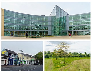
Blanchardstown is a large outer suburb of Dublin in the modern county of Fingal, Ireland. Located ten kilometres (6 mi) northwest of Dublin city centre, it has developed since the 1960s from a small village to a point where Greater Blanchardstown is the largest urban area in Fingal.

Iarnród Éireann, or Irish Rail, is the operator of the national railway network of Ireland. Established on 2 February 1987, it is a subsidiary of Córas Iompair Éireann (CIÉ). It operates all internal InterCity, Commuter, DART and freight railway services in the Republic of Ireland, and, jointly with Northern Ireland Railways, the Enterprise service between Dublin and Belfast. In 2019, IÉ carried a record peak of 50 million passengers, up from 48 million in 2018.

Gorey is a market town in north County Wexford, Ireland. It is bypassed by the main M11 Dublin to Wexford road. The town is also connected to the railway network along the same route. Local newspapers include the Gorey Guardian.

Cavan is the county town of County Cavan in Ireland. The town lies in Ulster, near the border with County Fermanagh in Northern Ireland. The town is bypassed by the main N3 road that links Dublin with Enniskillen, Ballyshannon and Donegal Town.

Kilmacanogue, officially Kilmacanoge, is a village in north County Wicklow, Ireland. It is southwest of Bray and is overlooked by Great Sugar Loaf mountain.
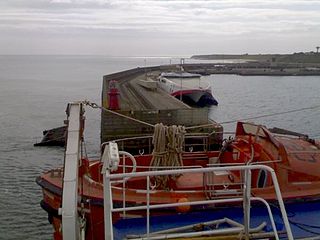
The village of Rosslare Harbour, also known as Ballygeary, grew up to serve the needs of the harbour of the same name, first developed in 1906 by the Great Western Railway and the Great Southern and Western Railway to accommodate steamferry traffic between Great Britain and Ireland. This port also serves France and Spain, traffic is mainly roll-on roll-off (RoRo). Rosslare Harbour railway station opened on 30 August 1906.

Kilcoole is a town in County Wicklow, Ireland. It is 3 kilometres (2 mi) south of Greystones, 14 kilometres (9 mi) north of Wicklow, and about 28 kilometres (20 mi) south of Dublin. It was used as a filming location for the Irish television series Glenroe, which ran through the 1980s and 1990s.

Kent Station is an Iarnród Éireann railway station in Cork, Ireland. Originally opened in 1893, the station operates as a hub for Intercity services to Dublin and Tralee and commuter services to Mallow, Cobh and Midleton. In 2016, Kent Station was the fifth busiest station in the Republic of Ireland, as well as the busiest outside of Dublin.

Enfield or Innfield is a town in south County Meath, Ireland, situated between Kilcock and Kinnegad and very close to the border with County Kildare. The town is on the Dublin-Sligo railway line. It is located on the R148 regional road, formerly the N4 national primary road connecting Dublin to Connacht.

Newtownmountkennedy is a small town in County Wicklow, Ireland. It developed within the historic townland of Ballygarny, although all that remains is a motte where a church, graveyard and a castle or tower house once stood just 0.85 km (0.53 mi) north of the town. It acquired its present name in the mid-seventeenth-century, when Sir Robert Kennedy, M.P. for Kildare, made it his principal residence. It is just off the N11 road to Wexford, just south of Kilpedder and south-west of Greystones. It is about 15 km (9.3 mi) north of Wicklow town, 15 km (9.3 mi) south of Bray and approximately 35 km (22 mi) from Dublin. The R772 regional road passes through the village. This was the main Dublin-Wexford route, the N11, but the village was bypassed by the new N11 dual carriageway in 1990. This town has one of the longest place names in Ireland.

Wexford railway station is a railway station located in Wexford Town in County Wexford, Ireland.

Longford Railway Station serves the town of Longford in County Longford, Ireland.

Glenealy is a village 8 km (5 mi) west of Wicklow Town, in County Wicklow, on the R752 road. The Dublin–Rosslare railway line also passes through the village.

Ashford, historically known as Ballymacahara, is a village in County Wicklow, Ireland. It lies on the River Vartry and at the meeting of the R772, R763 and R764 regional roads. The village was formerly on the main Dublin–Wexford route, the N11, but was bypassed by the new N11 in 2004. As of the 2022 census, the village had a population of 1,892 people.

The Limerick–Rosslare Main Line is a railway route in Ireland that linked the city of Limerick on the Atlantic coast with Rosslare Europort on the coast of the Irish Sea. It also serves the city of Waterford, and at Limerick Junction it connects with the Dublin–Cork railway line.

Inch is located in County Wexford, Ireland on the R772 road between Arklow and Gorey. In September 2007 Inch was bypassed, having formerly been on the N11 Dublin to Wexford road. There is a creamery in Inch run by Glanbia.

Kilmead, known for census purposes as Kilmeade, is a small village in County Kildare, Ireland. It is on the R418 road and is approximately 5.6 kilometres (3.5 mi) from Athy.


