Kingsessing is a neighborhood in the Southwest section of Philadelphia, Pennsylvania, United States. On the west side of the Schuylkill River, it is next to the neighborhoods of Cedar Park, Southwest Schuylkill, and Mount Moriah, as well as the borough of Yeadon in Delaware County. It is roughly bounded by 53rd Street to the northeast, Baltimore Avenue to the northwest, Cobbs Creek and 60th Street to the southwest, and Woodland Avenue to the southeast.

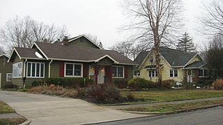
Strathmore, or Strathmore "By the Park" Subdivision, is a neighborhood in the southwest of Syracuse, New York, United States. It is a mostly residential neighborhood that has many houses from the early and middle of the twentieth century.

Northern Liberties is a neighborhood in Philadelphia, Pennsylvania, United States. Prior to its incorporation into Philadelphia in 1854, it was among the top 10 largest cities in the U.S. in every census from 1790 to 1850.

This is intended to be a complete list of the properties and districts on the National Register of Historic Places in Fairfield County, Connecticut, United States. The locations of National Register properties and districts for which the latitude and longitude coordinates are included below may be seen in an online map.

Spring Hill is the name of a ridge in the central part of the city of Somerville, Massachusetts, and the residential neighborhood that sits atop it. It runs northwest to southeast, roughly bounded by Highland Avenue, Somerville Avenue, Elm Street, and Willow Avenue. Summer Street runs along the hill's crest.
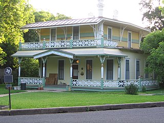
The Shadow Lawn Historic District is a historic district in central Austin, Texas that has a cohesive collection houses built in the southeast portion of Hyde Park during the late 1920s and 1930s.

The boundary markers of the original District of Columbia are the 40 milestones that marked the four lines forming the boundaries between the states of Maryland and Virginia and the square of 100 square miles (259 km2) of federal territory that became the District of Columbia in 1801. Working under the supervision of three commissioners that President George Washington had appointed in 1790 in accordance with the federal Residence Act, a surveying team that Major Andrew Ellicott led placed these markers in 1791 and 1792. Among Ellicott's assistants were his brothers Joseph and Benjamin Ellicott, Isaac Roberdeau, George Fenwick, Isaac Briggs and an African American astronomer, Benjamin Banneker.

The Cedar Crest Addition Historic District is a residential subdivision and historic district in Normal, Illinois. The subdivision is bounded roughly by Division Street to the south, Highland Avenue to the north, Fell Avenue to the west, and a local recreation trail, the Constitution Trail, to the east. Developed from 1914 to 1930, Cedar Crest Addition was the first large planned subdivision in Normal. Prior to its construction, Normal lacked paved streets and townwide electrical, sewer, and water systems and was considered more a rural area than a proper suburb of Bloomington. Planner Burt Marley Kuhn and architect Aaron T. Simmons planned the subdivision to be more developed and organized; in particular, it featured tree-lined curvilinear streets inspired by the City Beautiful movement. Simmons designed many of the houses in the district in the then-popular American Craftsman style, another modern addition to Normal. The subdivision gave Normal a much more modern reputation, and a local historian called it "one of the most important additions ever made to Normal" in the 1920s.

The Arden Park–East Boston Historic District is a neighborhood located in Detroit, Michigan, bounded on the west by Woodward Avenue, on the north by East Boston Boulevard, on the east by Oakland Avenue, and on the south by Arden Park Boulevard. The area is immediately adjacent to the much larger and better-known Boston-Edison Historic District, which is on the west side of Woodward Avenue, and also close to the Atkinson Avenue which is just south of Boston-Edison. There are 92 homes in the district, all on East Boston or Arden Park Boulevards. Arden Park Boulevard and East Boston Boulevard feature prominent grassy medians with richly planted trees and flowers. The setbacks of the homes are deep, with oversized lots. The district was listed on the National Register of Historic Places in 1982.

The Boston–Edison Historic District is a neighborhood located in Detroit, Michigan. It consists of over 900 homes built on four east-west streets: West Boston Boulevard, Chicago Boulevard, Longfellow Avenue and Edison Avenue, stretching from Woodward Avenue in the east to Linwood Avenue in the west. It is one of the largest residential historic districts in the nation. It is surrounded by Sacred Heart Major Seminary to the west, the Arden Park-East Boston Historic District and the Cathedral of the Most Blessed Sacrament to the east, and the Atkinson Avenue Historic District to the south. The district was designated a Michigan State Historic Site in 1973 and listed on the National Register of Historic Places in 1975.

The Campground Historic District, also known as The Campground is a historic district in the city of Mobile, Alabama, United States. Named for the Old Camp Ground, a military encampment that occupied the property during the American Civil War, this historically African-American neighborhood was placed on the National Register of Historic Places on July 7, 2005. It is roughly bounded by Martin Luther King Jr. Avenue, Rylands Street, St. Stephens Road, and Ann Street. The district covers 370 acres (1.5 km2) and contains 166 contributing buildings. The houses range from shotgun houses to bungalows and date from the late 19th century to the middle 20th century.

This list is of the properties and historic districts which are designated on the National Register of Historic Places or that were formerly so designated, in Hennepin County, Minnesota; there are 190 entries as of April 2023. A significant number of these properties are a result of the establishment of Fort Snelling, the development of water power at Saint Anthony Falls, and the thriving city of Minneapolis that developed around the falls. Many historic sites outside the Minneapolis city limits are associated with pioneers who established missions, farms, and schools in areas that are now suburbs in that metropolitan area.

The Virginia Park Historic District is located on the north side of New Center, an area in Detroit, Michigan, along both sides of Virginia Park Street from Woodward Avenue to the John C. Lodge Freeway access road. The district was listed on the National Register of Historic Places in 1982.

John S. Park Historic District, composed of the Park Place Addition and Vega Verde subdivisions, is in Las Vegas, Clark County, Nevada. The historic district is named for John S. Park who arrived in Las Vegas in 1907. It was listed on the United States National Register of Historic Places in 2003.

There are 75 properties listed on the National Register of Historic Places in Albany, New York, United States. Six are additionally designated as National Historic Landmarks (NHLs), the most of any city in the state after New York City. Another 14 are historic districts, for which 20 of the listings are also contributing properties. Two properties, both buildings, that had been listed in the past but have since been demolished have been delisted; one building that is also no longer extant remains listed.

The Court Square–Dexter Avenue Historic District is a 17.6-acre (7.1 ha) historic district in downtown Montgomery, Alabama, United States. Centered on the Court Square Fountain, the district includes twenty-seven contributing buildings and two objects. It is roughly bounded by Dexter Avenue, Perry, Court and Monroe streets. Architectural styles in the district include Italianate, Late Victorian, and various Revival styles. It was placed on the National Register of Historic Places on March 1, 1982. The boundaries were subsequently increased on August 30, 1984.
The Homecroft Historic District is a national historic district bounded roughly by Madison Avenue, Southview Drive, Orinoco Avenue, and Banta Road in Homecroft, Perry Township, Marion County, Indiana. It was listed on the National Register of Historic Places in 1996.

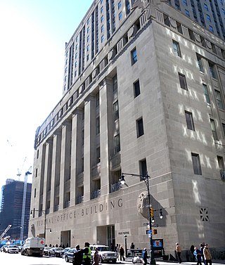
Appleton Prentiss Clark Jr. was an American architect from Washington, D.C. During his 60-year career, Clark was responsible for designing hundreds of buildings in the Washington area, including homes, hotels, churches, apartments and commercial properties. He is considered one of the city's most prominent and influential architects from the late 19th and early 20th centuries. Many of his designs are now listed on the National Register of Historic Places (NRHP).